|
Links to other sites:
Ordering books & Maps
Comments about this site or our book:

|
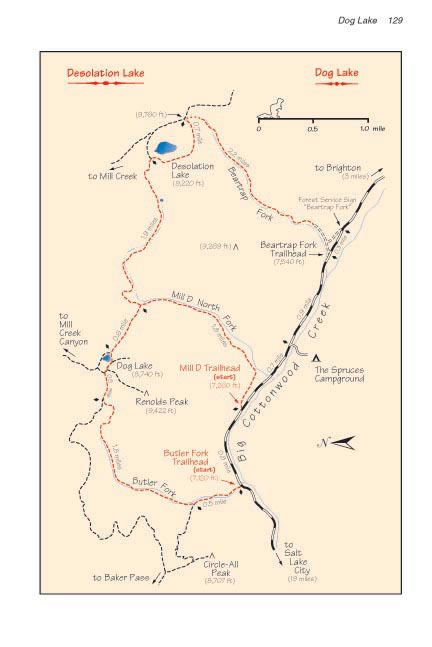
The prettiest part of the Dog
Lake loop is probably the first two miles of the hike, along
Butler Fork. Butler Fork meanders northward through a narrow
canyon filled with dense groves of quaking aspen, eventually
emerging into a more open forest of Engelmann spruce and Douglas
fir along the ridge above Mill Creek Canyon. Although Dog Lake
itself lies outside the Wilderness boundary, Butler Fork is part
of the Mount Olympus Wilderness Area. It is not uncommon to see
moose along this part of the trail. Look for their hoof tracks
along the path-similar to deer tracks, but two to three times
larger.
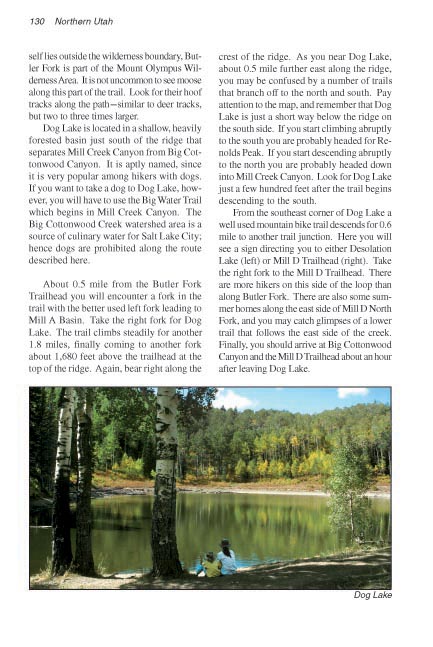
The Lake itself is located in a
shallow, heavily forested basin just south of the ridge that
separates Mill Creek Canyon from Big Cottonwood Canyon. It is
aptly named, since it is very popular among hikers who like to
bring their dogs with them. Although Big Cottonwood Canyon is
an important water catchment area for Salt Lake City, Dog Lake
has no surface outlet; hence there are no rules against dogs.
About 0.5 mile from the Butler
Fork Trailhead you will encounter a fork in the trail, with the
better used left fork leading to Mill A Basin. Take the right
fork for Dog Lake. The trail climbs steadily for another 1.8
miles, finally coming to another fork about 1,680 feet above
the trailhead at the top of the ridge. Again, bear right along
the crest of the ridge. As you near Dog Lake, about 0.5 mile
further east along the ridge, you may be confused by a number
of trails that branch off to the north and south. Pay attention
to the map, and remember that Dog Lake is just a short way below
the ridge on the south side. If you start climbing abruptly to
the south you are probably headed for Renolds Peak. If you start
descending abruptly to the north you are probably headed down
into Mill Creek Canyon. Look for Dog Lake just a few hundred
feet after the trail begins descending to the south.
From the southeast corner of Dog
Lake a well used mountain bike trail descends for 0.6 mile to
another trail junction. Here you will see a sign directing you
to either Desolation Lake (left) or Mill D Trailhead (right).
Take the right fork to the Mill D Trailhead. You will see a lot
more hikers on this side of the loop than you saw along Butler
Fork. There are also some summer homes along the east side of
Mill D North Fork, and you may catch glimpses of another trail
below you that follows the east side of the creek. You will arrive
at Big Cottonwood Canyon and the Mill D Trailhead about 2.4 miles
after leaving Dog lake. |