|
Links to other sites:
Do you have any recent information to add about this trail?
Ordering books & Maps
Free sample copies of Outdoor Magazines
Comments about this site or our book:

|
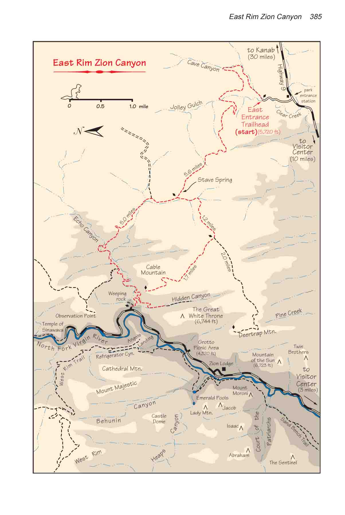
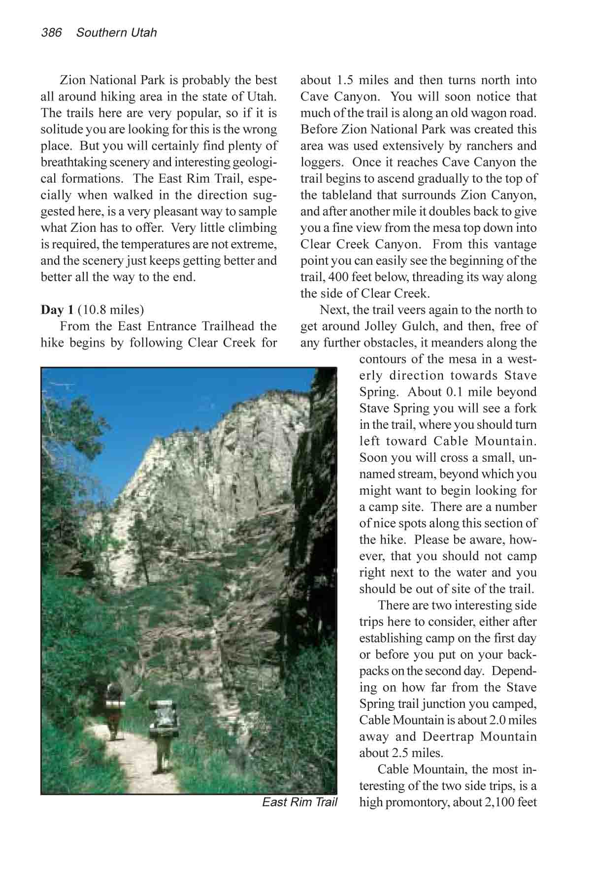
Zion National Park is probably
the best all around hiking area in the state of Utah. The trails
here are very popular, so if it is solitude you are looking for
this is the wrong place. But you will certainly find plenty of
breathtaking scenery and interesting geological formations. The
East Rim Trail, especially when walked in the direction suggested
here, is a very pleasant way to sample what Zion has to offer.
Very little climbing is required, the temperatures are not extreme,
and the scenery just keeps getting better and better all the
way to the end.
Day 1
From the East Entrance Trailhead
the hike begins by following Clear Creek for about 1.5 miles
and then turns north into Cave Canyon. You will soon notice that
much of the trail is along an old wagon road. Before Zion National
Park was created this area was used extensively by ranchers and
loggers. Once it reaches Cave Canyon the trail begins to ascend
gradually to the top of the tableland that surrounds Zion Canyon,
and after another mile it doubles back to give you a fine view
from the mesa top down into Clear Creek Canyon. From this vantage
point you can easily see the beginning of the trail, 400 feet
below, threading its way along the side of Clear Creek.
Next, the trail veers again to
the north to get around Jolley Gulch, and then, free of any further
obstacles, it meanders along the contours of the mesa in a westerly
direction towards Stave Spring. About 0.1 mile beyond Stave Spring
you will see a fork in the trail, where you should turn left
toward Cable Mountain. Soon you will cross a small, unnamed stream,
beyond which you might want to begin looking for a camp site.
There are a number of nice spots along this section of the hike.
Please be aware, however, that you should not camp right next
to the water and you should be out of site of the trail.
There are two interesting side
trips here to consider, either after establishing camp on the
first day or before you put on your backpacks on the second day.
Depending on how far from the Stave Spring trail junction you
camped, Cable Mountain is about 2.0 miles away and Deertrap Mountain
about 2.5 miles.
Cable Mountain, the most interesting
of the two side trips, is a high promontory, about 2,100 feet
above the Virgin River, with an unimpeded view of Angels Landing
and the West Rim. It is called Cable Mountain because in the
early 1900s, before Zion National Park was formed, the Zion Cable
Company operated a tram from the top of Cable Mountain to the
bottom of Zion Canyon. The tram was used primarily for lowering
lumber from the mesa top to the canyon floor where it was loaded
onto wagons and hauled to nearby towns like Springdale and Rockville.
Quite a bit of the original structure can still be seen on the
edge of the mountain, although the tram hasn’t been operated
for seventy years.
The second side trip you might
want to consider while you are on the mesa top is the walk to
the Deertrap Mountain. Deertrap, which is situated high above
the Zion Lodge, offers a fine view of the Court of the Patriarchs
and Lady Mountain on the other side of the Canyon. You can easily
walk to either one of these viewpoints and back in a couple of
hours.
Day 2
The trail from Stave Spring to
Weeping Rock is one of the most scenic walks in Zion. It is all
downhill and it is only 5.0 miles. It will only take a few hours
to complete the trip, so if you haven’t taken the side trip
to Cable Mountain yet you should definitely do so before starting
down. The trail to Weeping Rock passes directly beneath Cable
Mountain on the way down, and it is all the more interesting
if you have also seen it from the top.
The trail first heads north into
the back of Echo Canyon, and then turns west to follow the canyon
to the bottom of Zion. The scenery starts getting very interesting
after about 1.5 miles. Echo Canyon gets narrower and narrower
as you go down; in places the canyon is only 20 feet wide, and
everywhere there are water-carved etchings in the rock. Finally
the side canyon breaks out into the main canyon about 500 feet
above the Virgin River, and the trail switchbacks the rest of
the way to the bottom. 2.8 miles below Stave Spring there is
another junction where the trail to the East Rim Observation
Point climbs north out of Echo Canyon. Observation Point offers
another possible side trip, but if you have already been to the
top of Cable Mountain you will note that the view is quite similar.
Finally, 0.6 miles before you reach
the bottom there is still another possible side trip that is
quite worthwhile: the trail into Hidden Canyon. Hidden Canyon
is another narrow slot canyon, similar to the lower reaches of
Echo Canyon, that protrudes for a little over a mile from Zion
Canyon into the East Rim. Depending on how much exploring you
want to do, it will take from half an hour to an hour more of
your time to check it out. Note, camping is not allowed in Hidden
Canyon. |