|
Links to other sites:
Do you have any recent information to add about this trail?
Ordering books & Maps
Free sample copies of Outdoor Magazines
Comments about this site or our book:

|
The area below the rim of Bryce
Canyon National Park is a fantasyland of strange and wonderful
geologic formations. Stone spires and pinnacles with fanciful
names like the “Chinese Wall” and “Seal Castle”
surround the trails, making them delightful places to hike. The
Fairyland Loop Trail provides a particularly fine opportunity
to examine some of these natural sculptures and, as it is somewhat
of the beaten path, it is not as crowded as other trails in the
park.
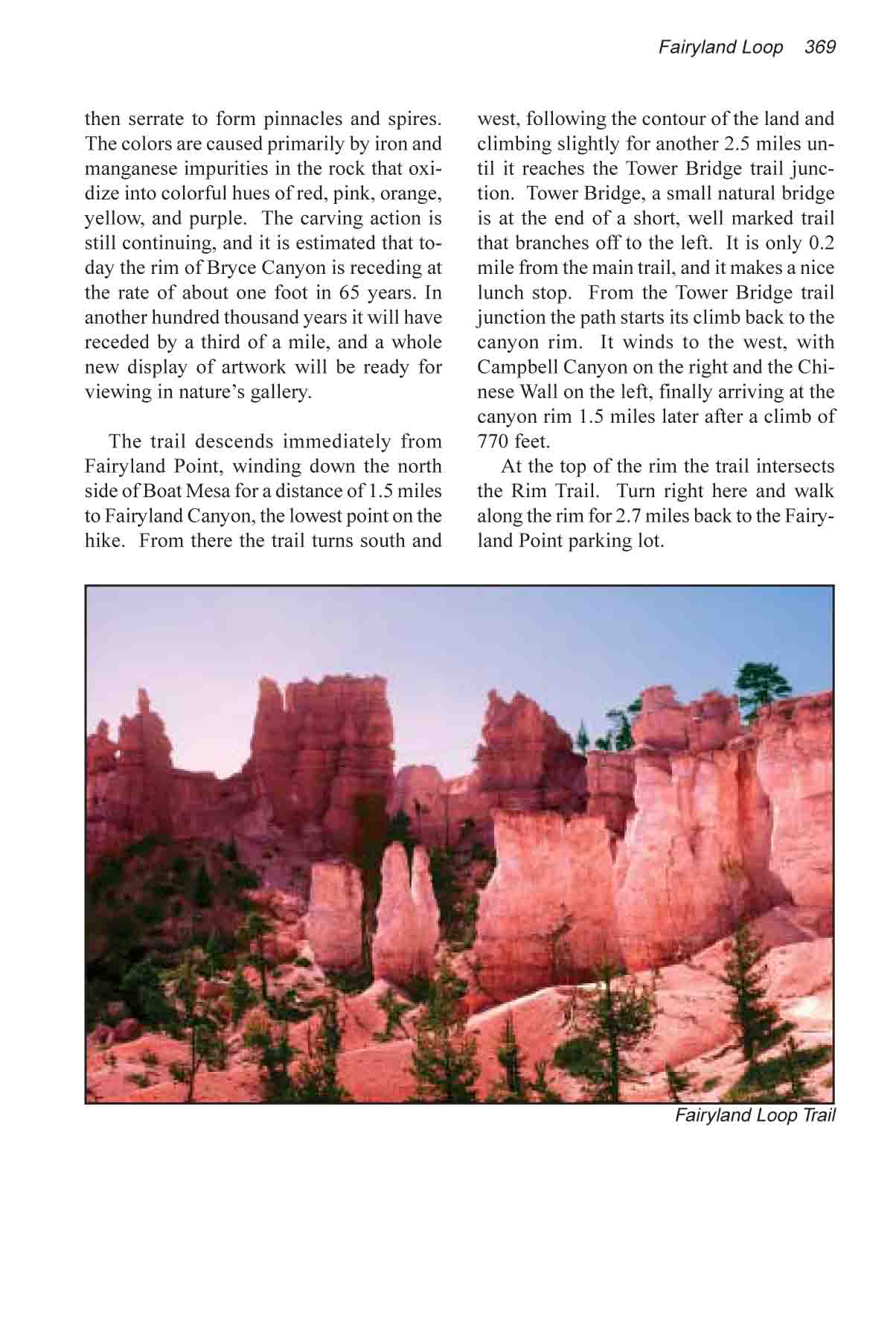
The stone sculptures of Bryce Canyon,
whimsically called “hoodoos”, have been eroded from
a thick layer of soft sedimentary rock called the Claron Formation
that was deposited in Utah some 60 million years ago. As the
canyon rim erodes, new hoodoos are formed. They begin first as
tall thin fins, then serrate to form pinnacles and spires. The
colors are caused primarily by iron and manganese impurities
in the rock that oxidize into colorful hues of red, pink, orange,
yellow, and purple. The carving action is still continuing, and
it is estimated that today the rim of Bryce Canyon is receding
at the rate of about one foot in 65 years. In another hundred
thousand years it will have receded by a third of a mile, and
a whole new display of artwork will be ready for viewing in nature’s
gallery.
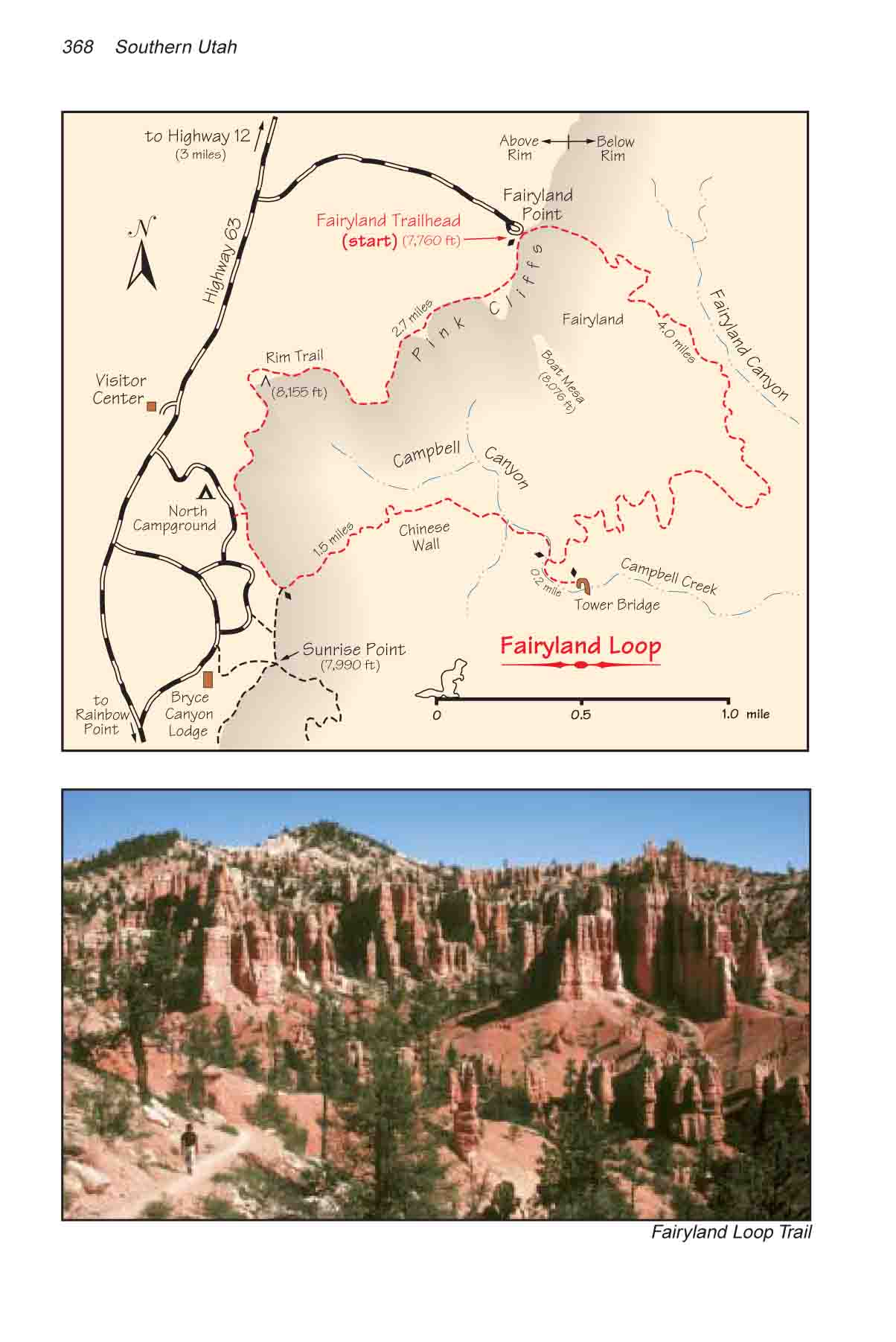
The trail descends immediately
from Fairyland Point, winding down the north side of Boat Mesa
for a distance of 1.5 miles to Fairyland Canyon, the lowest point
on the hike. From there the trail turns south and west, following
the contour of the land and climbing slightly for another 2.5
miles until it reaches the Tower Bridge trail junction. Tower
Bridge is at the end of a short, well marked trail that branches
off to the left. It is only 0.2 miles from the main trail, and
it makes a nice lunch stop. From the Tower Bridge trail junction
the path starts its climb back to the canyon rim. It winds to
the west, with Campbell Canyon on the right and the Chinese Wall
on the left, finally arriving at the canyon rim 1.5 miles later
after a climb of 770 feet.
At the top of the rim the trail
intersects the Rim Trail. Turn right here and walk along the
rim for 2.7 miles back to the Fairyland Point parking lot. |