|
Links to other sites:
Ordering books & Maps
Comments about this site or our book:

|
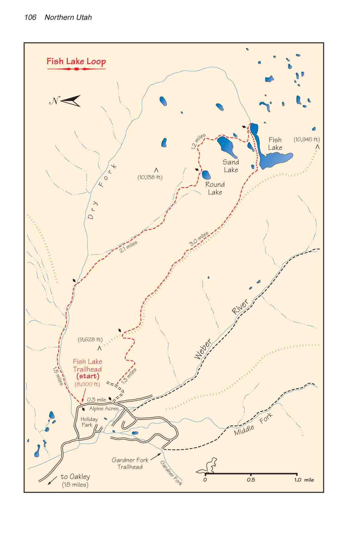
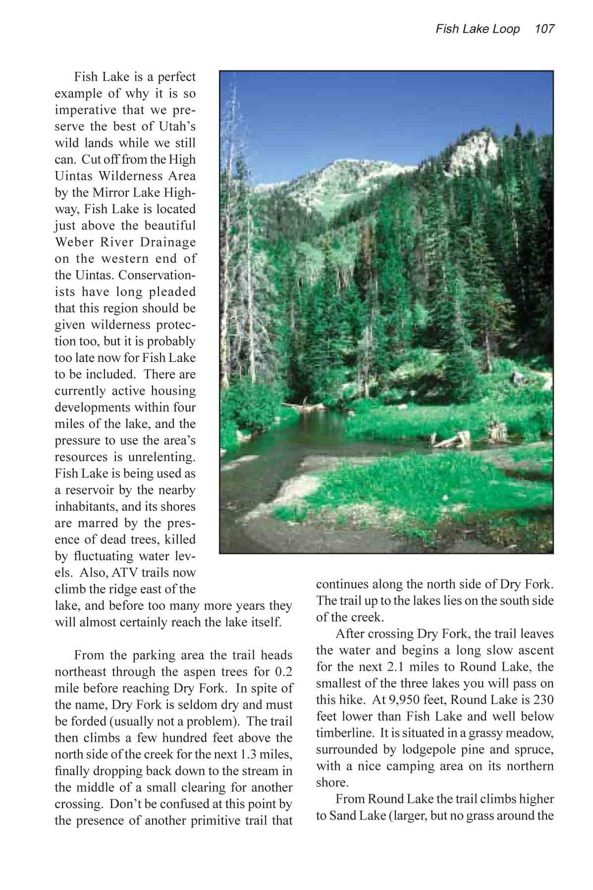
Fish Lake is a perfect example
of why it is so imperative that we preserve the best of Utah’s
wild lands while we still can. Cut off from the High Uintas Wilderness
Area by the Mirror Lake Highway, Fish Lake is located just above
the beautiful Weber River Drainage on the western end of the
Uintas. Conservationists have long pleaded that this region should
be given wilderness protection too, but it is probably too late
now for Fish Lake to be included. There are currently active
housing developments within four miles of the lake, and the pressure
to use the area’s resources is unrelenting. Fish Lake is
being used as a reservoir by the nearby inhabitants, and its
shores are marred by the presence of dead trees, killed by fluctuating
water levels. Also, ATV trails now climb the ridge east of the
lake, and before too many more years they will almost certainly
reach the lake itself.
From the parking area the trail
heads northeast through the aspen trees for 0.2 miles before
reaching Dry Fork. In spite of the name, Dry Fork is seldom dry
and must be forded (usually not a problem). The trail then climbs
a few hundred feet above the north side of the creek for the
next 1.3 miles, finally dropping back down to the stream in the
middle of a small clearing for another crossing. Don’t be
confused at this point by the presence of another primitive trail
that continues along the north side of Dry Fork. The trail up
to the lakes lies on the south side of the creek.
After crossing Dry Fork, the trail
leaves the water and begins a long slow ascent for the next 2.1
miles to Round Lake, the smallest of the three lakes you will
pass on this hike. At 9,950 feet, Round Lake is 230 feet lower
than Fish Lake and well below timberline. It is situated in a
grassy meadow, surrounded by lodgepole pine and spruce, with
a nice camping area on its northern shore.
From Round Lake the trail climbs
higher to Sand Lake (larger, but no grass around the sides),
and finally, after 1.2 miles, to Fish Lake. Fish Lake is the
source of the Dry Fork, and there is a small dam on its eastern
side where the trail meets the lake. The flow through the dam
is regulated to assure that there is always water running down
the Dry Fork. The L-shaped lake is scenically situated at the
base of a rocky ridge with one side of the L parallel to the
ridge. The shores are also very rocky, but there are a few good
camp sites on the northern side.
The trail seems to end at the dam,
but if you proceed along the northern shore to the western end
of the lake you will see another obvious trail starting up the
ridge in a westerly direction from the corner of the L. The trail
climbs 200 feet to the top of the ridge and then follows the
crest back towards the road. The upper part of the trail is not
well used and may occasionally seem to disappear. But don’t
be concerned if you have trouble following the trail. Just continue
along the top of the ridge. Walking is very easy through the
open forest, and as long as you stay on the ridge you can’t
really get lost. After 3.0 miles you will come to a saddle where
the trail drops off the ridge’s western side. Beyond the
saddle the ridge heads abruptly upward to the top of a small
peak. But the trail is very distinct as you approach the saddle,
so you really don’t have to worry about missing the route
down.
The last 1.3 miles of trail, from
the ridge to the road below, has been seriously degraded by ATVs
driving up and down the mountain. The trail is occasionally completely
obliterated by the ATV roads. About 0.5 miles before reaching
the bottom you will encounter a steep, narrow gravel road which
is part of the Alpine Acres Subdivision. Just follow this new
road downhill until it reaches the main access road near the
Weber River. When you reach the main road turn right and walk
0.3 miles back to your car. |