|
Links to other sites:
Ordering books & Maps
Comments about this site or our book:

|
Hiking the Murphy Trail is an
excellent way to gain an appreciation for the wild beauty and
expanse of Canyonlands National Park. It is also a good way to
sample some of the history of Canyonlands. The trail was built
during World War One by the Murphy brothers, who grazed cattle
in the area from 1917 until about 1920. The area on and below
the Island in the Sky Mesa was used extensively for winter grazing
by local cattle ranchers during the first half of this century,
and many remnants of their occupation can still be seen.
The Island in the Sky district
was also an active exploration area for uranium prospectors during
the 1950s. Uranium ore is often found in the Chinle geologic
formation above the White Rim Plateau, and during the nuclear
energy craze of the 1950s prospectors came from all over the
country to try their luck in Canyonlands. There are no active
mines in the area now, but if you stand just about anywhere on
the rim of Island in the Sky and gaze down into the canyon you
can see parts of the old roads and trails built by the miners.
When the area became a national
park in 1964 prospecting was no longer allowed, but 4-wheeling
and bicycling on some of the old roads has become very popular.
In particular, the 100-mile-long 4-wheel drive White Rim Road,
which circles the Island in the Sky has become one of the parks
best known attractions. The middle 1.4 miles of this hike, connecting
Murphy Hogback to Murphy Wash, is along the White Rim Road.
From the parking area on Murphy
Point the trail proceeds for 0.6 mile to the edge of the rim
before plunging downward through a fault in the Wingate Sandstone.
When you first look over the edge you may wonder how on earth
anyone could get down there. But, miraculously, there is a way.
The trail switchbacks down a series of ledges near the top, then
finds a debris-scattered slope for the rest of the route. Near
the bottom there is one exciting part where the Murphy brothers
built a wooden bridge across a ten-foot gap in the trail. The
logs in the bridge are close to a hundred years old now, but
they still seem sturdy enough.
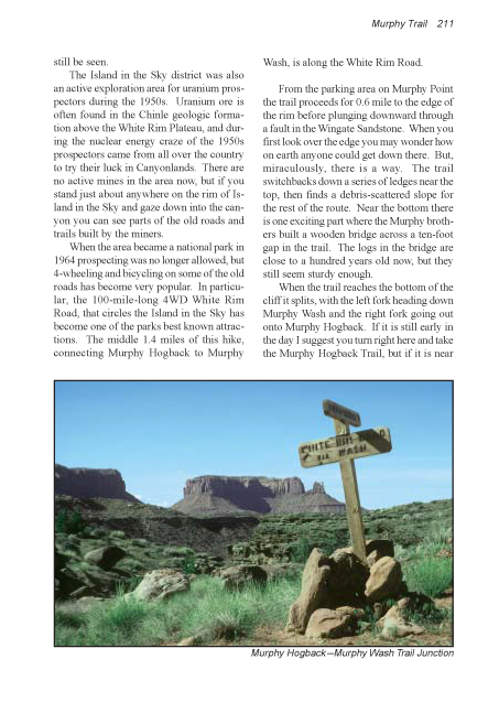
When the trail reaches the bottom
of the cliff it splits, with the left fork heading down Murphy
Wash and the right fork going out onto Murphy Hogback. If it
is still early in the day I suggest you turn right here and take
the Murphy Hogback Trail, but if it is near noon you should go
down Murphy Wash first. The reason for this is that the most
beautiful part of the hike is along the Hogback, and you should
save this portion for when the sun is lower in the sky. If the
sun is directly overhead the geology of the shadowless canyons
is not as interesting. From a practical point of view it doesn’t
really matter which fork you take. The trails are joined at the
other end by the White Rim Road, and the loop can be walked in
either direction. I will assume here, however, that you choose
to proceed via the Hogback trail.
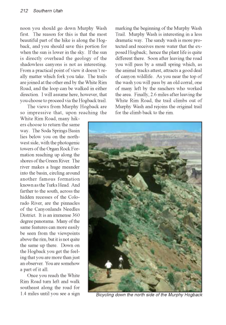
The views from Murphy Hogback are
so impressive that, upon reaching the White Rim Road, many hikers
choose to return the same way. The Soda Springs Basin lies below
you on the northwest side, with the photogenic towers of the
Organ Rock Formation reaching up along the shores of the Green
River. The river makes a huge meander into the basin, circling
around another famous formation known as the Turks Head. And
farther to the south, across the hidden recesses of the Colorado
River, are the pinnacles of the Canyonlands Needles District.
It is an immense 360 degree panorama. Many of the same features
can more easily be seen from the viewpoints above the rim, but
it is not quite the same up there. Down on the Hogback you get
the feeling that you are more than just an observer. You are
somehow a part of it all.
Once you reach the White Rim Road
turn left and walk southeast along the road for 1.4 miles until
you see a sign marking the beginning of the Murphy Wash Trail.
Murphy Wash is interesting in a less dramatic way. The sandy
wash is more protected and receives more water that the exposed
Hogback; hence the plant life is quite different there. Soon
after leaving the road you will pass by a small spring which,
as the animal tracks attest, attracts a good deal of canyon wildlife.
As you near the top of the wash you will pass by an old corral,
one of many left by the ranchers who worked the area. Finally,
2.6 miles after leaving White Rim Road, the trail climbs out
of Murphy Wash and rejoins the original trail for the climb back
to the rim. |