|
Links to other sites:
Ordering books & Maps
Comments about this site or our book:

|
The High Uintas are famous for
their gorgeous alpine basins, but none of them can beat the memorable
scenery of Naturalist Basin. In my opinion, this small collection
of lakes and meadows, nestled together against the southern slopes
of Mount Agassiz and Spread Eagle Peak, is the crown jewel of
the High Uintas Wilderness Area. Unfortunately, Naturalist Basin
is also one of the most popular backpacking destinations in the
High Uintas, so if you are looking for solitude you had better
choose another hike. But most hikers tend to congregate around
Jordan Lake and the Morat Lakes, where the best fishing can be
found, so if you are willing to camp elsewhere it is still possible
to enjoy a measure of privacy.
Few hikers venture onto the upper
plateau of Naturalist Basin, where 2.5 miles of this hike are
located. Five icy lakes cling tenaciously to the talus slopes
in the top of the basin, just below the 11,000-foot contour line
and just above timberline. Hiking across the stark, sparsely
vegetated terrain that separates the small lakes can be an almost
otherworldly experience. It is an environment where most life
ceases to exist during the wintertime, but during the two or
three months of summer a few dormant species suddenly burst forth
to quickly mature and reproduce before the arctic cold again
forces them into submission. By the end of July, after most of
the snow has melted, the thin, rocky soil is usually covered
with a colorful carpet of tiny blossoms as the hardy plants begin
another cycle of their precarious existence.
Day 1
From the Highline Trailhead the
trail meanders gradually downhill through a forest of Engelmann
spruce and lodgepole pine. At the higher elevations the forest
is almost entirely spruce, but more and more lodgepole pine begin
to appear as elevation is lost. After walking for an hour you
will see your first lake, Scudder Lake, glinting through the
trees. This lake is popular with day hikers, although it is too
shallow for good fishing. It can be accessed over a short spur
that branches off to the right of the main trail.
From Scudder Lake it is another
half hour walk to the Packard Lake Trail junction. Once you reach
this junction you are only 2.2 miles from Naturalist Basin, so
unless you got off to a late start you will probably want to
take a short side trip to see Wilder, Wyman, and Packard Lakes.
They are all on the 1.4-mile-long Packard Lake Trail. There is
also a nice view of the Uintas near the end of the trail. Packard
Lake is situated only a hundred yards north of the rim of a 600-foot-deep
canyon, in the bottom of which runs the East Fork of the Duchesne
River.
Back on the Highline Trail, 1.2
miles beyond the Packard Lake Trail, you will see a sign directing
you to Naturalist Basin. Turn left here and proceed north. The
path climbs very gradually for about a mile before emerging from
the trees on the edge of a wide green meadow with the picturesque
cliffs of the Uinta Crest behind it. From the scene in front
of you, it should be immediately obvious that you are entering
into a very special place.
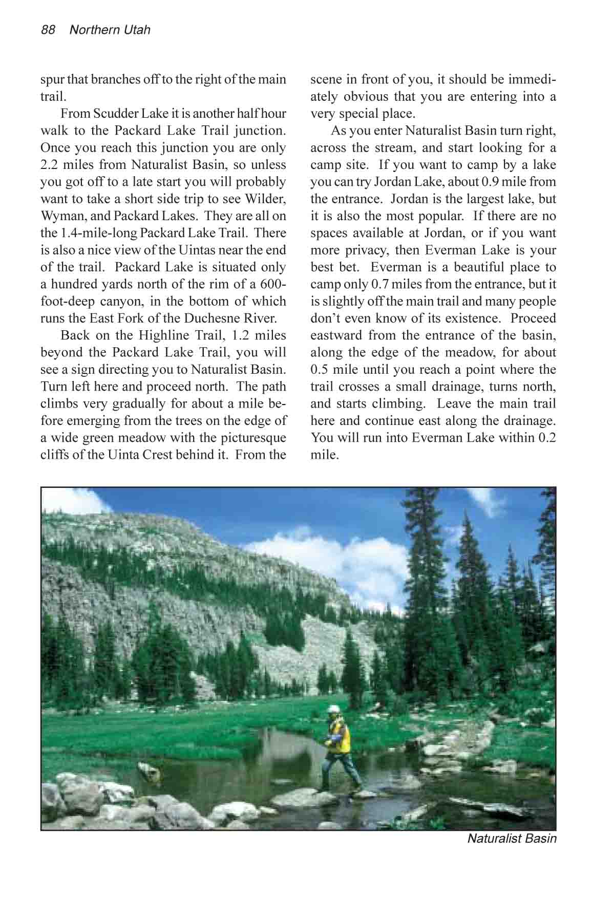
As you enter Naturalist Basin turn
right, across the stream, and start looking for a camp site.
If you want to camp by a lake you can try Jordan Lake, about
0.9 miles from the entrance. Jordan is the largest lake, but
it is also the most popular. If there are no spaces available
at Jordan, or if you want more privacy, then Everman Lake is
your best bet. Everman is a beautiful place to camp only 0.7
miles from the entrance, but it is slightly off the main trail
and many people don’t even know of its existence. Proceed
eastward from the entrance of the basin, along the edge of the
meadow, for about 0.5 mile until you reach a point where the
trail crosses a small drainage, turns north, and starts climbing.
Leave the main trail here and continue east along the drainage.
You will run into Everman Lake within 0.2 mile.
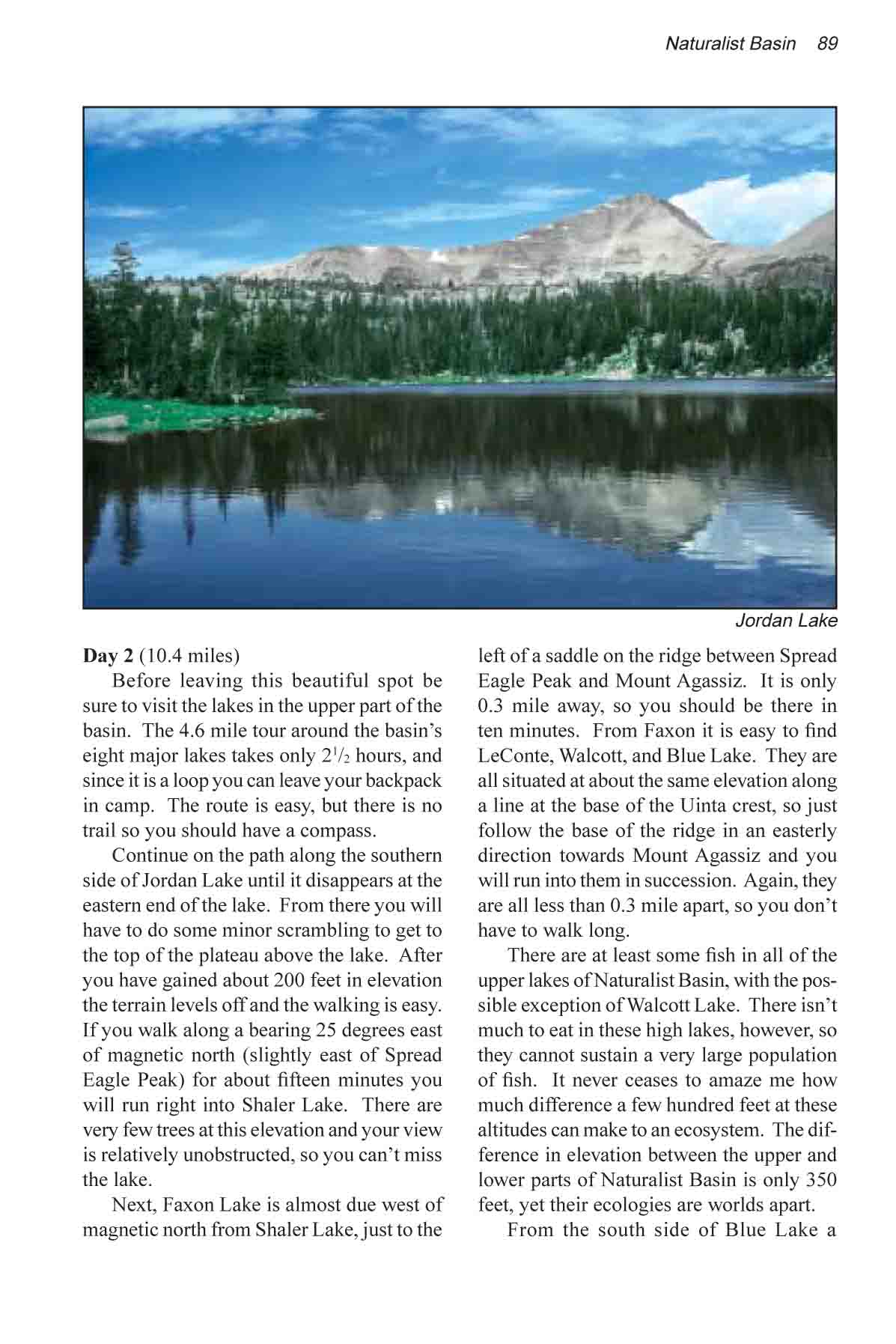
Day 2
Before leaving this beautiful spot
be sure to visit the lakes in the upper part of the basin. The
4.6 mile tour around the basin’s 8 major lakes takes only
21/2 hours, and since it is a loop you can leave your backpack
in camp. The route is easy, but there is no trail so you should
have a compass.
Continue on the trail along the
southern side of Jordan Lake until the trail disappears at the
eastern end of the lake. From there you will have to do some
minor scrambling to get to the top of the plateau above the lake.
After you have gained about 200 feet in elevation the terrain
levels off and the walking is easy. If you walk along a bearing
25 degrees east of magnetic north (slightly east of Spread Eagle
Peak), for about fifteen minutes you will run right into Shaler
Lake. There are very few trees at this elevation and your view
is relatively unobstructed, so you can’t miss the lake.
Next, Faxon Lake is almost due
west of magnetic north from Shaler Lake, just to the left of
a saddle on the ridge between Spread Eagle Peak and Mount Agassiz.
It is only 0.3 mile away, so you should be there in ten minutes.
From Faxon it is easy to find LeConte, Walcott, and Blue Lakes.
They are all situated at about the same elevation along a line
at the base of the Uinta crest, so just follow the base of the
ridge in an easterly direction towards Mount Agassiz and you
will run into them in succession. Again, they are all less than
0.3 mile apart, so you don’t have to walk long.
There are at least some fish in
all of the upper lakes of Naturalist Basin, with the possible
exception of Walcott Lake. There isn’t much to eat in these
high lakes, however, so they cannot sustain a very large population
of fish. It never ceases to amaze me how much difference a few
hundred feet at these altitudes can make to an ecosystem. The
difference in elevation between the upper and lower parts of
Naturalist Basin is only 350 feet, yet their ecologies are worlds
apart.
From the south side of Blue Lake
a primitive trail leads down to the twin Morat Lakes. The trail
is vague at first, but soon becomes more distinct as it begins
to descend into the lower basin. As you make the short descent
you will be treated to a nice view of the two Morat Lakes, with
the wide expanse of the Uintas below them. Thank goodness this
magnificent land is now protected as a wilderness area. From
Morat Lakes a good trail will take you the remaining 0.6 mile
back to the bottom of the lower meadow, and from their you can
easily retrieve your backpack for the walk back to the Highline
Trailhead.
Four Lakes Basin
For those who want to get farther
away from civilization than Naturalist Basin and still enjoy
the serenity of a beautiful basin on the south slopes of the
Uinta crest, Four Lakes Basin provides a good alternative. The
fishing is also excellent there-especially in Jean and Dean Lakes.
To get to the Four Lakes Basin
continue eastward on the Highline Trail for 2.8 miles beyond
the junction with Naturalist Basin Trail. There you will come
to another junction with the trail to Four Lakes Basin departing
on the right. Turn south here, and after another 1.2 miles you
will arrive at Jean Lake, the first of the basin’s four
lakes. The total distance to Jean Lake from Naturalist Basin
is 5.0 miles, one way, or from the Highline Trailhead it is 8.1
miles. The route is clearly marked with Forest Service signs.
The best camp sites are at Dean
Lake, immediately northeast of Jean at the base of the Uinta
Crest. There is no proper trail to Dean Lake but it is easy to
get to. Just walk along the southern shore of Jean for about
0.3 mile, and a few hundred feet beyond the eastern end of the
lake you will come to Dean Lake. Both lakes are situated against
the southern base of the Uinta Crest, about 1.5 miles south of
the Rocky Sea Pass. The water is deeper along the north shore
of the lakes; hence the chances of hooking a larger fish are
better, but the fishing is also good on the more easily accessible
south shore.
If you feel like exploring, there
is an old airplane crash a short way up the slope from the eastern
end of Dean Lake. The unfortunate pilot was only about 500 feet
too low to clear the ridge when he crashed. The other two lakes,
Dale and Daynes, are another 0.5 miles south of Jean Lake on
the east side of the main trail. There are a number of good camp
sites around these two lakes as well, but they aren’t quite
as scenic as Jean and Dean. |