|
Links to other sites:
Ordering books & Maps
Comments about this site or our book:

|
The Notch Mountain Trail is a delightful path on the
western side of the Uinta Mountains that winds lazily through the subalpine
forest west of Bald Mountain and eventually returns to the Mirror Lake
Highway through the notch in Notch Mountain. It is an area strewn with lakes
and talus covered mountain peaks-all shaped and sculpted by the glaciers of
the last Ice Age. A hundred thousand years ago this area was a sea of ice,
broken only by the island peaks of Bald Mountain, Notch Mountain, Mount
Watson, Haystack, and a few other summits. At least four separate glaciers
came together on the slopes of Bald Mountain, with long fingers extending
for up to twenty miles down the north and south slopes of the range. As the
glaciers moved they gouged deep pockets into the earth and rock, and today
the result is a landscape punctuated by scores of picturesque lakes.
The trail begins on the south side of Bald Mountain and
proceeds westward along its rocky base. A hundred yards from the trailhead
you will come to a junction where the 1.7-mile trail to the summit of Bald
Mountain takes off to the right. The Notch Mountain Trail continues to the
left along the southern slope of the peak for another 0.6 mile, and then
turns northwest toward Notch Mountain.
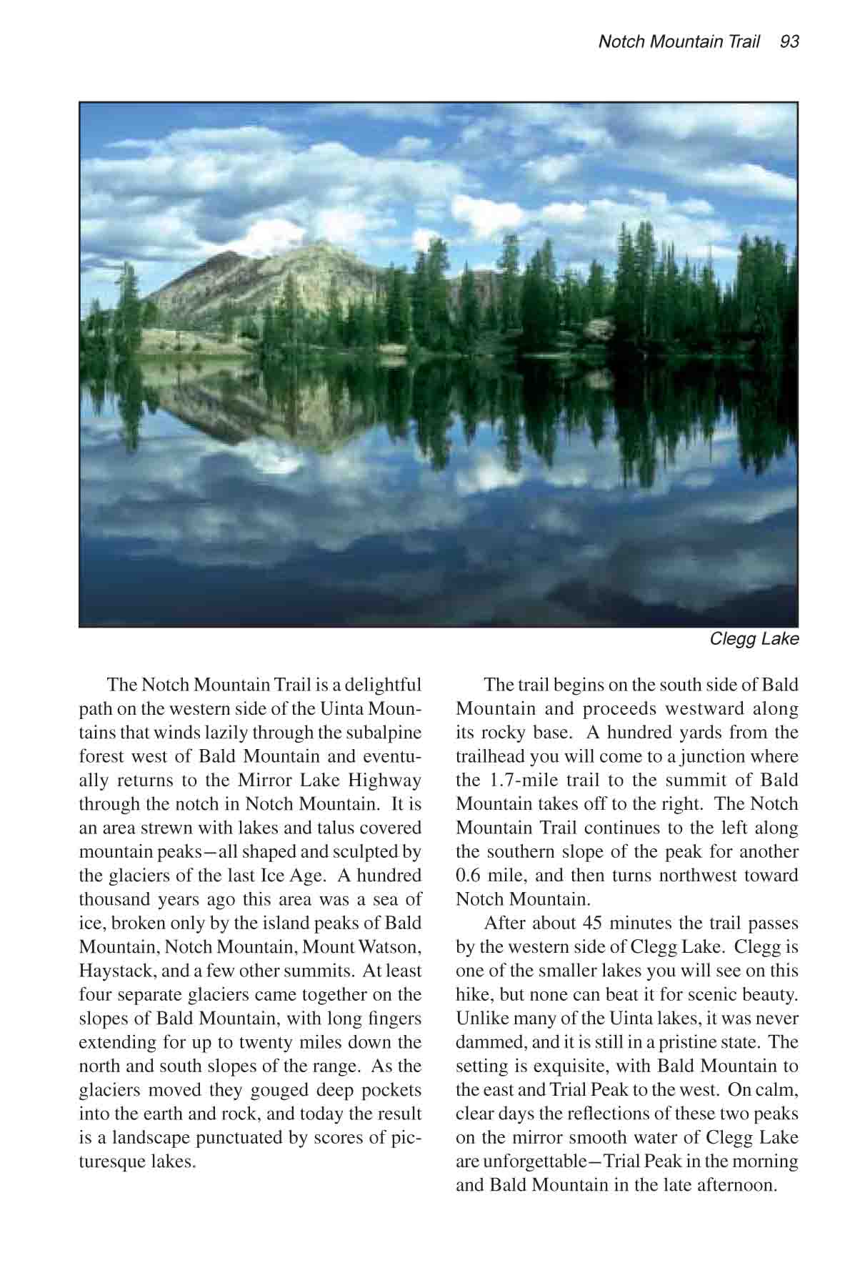
After about 45 minutes the trail passes by the western
side of Clegg Lake. Clegg is one of the smaller lakes you will see on this
hike, but none can beat it for scenic beauty. Unlike many of the Uinta
lakes, it was never dammed, and it is still in a pristine state. The setting
is exquisite, with Bald Mountain to the east and Trial Peak to the west. On
calm, clear days the reflections of these two peaks on the mirror smooth
water of Clegg Lake are unforgettable-Trial Peak in the morning and Bald
Mountain in the late afternoon.
Soon after leaving Clegg Lake the trail crosses between
Bald Mountain and Notch Mountain, leaving the Provo River Drainage and
entering the Weber River Drainage. Within the next mile three more lakes
will come into view along the eastern slopes of Notch Mountain: Dean Lake,
Notch Lake, and Bench Lake. Of these, Notch Lake is the biggest and the most
popular among fishermen, but I really can�t say much for its scenic
beauty. It has an active dam, and when the water level is low at the end of
summer about half of the lake�s surface area is replaced by lifeless,
sun-bleached shoreline. Bench Lake, on the other hand, is a scenic gem with
huge Engelmann spruce growing right to the water�s edge.
The trail continues downhill from Bench Lake for another
1.5 miles, then crosses a small creek and begins a gentle uphill climb. Ten
minutes later you should see the spur trail to Meadow Lake leaving on the
right. The spur is marked by a small sign nailed to a spruce tree, but if
you aren�t paying attention you can easily miss it. Meadow Lake is 0.4
mile off the main trail. It is the second largest off-road lake you will see
on this hike, and it is a popular overnight stop among scout groups.
Unfortunately, however, the lake has suffered from the same fate that has
befallen so many other lakes in the High Uintas. It has an active dam on its
north side, and the resulting fluctuations in water level often expose large
ugly swathes of lifeless wasteland along its shores. But I am told that the
fishing is good; Meadow Lake contains a large population of cutthroat trout.
The second half of this hike, from Meadow Lake to Trial
Lake, is perhaps the most interesting. The trail meanders gently uphill for
2.0 miles, past Ibantik Lake and Lovenia Lake, then crosses through the
Notch of Notch Mountain and drops down again into the Provo River watershed.
There is a fine view of Lovenia Lake from the Notch, and to the south Wall
Lake, the largest lake along the trail, glints through the forest.
Wall Lake was "under construction" when I last
stood in the Notch in the summer of 1999. The sounds of heavy equipment
drifted up from far below, and I could see from the denuded land on the
south end of the lake that a major earth moving project was well underway.
Although Wall Lake is no longer used for water storage, its ancient dam has
for years been in need of repair. Many environmentalists suggested that the
dam should be breached and the lake allowed to return to its natural size.
The lake is very popular with fishermen, however, and for that reason the
Forest Service decided to reconstruct the dam and maintain the lake at its
current size.
From the Notch, the trail descends across two narrow
benches before coming to the southeast shore of Wall Lake. The route then
follows the shore of the lake for 0.2 mile before coming to a junction near
the dam where the trail to Lily Lakes departs. Bear left here for Trial
Lake. Soon the lake will come into view, with the trail following closely
along its western side. When you reach the south end of the lake you can
walk across the dam to the parking area where your shuttle car is parked. |