|
Links to other sites:
Do you have any recent information to add about this trail?
Ordering books & Maps
Free sample copies of Outdoor Magazines
Comments about this site or our book:

|
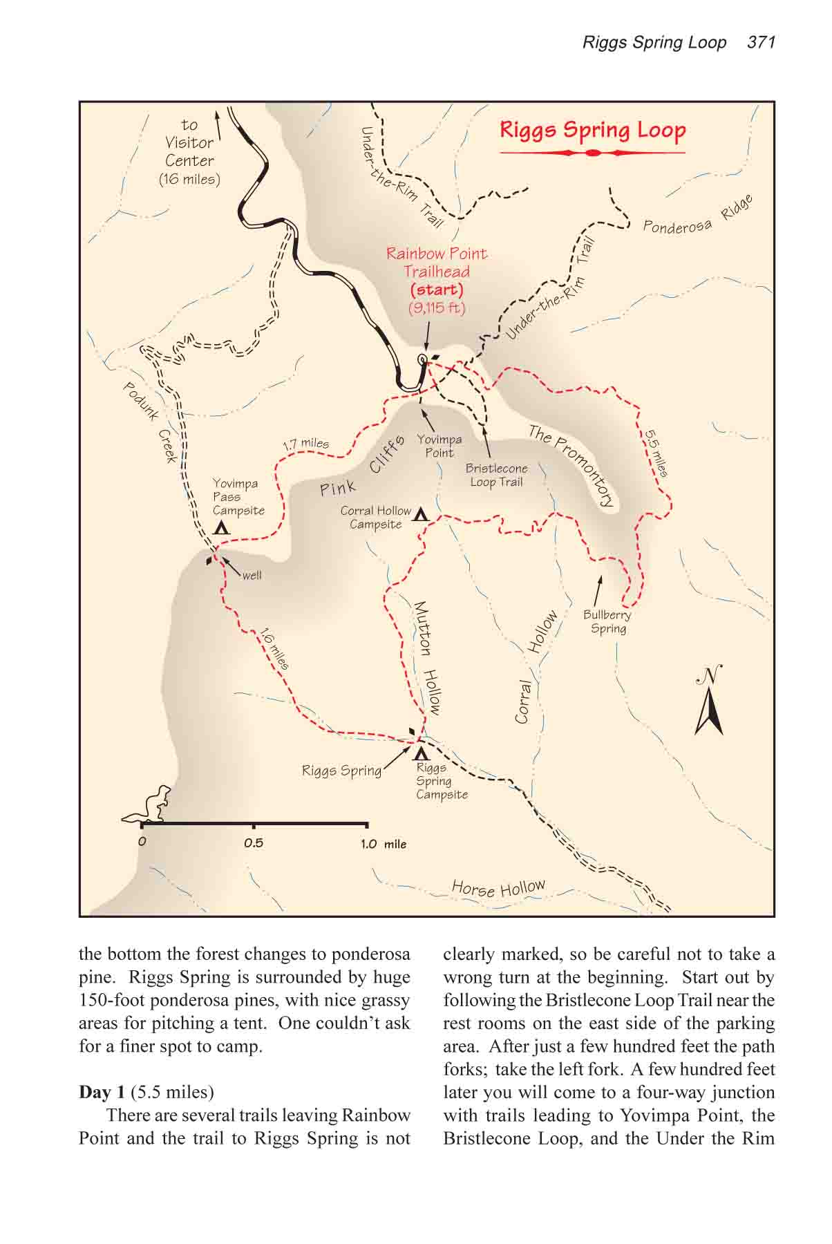
This loop hike can easily be
completed in one day, but Riggs Spring is such a pleasant place
to spend a night it would be a shame not to. The loop can be
walked in either direction, but if you are interested in taking
photographs the western half of the loop is prettiest in the
morning when the eastern sun is shining directly on the Pink
Cliffs. Unless you are getting an early start, save that section
of the trail for the second day.
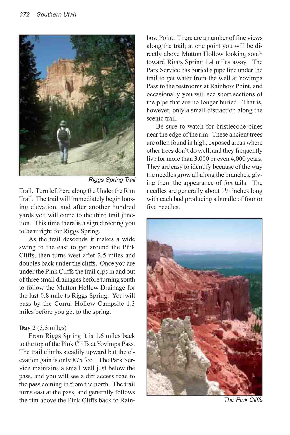
Although there are a few nice views
of Bryce Canyon’s famous rock formations on this hike, the
main attraction is the forest itself. At the higher elevations
you will be in a heavy forest of spruce, Douglas fir, white fir,
and an occasional bristlecone pine. Near the bottom the forest
changes to ponderosa pine. Riggs Spring is surrounded by huge
150-foot ponderosa pines, with nice grassy areas for pitching
a tent. One couldn’t ask for a finer spot to camp.
Day 1
There are several trails leaving
Rainbow Point and the trail to Riggs Spring is not clearly marked,
so be careful not to take a wrong turn at the beginning. Start
out by following the Bristlecone Loop Trail near the rest rooms
on the east side of the parking area. After just a few hundred
feet the path forks; take the left fork. A few hundred feet later
you will come to a four-way junction with trails leading to Yovimpa
Point, the Bristlecone Loop, and the Under the Rim Trail. Turn
left here along the Under the Rim Trail. The trail will immediately
begin loosing elevation, and after another hundred yards you
will come to the third trail junction. This time there is a sign
directing you to bear right for Riggs Spring.
As the trail descends it makes
a wide swing to the east to get around the Pink Cliffs, then
turns west after 2.5 miles and doubles back under the cliffs.
Once you are under the Pink Cliffs the trail dips in and out
of three small drainages before turning south to follow the Mutton
Hollow Drainage for the last 0.8 mile to Riggs Spring. You will
pass by the Corral Hollow campsite 1.3 miles before you get to
the spring.
Day 2
From Riggs Spring it is 1.6 miles
back to the top of the Pink Cliffs at Yovimpa Pass. The trail
climbs steadily upward but the elevation gain is only 875 feet.
The Park Service maintains a small well just below the pass,
and you will see a dirt access road to the pass coming in from
the north. The trail turns east at the pass, and generally follows
the rim above the Pink Cliffs back to Rainbow Point. There are
a number of fine views along the trail; at one point you will
be directly above Mutton Hollow looking south towards Riggs Spring
1.4 miles away. The Park Service has buried a pipe line under
the trail to get water from the well at Yovimpa Pass to the restrooms
at Rainbow Point, and occasionally you will see short sections
of the pipe that are no longer buried. That is, however, only
a small distraction along the scenic trail.
Be sure to watch for bristlecone
pines near the edge of the rim. These ancient trees are often
found in high, exposed areas where other trees don’t do
well, and they frequently live for more than 3,000 or even 4,000
years. They are easy to identify because of the way the needles
grow all along the branches, giving them the appearance of fox
tails. The needles are generally about 1 1/2 inches long with
each bud producing a bundle of four or five needles. |