|
Links to other sites:
Ordering books & Maps
Comments about this site or our book:

|
Ryder and Kermsuh Lakes are
the other two major lakes, besides Amethyst Lake, that lie within
the Stillwater Drainage of the High Uintas Wilderness Area. When
ancient glaciers were carving the glove-shaped valley during
the past ice age, three large fingers were gouged out of its
southern flanks. Today we call these depressions Amethyst Basin,
West Basin, and Middle Basin. These high mountain basins became
natural places for the formation of lakes when the glaciers melted;
hence the presence of Ryder, Kermsuh, and Amethyst lakes. Amethyst
Lake, of course, is located in Amethyst Basin. Kermsuh Lake is
in West Basin and Ryder is in Middle Basin. All are surrounded
almost entirely by the billion-year-old Precambrian quartzite
cliffs that define the Uinta Crest.
Day 1
For the first 2.6 miles the trail
to Kermsuh and Ryder Lakes is the same as the trail to Amethyst
Lake. The path winds lazily along the eastern side of Christmas
Meadows. Moose are common in this area, and if you gaze out into
the meadow from time to time there is a good chance of seeing
at least a moose cow or young bull. Don’t count on seeing
an older bull, however, as they are much more reclusive than
the younger males. There are also a lot of beaver in the meadow,
as evidenced by the fallen aspen along the way. Beaver seem to
prefer aspen to the other trees-probably because the wood is
softer and less resinous.
After about two miles Christmas
Meadows and most of the quaking aspen are left behind, the canyon
floor narrows, and the creek begins to run a little faster. At
this point the forest is predominantly lodgepole pine, with some
scattered Engelmann spruce. Soon you will encounter a forest
service sign informing you that you have crossed the northern
boundary of the High Uintas Wilderness Area, and a few minutes
later you will see the trail to Amethyst Lake leaving on the
left. Keep to the right here, continuing to follow along the
left bank of the Stillwater Creek.
The trail continues on for another
2.0 miles, climbing very gradually along the canyon floor until
it comes to the next trail junction. As you walk you will begin
to see glimpses of A-1 Peak through the trees on your right and
Mount Agassiz straight ahead. These rocky peaks, reaching 3,000
feet above the Stillwater Creek, are a preview of what lies ahead.
Finally, at a point which is directly magnetic east of A-1 Peak
the trail forks again, and a small sign on a tree indicates the
way to Kermsuh Lake on the right. You should make a mental note
of this trail junction because you will be taking the Kermsuh
Lake trail on the return from Ryder, and it is easy to miss the
sign when walking in the opposite direction. For now, however,
continue straight ahead along the Stillwater.
The trail continues for another
1.8 miles beyond the Kermsuh Lake trail junction before leaving
Stillwater Creek. At an elevation of 9,870 feet, the path crosses
the creek and begins climbing for the last 1.7 miles into the
Middle Basin. But when you reach this point you will probably
want to pause for a while before continuing, because the scenery
is delightful. A clearing in the forest presents you with an
marvelous view of Mount Agassiz across a grassy meadow. If it
is late summer the meadow will be filled with wildflowers.
From Stillwater Creek the trail
climbs rather steeply for 0.5 mile, then levels out for another
beautiful, gentle walk through the high alpine meadows towards
the back of the basin. It is a stunning approach to the lake.
For almost 360 degrees around you you can see the rocky cliffs
that surround Middle Basin, and as you progress westward you
will see Hayden Peak rising up on your right. Finally, after
passing several small ponds, you will cross a small rise in the
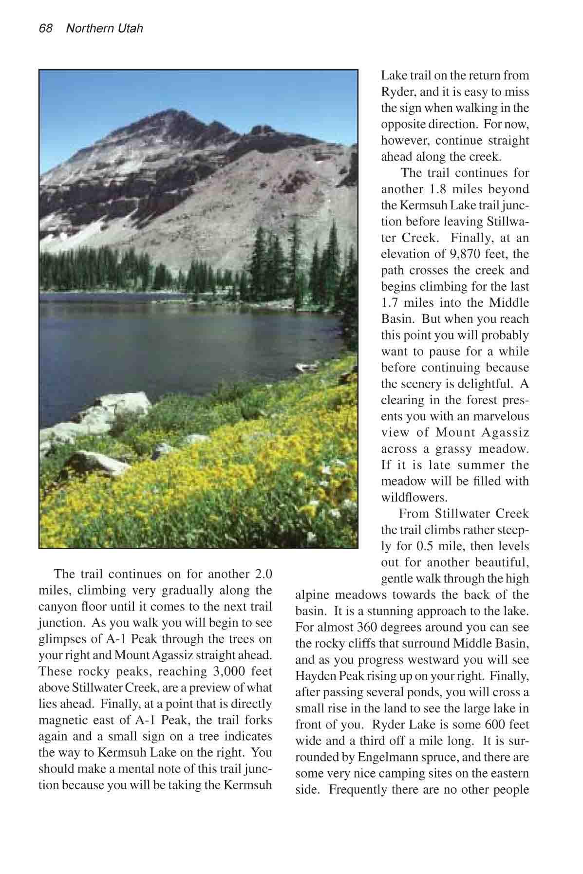
land to see the large lake in front of you. Ryder Lake is some
600 feet wide and 1/3 of a mile long. It is surrounded by Engelmann
spruce, and there are some very nice camping sites on the eastern
side. Frequently there are no other people camping at the lake,
and if you are there on one of those days it will feel as if
you own the entire Middle Basin.
Day 2
If you have time after breaking
camp, you should take a short side hike to McPheters Lake, only
0.4 mile northwest of Ryder. If you have a compass, select a
heading due northwest of Ryder. If you don’t have a compass
just head for the lowest point in the ridge east of Hayden Peak.
You should see the lake after a fifteen-minute walk and an elevation
gain of about 240 feet. McPheters, about the same size as Ryder,
is reputed to be deeper and there are said to be some large fish
in the bottom of the Lake. There are not many trees around the
lake, however, and the camping is far nicer at Ryder.
From the Middle Basin you must
backtrack to Stillwater Creek and down to the Kermsuh Lake Trail,
which you passed on the way to Ryder. Again, the trail to Kermsuh
Lake rises rather steeply for about 0.5 mile after leaving Stillwater,
but soon settles down to a very pleasant walk through a series
of meadows to the back of West Basin. Finally, 2.8 miles from
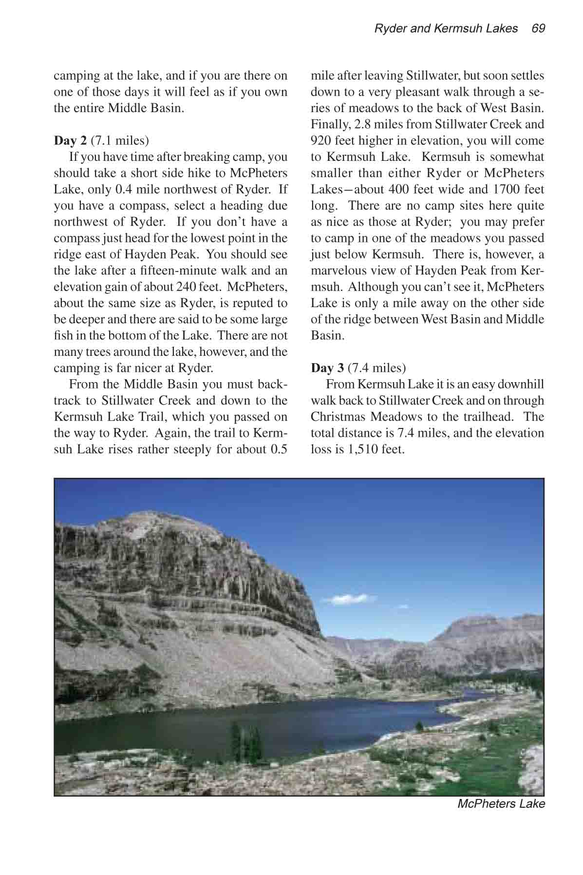
Stillwater Creek and 920 feet higher in elevation, you will come
to Kermsuh Lake. Kermsuh is somewhat smaller than either Ryder
or McPheters Lakes-about 400 feet wide and 1700 feet long. There
are no camp sites here quite as nice as those at Ryder; you may
prefer to camp in one of the meadows you passed just below Kermsuh.
There is, however, a marvelous view of Hayden Peak from Kermsuh.
Also, although you can’t see it, McPheters Lake is only
a mile away on the other side of the ridge between West Basin
and Middle Basin.
Day 3
From Kermsuh Lake it is an easy
downhill walk back to Stillwater Creek and from there to Christmas
Meadows. The total distance is 7.4 miles, and the elevation loss
is 1,510 feet. |