The Kolob Canyons section of Zion National Park offers
visitors a splendid opportunity to enjoy Zion’s unique redrock canyons
without enduring the crowds of people that are usually present in Zion
Canyon. Of particular interest to hikers are the Finger Canyons of the Kolob.
These scenic canyons are deeply etched into the western side of the Kolob
Plateau, and from above they look like so many fingers clawing their way
into the plateau’s rouge colored sandstone. None of the canyons are more
than a few miles long, but they are notable because of their sheer walls.
Typically the cliffs are over a thousand feet high, rising nearly vertically
through the Navajo Sandstone Formation that underlies the plateau.
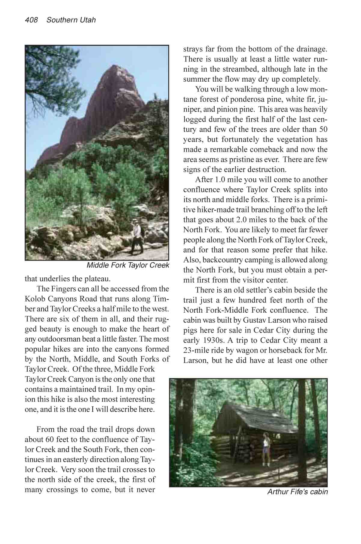
The Fingers can all be accessed from the Kolob Canyons
Road that runs along Timber and Taylor Creeks a half mile to the west. There
are six of them in all, and their rugged beauty is enough to make the heart
of any outdoorsman beat a little faster. The most popular hikes are into the
canyons formed by the North, Middle, and South Forks of Taylor Creek. Of the
three, Middle Fork Taylor Creek Canyon is the only one that contains a
maintained trail. In my opinion this hike is also the most interesting one,
and it is the one I will describe here.
From the road the trail drops down about 60 feet to the
confluence of Taylor Creek and the South Fork, then continues in an easterly
direction along Taylor Creek. Very soon the trail crosses to the north side
of the creek, the first of many crossings to come, but it never strays far
from the bottom of the drainage. There is usually at least a little water
running in the streambed, although late in the summer the flow may dry up
completely.
You will be walking through a low montane forest of
ponderosa pine, white fir, juniper, and pinion pine. This area was heavily
logged during the first half of the last century and few of the trees are
older than 50 years, but fortunately the vegetation has made a remarkable
comeback and now the area seems as pristine as ever. There are few signs of
the earlier destruction.
After 1.0 mile you will come to another confluence where
Taylor Creek splits into its north and middle forks. There is a primitive
hiker-made trail branching off to the left that goes about 2.0 miles to the
back of the North Fork. You are likely to meet far fewer people along the
North Fork of Taylor Creek, and for that reason some prefer that hike. Also,
backcountry camping is allowed along the North Fork, but you must obtain a
permit first from the visitor center.
There is an old settler’s cabin beside the trail just a
few hundred feet north of the North Fork-Middle Fork confluence. The cabin
was built by Gustav Larson who raised pigs here for sale in Cedar City
during the early 1930s. A trip to Cedar City meant a 23-mile ride by wagon
or horseback for Mr. Larson, but he did have at least one other neighbor in
the area. In 1930, about the same year that the Larson Cabin was built, a
professor named Arthur Fife from the agricultural college in Cedar City
built a cabin along the Middle Fork of Taylor Creek. Professor Fife’s
cabin is located on the left side of the creek 1.0 miles further upstream.
Middle Fork Canyon begins about 300 yards upstream from
the Larson cabin, and by the time you reach the Fife cabin the canyon will
have narrowed to just a few hundred feet. Fife raised goats on his property,
and he built a fence across the canyon in order to contain his animals.
There is now no trace of Fife’s fence, but both his and Larson’s cabins
are still in remarkably good condition. The Fife cabin is right by the
trail, but if you are walking in the streambed, as many people do, you might
miss it. It is located about 20 feet from the left bank of the creek in a
heavily shaded grove of trees.
The trail ends at the Double Arch Alcove, 0.7 mile beyond
Arthur Fife’s cabin. This alcove is a large cave, about 150 feet deep and
150 feet in diameter, located 20 feet above the streambed on the south side
of the canyon. Like most sandstone alcoves, this one was formed by a seep in
the side of the cliff. Water seeping out from the canyon wall weakens the
sandstone and eventually causes it to crumble away. A great deal of water is
still seeping out of the Double Arch Alcove, and, judging from the size of
the cave, the seep has been active for many thousands of years. The alcove
was named after two blind arches (arches that have not yet been completely
formed) that are located on the cliffs above.
If you still have energy left when you reach the Double
Arch Alcove it is possible to continue up Middle Fork Canyon for another 0.8
mile before the walls close in and make further progress impossible. 0.2
mile above the alcove the canyon is blocked by an ancient rockslide, but if
you are willing to do some scrambling you can easily climb around the right
side of this obstacle. After climbing about a hundred feet to the top of the
slide the canyon floor flattens out again and widens into a small hanging
valley. From there you can continue another 0.6 mile or so before further
progress becomes impossible.