Davis Canyon
excerpted from our book
Canyonlands National Park
Favorite Jeep Roads & Hiking Trails
pages 201-205
|
Buy book directly from the author!
Canyonlands National Park
Favorite Jeep Roads & Hiking Trails
- has access info for 75 trailheads
- 56 detailed trail maps
- 241 photographs
- loads of driving and hiking tips
|
regularly $14.95
now on sale for only
$11.95
click here
for book orders
|
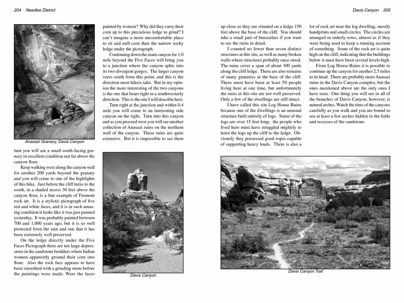
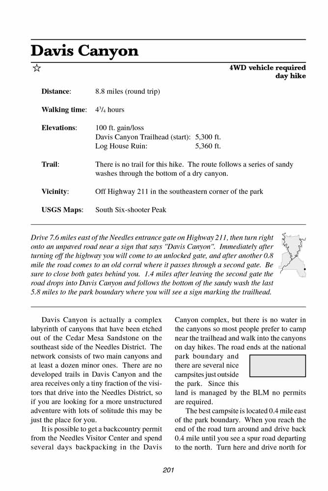 Davis Canyon is actually a complex labyrinth of canyons that have been etched out of the Cedar Mesa Sandstone on the southeast side of the Needles District.
The network consists of two main canyons and at least a dozen minor ones.
There are no developed trails in Davis Canyon and the area receives only a tiny fraction of the visitors that drive into the Needles District,
so if you are looking for a more unstructured adventure with lots of solitude this may be just the place for you.
Davis Canyon is actually a complex labyrinth of canyons that have been etched out of the Cedar Mesa Sandstone on the southeast side of the Needles District.
The network consists of two main canyons and at least a dozen minor ones.
There are no developed trails in Davis Canyon and the area receives only a tiny fraction of the visitors that drive into the Needles District,
so if you are looking for a more unstructured adventure with lots of solitude this may be just the place for you.
It is possible to get a backcountry permit from the Needles Visitor Center and spend several days backpacking in the Davis Canyon complex,
but there is no water in the canyons so most people prefer to camp near the trailhead and walk into the canyons on day hikes.
The road ends at the national park boundary and there are several nice campsites just outside the park. Since this land is managed by the BLM no permits are required.
The best campsite is located 0.4 mile east of the park boundary. When you reach the end of the road turn around and drive back 0.4 mile until you see a spur road departing to the north.
Turn here and drive north for another 200 yards to the end of the spur.
The road ends at a beautiful campsite below the northern wall of the canyon, and as an added bonus there are two small Anasazi granaries on a ledge 20 feet above the camp.
You can see one of the granaries from the camp, but if you want a closer look walk east along the base of the sandstone cliff for 150 yards.
There you will find a break in the wall where it is possible to climb up to the ledge and backtrack to the granaries.
The hike described below is one that I found particularly interesting, but it explores just one section of the Davis Canyon complex.
If you enjoy it I encourage you to walk up some of the other side canyons and see what you can discover on your own.
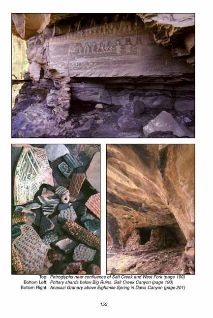
700 years ago there was a significant population of Anasazi Indians living near the Davis Canyon Trailhead.
Eight Mile Spring is located in the bottom of the wash just east of the park boundary, and the number of ruins in the area indicate that the spring must have supported a sizable Indian community.
Today the spring is completely overgrown with willows, tamarisk, and cottonwoods, but at that time this area was undoubtedly productive farmland.
 As you walk into the national park from the trailhead you will soon begin to see the remnants of the ancient Anasazis.
The first ruin is located in the back of a high alcove 200 yards from the traihhead on the north side of the canyon.
The alcove is about 50 feet wide, 30 feet high, and 100 feet above the canyon floor.
There are also a few remains of other small structures along the base of the cliffs west of the alcove, but most of them are so deteriorated they are hard to recognize.
As you walk into the national park from the trailhead you will soon begin to see the remnants of the ancient Anasazis.
The first ruin is located in the back of a high alcove 200 yards from the traihhead on the north side of the canyon.
The alcove is about 50 feet wide, 30 feet high, and 100 feet above the canyon floor.
There are also a few remains of other small structures along the base of the cliffs west of the alcove, but most of them are so deteriorated they are hard to recognize.
200 yards beyond the alcove, or 0.2 mile from the trailhead, the canyon wall makes a 90-degree turn to the west.
Continue following along the base of the cliff on your right and just 100 yards after making the turn you will see a small south-facing granary in excellent condition not far above the Davis
Canyon floor.
Keep walking west along the Davis Canyon wall for another 200 yards beyond the granary and you will come to one of the highlights of this hike.
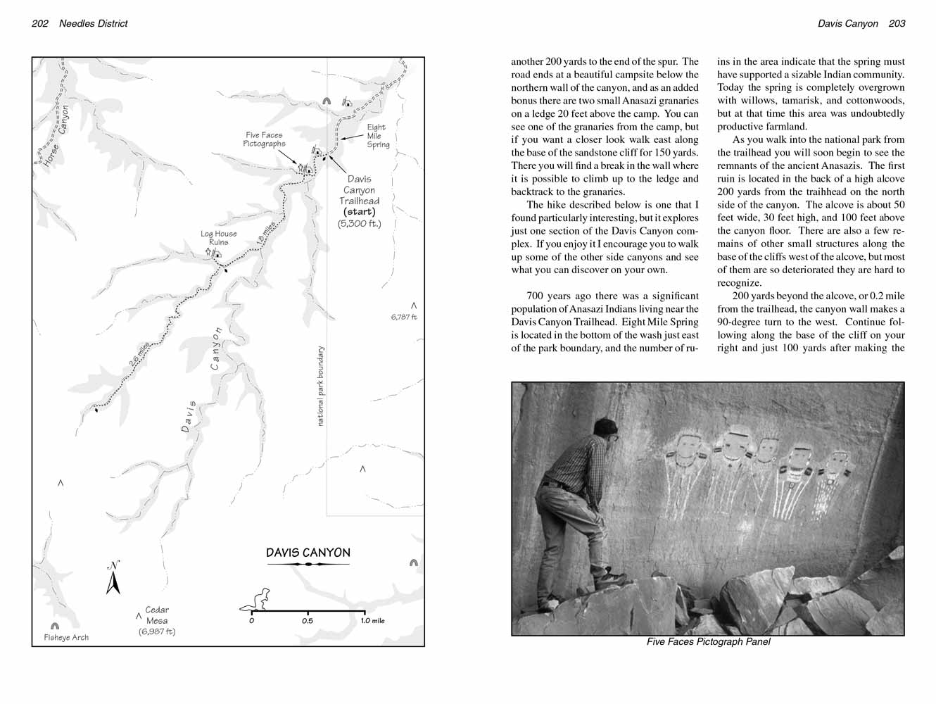
Just before the cliff turns to the south, in a shaded recess 30 feet above the canyon floor, is a fine example of Fremont rock art.
It is a stylistic pictograph of five red and white faces, and it is in such amazing condition it looks like it was just painted yesterday.
It was probably painted between 700 and 1,000 years ago, but it is so well protected from the rain and sun that it has been extremely well preserved.
On the ledge directly under the Five Faces Pictograph there are ten large depressions in the sandstone boulders where Indian women apparently ground their corn into flour.
Also the rock face appears to have been smoothed with a grinding stone before the paintings were made. Were the faces painted by women?
Why did they carry their corn up to this precarious ledge to grind? I can’t imagine a more uncomfortable place to sit and mill corn than the narrow rocky ledge under the pictograph.
 Continuing down Davis Canyon for 1.0 mile beyond the Five Faces will bring you to a junction where the canyon splits into its two divergent gorges.
The larger canyon veers south from this point, and this is the direction most hikers take. But in my opinion the more interesting of the two canyons is the one that bears right in a southwesterly direction.
This is the one I will describe here.
Continuing down Davis Canyon for 1.0 mile beyond the Five Faces will bring you to a junction where the canyon splits into its two divergent gorges.
The larger canyon veers south from this point, and this is the direction most hikers take. But in my opinion the more interesting of the two canyons is the one that bears right in a southwesterly direction.
This is the one I will describe here.
Turn right at the junction and within 0.4 mile you will come to an interesting side canyon on the right.
Turn into this canyon and as you proceed west you will see another collection of Anasazi ruins on the northern wall of the canyon.
These ruins are quite extensive. But it is impossible to see them up close as they are situated on a ledge 150 feet above the base of the cliff.
You should take a small pair of binoculars if you want to see the ruins in detail.
I counted no fewer than seven distinct structures at this site, as well as many broken walls where structures probably once stood.
The ruins cover a span of about 100 yards along the cliff ledge. There are also remains of many granaries at the base of the cliff.
There must have been at least 50 people living here at one time, but unfortunately the ruins at this site are not well preserved. Only a few of the dwellings are still intact.
I have called this site Log House Ruins because one of the dwellings is an unusual structure built entirely of logs.
Some of the logs are over 15 feet long; the people who lived here must have struggled mightily to hoist the logs up the cliff to the ledge.
Obviously they possessed good ropes capable of supporting heavy loads. There is also a lot of rock art near the log dwelling, mostly handprints and small circles.
The circles are arranged in orderly rows, almost as if they were being used to keep a running account of something.
Some of the rock art is quite high on the cliff, indicating that the buildings below it must have been several levels high.
From Log House Ruins it is possible to continue up the canyon for another 2.5 miles to its head.
There are probably more Anasazi ruins in the Davis Canyon complex, but the ones mentioned above are the only ones I have seen.
One thing you will see in all of the branches of Davis Canyon, however, is natural arches.
Watch the rims of the canyons carefully as you walk and you are bound to see at least a few arches hidden in the folds and recesses of the sandstone.
Note to web developers: You may copy this material onto your site, but in return please include a link to my home page
www.utahtrails.com. Thank you, David Day (utahdavidday at gmail.com)
Click here to see more trails in
Canyonlands National Park
© Rincon Publishing Company, all rights reserved
|