Devils Pocket
Loop Trail
excerpted from our book
Canyonlands National Park
Favorite Jeep Roads & Hiking Trails
pages 175-177
|
Buy book directly from the author!
Canyonlands National Park
Favorite Jeep Roads & Hiking Trails
- has access info for 75 trailheads
- 56 detailed trail maps
- 241 photographs
- loads of driving and hiking tips
|
regularly $14.95
now on sale for only
$11.95
click here
for book orders
|
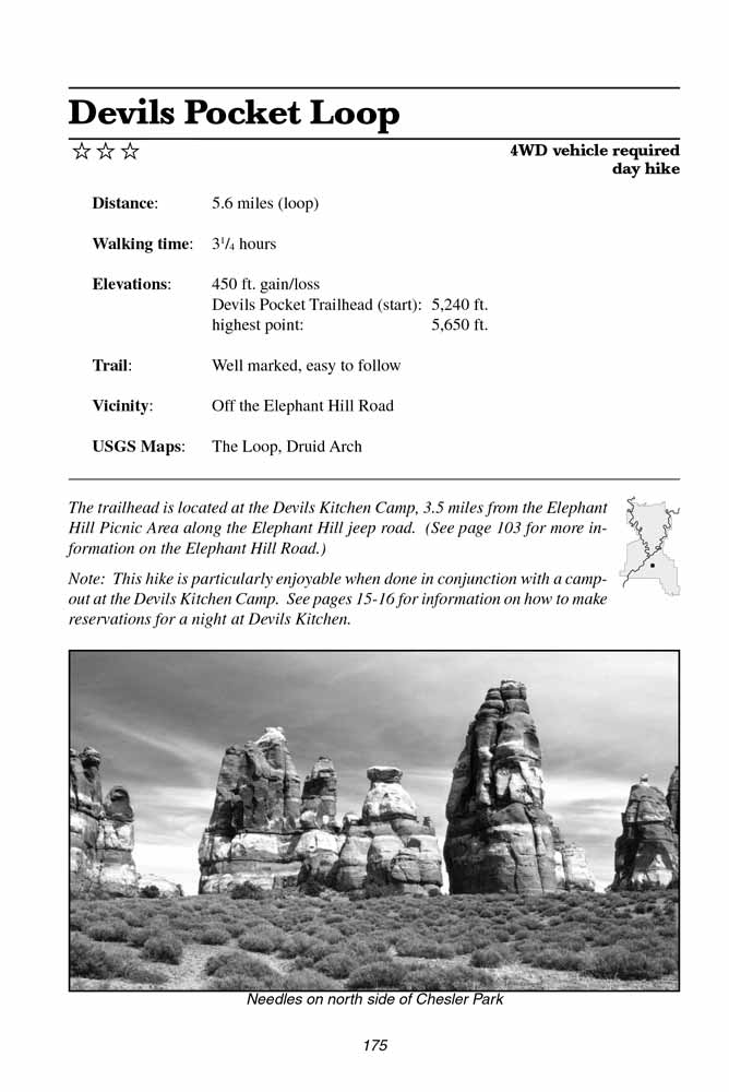 Devils Pocket is the whimsical name given to an odd, flat-bottomed canyon that extends southward from the Devils Kitchen Campground.
This canyon is one of many unusual depressions that occur east of the Colorado River in the Needles area.
Geologists call them grabens, and they are formed in areas where the surface of the land has dropped downward between two parallel faults.
In Canyonlands this geologic activity is the result of a huge deposit of salt that lies several thousand feet below the surface.
The fluid-like salt is continually being pushed and squeezed by movements in the earth’s crust, causing the overlying rock to collapse into sinkholes and grabens or be pushed up into domes and horsts.
Devils Pocket is the whimsical name given to an odd, flat-bottomed canyon that extends southward from the Devils Kitchen Campground.
This canyon is one of many unusual depressions that occur east of the Colorado River in the Needles area.
Geologists call them grabens, and they are formed in areas where the surface of the land has dropped downward between two parallel faults.
In Canyonlands this geologic activity is the result of a huge deposit of salt that lies several thousand feet below the surface.
The fluid-like salt is continually being pushed and squeezed by movements in the earth’s crust, causing the overlying rock to collapse into sinkholes and grabens or be pushed up into domes and horsts.
Walking south from Devils Kitchen through Devils Pocket is a little like walking down a long, wide racetrack,
with parallel walls of sandstone that rise along either side like bleachers for the imaginary spectators.
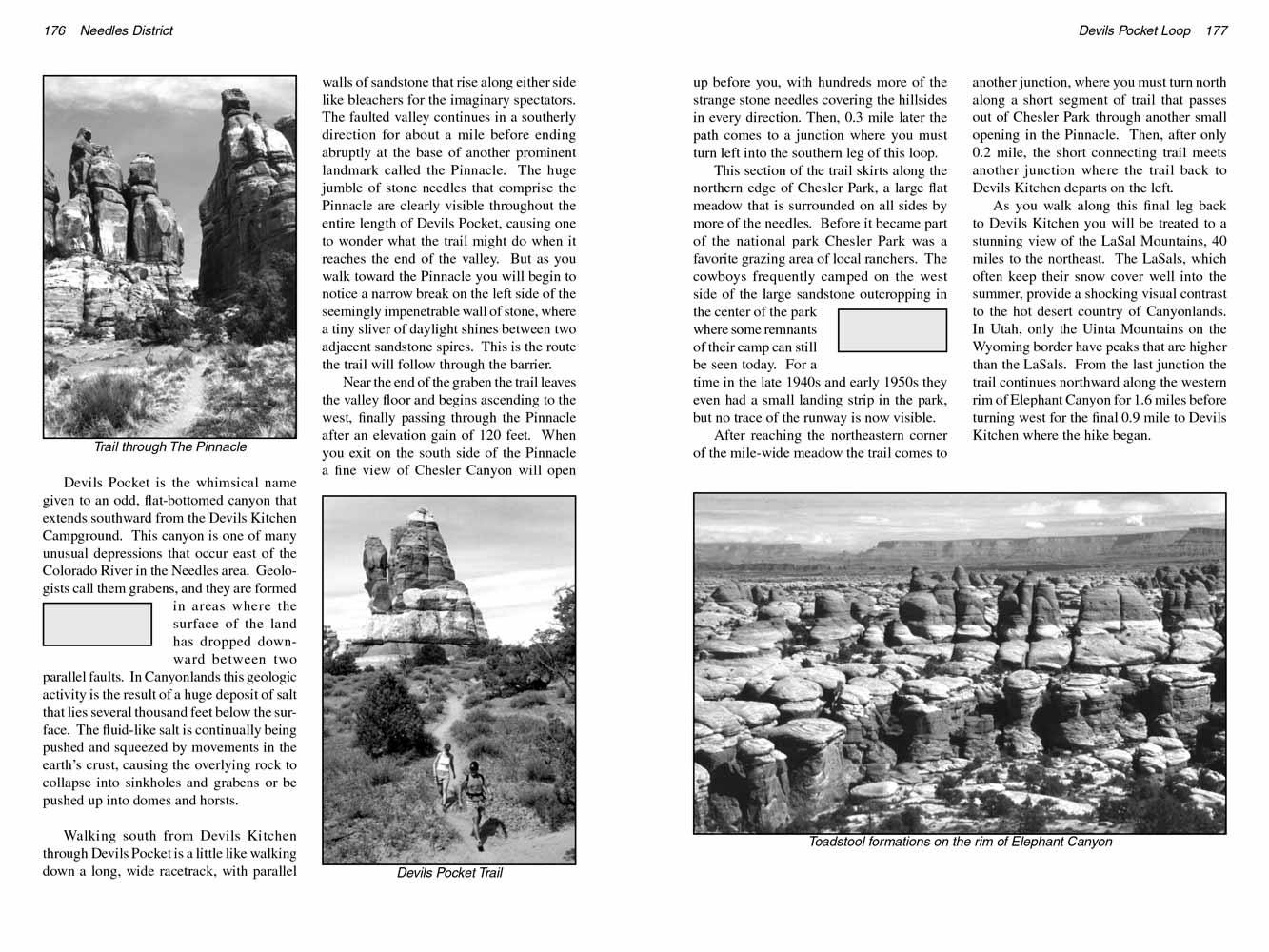
The faulted valley continues in a southerly direction for about a mile before ending abruptly at the base of another prominent landmark called the Pinnacle.
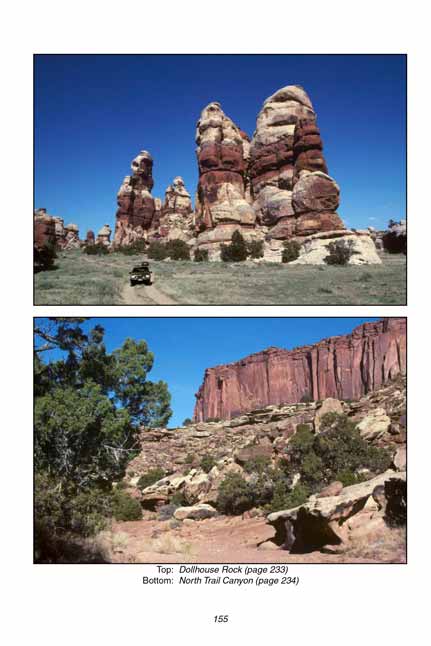
The huge jumble of stone needles that comprise the Pinnacle are clearly visible throughout the entire length of Devils Pocket, causing one to wonder what the trail might do when it reaches the end of the valley.
But as you walk toward the Pinnacle you will begin to notice a narrow break on the left side of the seemingly impenetrable wall of stone, where a tiny sliver of daylight shines between two adjacent sandstone spires.
This is the route the trail will follow through the barrier.
 Near the end of the Devils Pocket graben the trail leaves the valley floor and begins ascending to the west, finally passing through the Pinnacle after an elevation gain of 120 feet.
When you exit on the south side of the Pinnacle a fine view of Chesler Canyon will open up before you, with hundreds more of the strange stone needles covering the hillsides in every direction.
Then, 0.3 mile later the path comes to a junction where you must turn left into the southern leg of the Devils Pocket loop.
Near the end of the Devils Pocket graben the trail leaves the valley floor and begins ascending to the west, finally passing through the Pinnacle after an elevation gain of 120 feet.
When you exit on the south side of the Pinnacle a fine view of Chesler Canyon will open up before you, with hundreds more of the strange stone needles covering the hillsides in every direction.
Then, 0.3 mile later the path comes to a junction where you must turn left into the southern leg of the Devils Pocket loop.
This section of the Devils Pocket trail skirts along the northern edge of Chesler Park, a large flat meadow that is surrounded on all sides by more of the needles.
Before it became part of the national park Chesler Park was a favorite grazing area of local ranchers.
The cowboys frequently camped on the west side of the large sandstone outcropping in the center of the park where some remnants of their camp can still be seen today.
For a time in the late 1940s and early 1950s they even had a small landing strip in the park, but no trace of the runway is now visible.
After reaching the northeastern corner of the mile-wide meadow the trail comes to another junction,
where you must turn north along a short segment of trail that passes out of Chesler Park through another small opening in the Pinnacle.
Then, after only 0.2 mile, the short connecting trail meets another junction where the trail back to Devils Kitchen departs on the left.
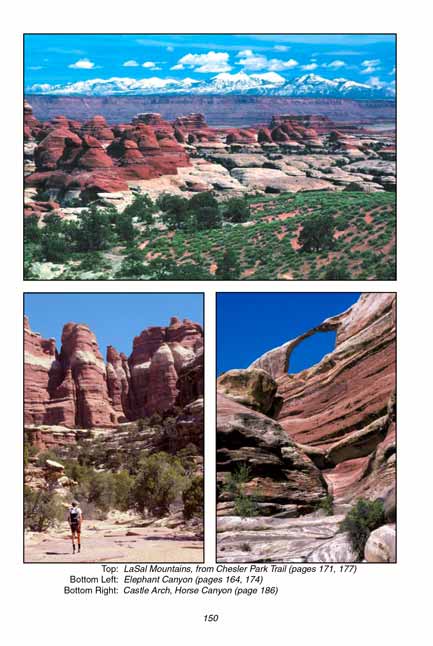
As you walk along this final leg back to Devils Kitchen you will be treated to a stunning view of the LaSal Mountains, 40 miles to the northeast.
The LaSals, which often keep their snow cover well into the summer, provide a shocking visual contrast to the hot desert country of Canyonlands
National Park.
In Utah, only the Uinta Mountains on the Wyoming border have peaks that are higher than the LaSals.
From the last junction the trail continues northward along the western rim of Elephant Canyon for 1.6 miles before turning west for the final 0.9 mile to Devils Kitchen where the hike began.
Note to web developers: You may copy this material onto your site, but in return please include a link to my home page
www.utahtrails.com. Thank you, David Day (utahdavidday at gmail.com)
Click here to see more trails in
Canyonlands National Park
© Rincon Publishing Company, all rights reserved
|