Horse Canyon
Salt Creek Canyon
excerpted from our book
Canyonlands National Park
Favorite Jeep Roads & Hiking Trails
pages 109-113
|
Buy book directly from the author!
Canyonlands National Park
Favorite Jeep Roads & Hiking Trails
- has access info for 75 trailheads
- 56 detailed trail maps
- 241 photographs
- loads of driving and hiking tips
|
regularly $14.95
now on sale for only
$11.95
click here
for book orders
|
 Horse Canyon, a major tributary of Salt Creek Canyon, was probably named by the Milton family who ran horses in the canyon around 1930. There is no easy way out of the upper
part of the canyon, and with a fence across the lower canyon it made a perfect enclosure.
Horse Canyon was also important to the prehistoric Indians, and several archeological sites attest to their early habitation. Most of the ruins were built by the Anasazis, but there is also at least
one panel of Fremont pictographs. Unlike Salt Creek Canyon there is now little water in Horse Canyon, but perhaps that was not the case 800 years ago when the Anasazis were growing their crops.
Horse Canyon, a major tributary of Salt Creek Canyon, was probably named by the Milton family who ran horses in the canyon around 1930. There is no easy way out of the upper
part of the canyon, and with a fence across the lower canyon it made a perfect enclosure.
Horse Canyon was also important to the prehistoric Indians, and several archeological sites attest to their early habitation. Most of the ruins were built by the Anasazis, but there is also at least
one panel of Fremont pictographs. Unlike Salt Creek Canyon there is now little water in Horse Canyon, but perhaps that was not the case 800 years ago when the Anasazis were growing their crops.
Before 1998 it was possible to drive 4WD vehicles up Salt Creek Canyon all the way to Angel Arch, but in an effort to better preserve the canyon ecology the road has now been closed. Hikers
are still permitted to use upper Salt Creek Canyon, but vehicles are now allowed only as far as the Peekaboo Camp. (See page 189 for a description of the Salt Creek Trail above Peekaboo Camp.)
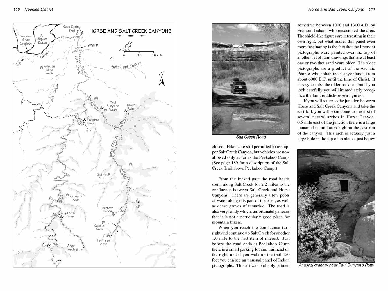
From the locked gate the road heads south along Salt Creek for 2.2 miles to the confluence between Salt Creek
Canyon and Horse Canyon. There are generally a few pools of water along this part of the road, as well as dense groves of tamarisk. The road is also very sandy which, unfortunately, means that it
is not a particularly good place for mountain bikers.
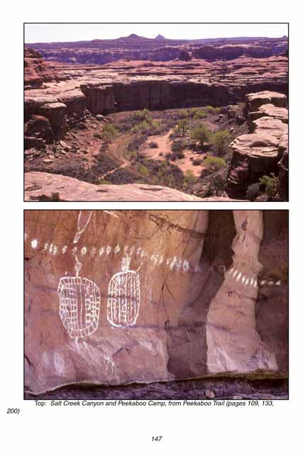
When you reach the confluence turn right and continue up Salt Creek Canyon for another 1.0 mile to the first item of interest. Just before the road ends at Peekaboo Camp there is a small parking
lot and trailhead on the right, and if you walk up the trail 150 feet you can see an unusual panel of Indian pictographs. This art was probably painted sometime between 1000 and 1300 A.D. by
Fremont Indians who occasioned the area. The shield-like figures are interesting in their own right, but what makes this panel even more fascinating is the fact that the Fremont pictographs
were painted over the top of another set of faint drawings that are at least one or two thousand years older. The older pictographs are a product of the Archaic People who inhabited
Canyonlands from about 6000 B.C. until the time of Christ. It is easy to miss the older rock art, but if you look carefully you will immediately recognize the faint reddish-brown figures..
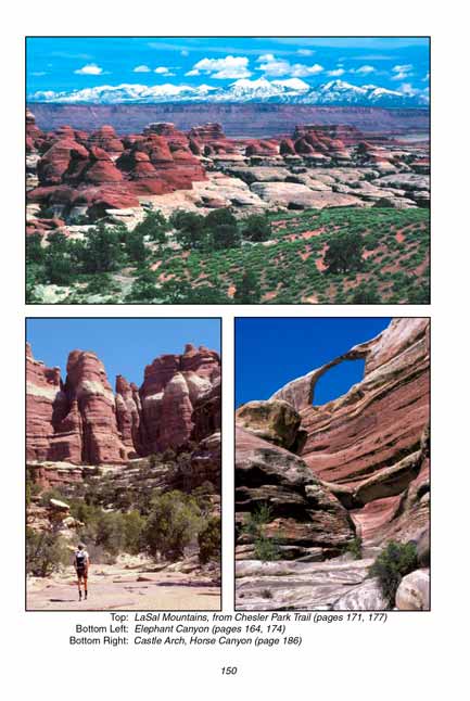
 If you will return to the junction between Horse Canyon and Salt Creek Canyon and take the east fork you will soon come to the first of several natural arches in Horse Canyon.
0.5 mile east of the junction there is a large unnamed natural arch high on the east rim of
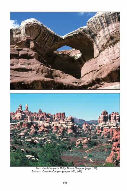
Salt Creek canyon. This arch is actually just a large hole in the top of an alcove just below the rim. Then another 0.5 mile will bring you to Paul Bunyan’s Potty, the best known arch in the canyon.
Again, Paul Bunyan’s Potty consists of a large hole in the top of an alcove on the east side of the canyon. The alcove is about 150 feet in diameter, with the opening at the top about half that
size. It is well named-it looks just like a giant toilet seat.
If you will return to the junction between Horse Canyon and Salt Creek Canyon and take the east fork you will soon come to the first of several natural arches in Horse Canyon.
0.5 mile east of the junction there is a large unnamed natural arch high on the east rim of
Salt Creek canyon. This arch is actually just a large hole in the top of an alcove just below the rim. Then another 0.5 mile will bring you to Paul Bunyan’s Potty, the best known arch in the canyon.
Again, Paul Bunyan’s Potty consists of a large hole in the top of an alcove on the east side of the canyon. The alcove is about 150 feet in diameter, with the opening at the top about half that
size. It is well named-it looks just like a giant toilet seat.
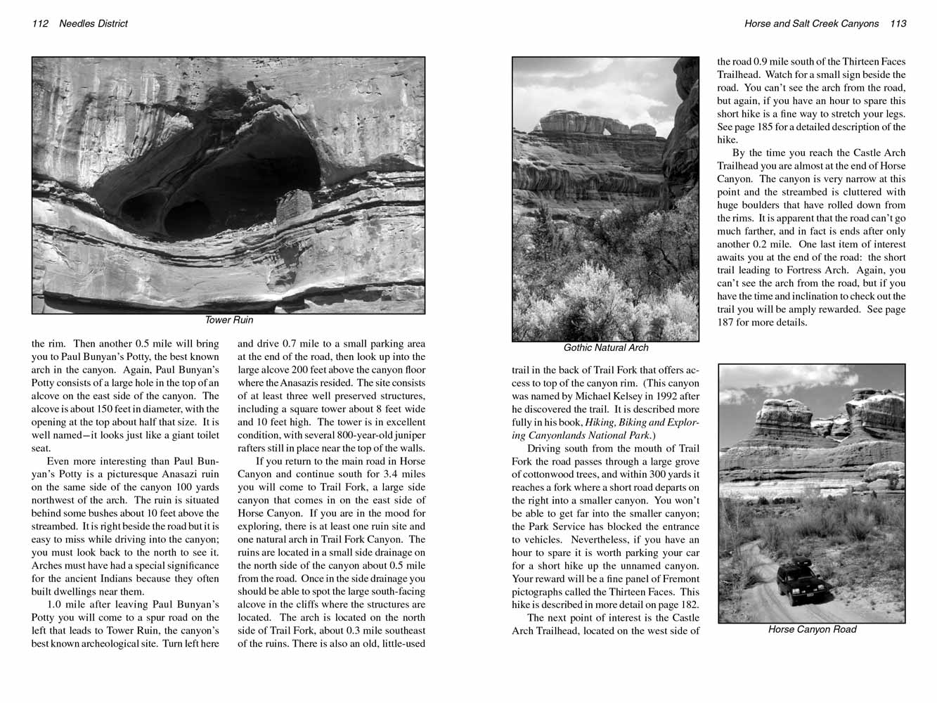
Even more interesting than Paul Bunyan’s Potty is a picturesque Anasazi ruin on the same side of the canyon 100 yards northwest of the arch. The ruin is situated behind some bushes about 10 feet
above the streambed. It is right beside the road but it is easy to miss while driving into the canyon; you must look back to the north to see it. Arches must have had a special significance for
the ancient Indians because they often built dwellings near them.
1.0 mile after leaving Paul Bunyan’s Potty you will come to a spur road on the left that leads to Tower Ruin,
Horse Canyon’s best known archeological site. Turn left here and drive 0.7 mile to a
small parking area at the end of the road, then look up into the large alcove 200 feet above the canyon floor where the Anasazis resided. The site consists of at least three well preserved
structures, including a square tower about 8 feet wide and 10 feet high. The tower is in excellent condition, with several 800-year-old juniper rafters still in place near the top of the walls.
If you return to the main road in Horse Canyon and continue south for 3.4 miles you will come to Trail Fork, a large side canyon that comes in on the east side of Horse Canyon.
If you are in the mood for more exploring, there is at least one ruin site and one natural arch in Trail Fork Canyon. The ruins are located in a small side drainage on the north side of the canyon
about 0.5 mile from the road. Once in the side drainage you should be able to spot the large south-facing alcove in the cliffs where the structures are located. The arch is located on the
north side of Trail Fork, about 0.3 mile southeast of the ruins. There is also an old, little-used trail in the back of Trail Fork that offers access to top of the canyon rim.
(This canyon was named by Michael Kelsey in 1992 after he discovered the trail. It is described more fully in his book,
"Hiking, Biking and Exploring Canyonlands National Park".
 Driving south from the mouth of Trail Fork the road passes through a large grove of cottonwood trees, and within 300 yards it reaches a fork where a short road departs on the
right into a smaller canyon. You won’t be able to get far into the smaller canyon: the Park Service has blocked the entrance to vehicles. Nevertheless, if you have an hour to spare it is worth
parking your car for a short hike up the unnamed canyon. Your reward will be a fine panel of Fremont pictographs called the Thirteen Faces. This hike is described in more detail on page 182.
Driving south from the mouth of Trail Fork the road passes through a large grove of cottonwood trees, and within 300 yards it reaches a fork where a short road departs on the
right into a smaller canyon. You won’t be able to get far into the smaller canyon: the Park Service has blocked the entrance to vehicles. Nevertheless, if you have an hour to spare it is worth
parking your car for a short hike up the unnamed canyon. Your reward will be a fine panel of Fremont pictographs called the Thirteen Faces. This hike is described in more detail on page 182.
The next point of interest is the Castle Arch Trailhead, located on the west side of the Horse Canyon road 0.9 mile south of the Thirteen Faces Trailhead. Watch for a small sign beside the road.
You can’t see the arch from the road, but again, if you have an hour to spare this short hike is a fine way to stretch your legs. See page 185 for a detailed description of the hike.
By the time you reach the Castle Arch Trailhead you are almost at the end of Horse Canyon. The canyon is very narrow at this point and the streambed is cluttered with huge boulders that have
rolled down from the rims. It is apparent that the road can’t go much farther, and in fact is ends after only another 0.2 mile. One last item of interest awaits you at the end of the road: the
short trail leading to Fortress Arch. Again, you can’t see the arch from the road, but if you have the time and inclination to check out the trail you will be amply rewarded. See page 187 for more details.
Note to web developers: You may copy this material onto your site, but in return please include a link to my home page
www.utahtrails.com. Thank you, David Day (utahdavidday at gmail.com)
Click here to see more trails in
Canyonlands National Park
© Rincon Publishing Company, all rights reserved
|