Needles District
Overview
excerpted from our book
Canyonlands National Park
Favorite Jeep Roads & Hiking Trails
page 206
|
Buy book directly from the author!
Canyonlands National Park
Favorite Jeep Roads & Hiking Trails
- has access info for 75 trailheads
- 56 detailed trail maps
- 241 photographs
- loads of driving and hiking tips
|
regularly $14.95
now on sale for only
$11.95
click here
for book orders
|
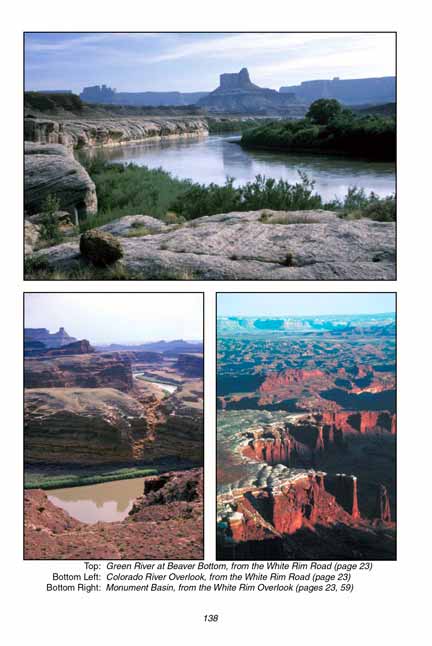
The Needles District, separated from the rest of Canyonlands
National Park by the mighty Colorado River, offers a lesson in geology very different from that presented by the Island in the Sky.
Missing are the impressive red cliffs of Wingate Sandstone, and gone is the wide, flat plateau of White Rim Sandstone.
These geologic strata have been largely eroded away from the land immediately east of the Colorado
River, leaving exposed large patches of the much older Cedar Mesa Sandstone.
The process of erosion is very uneven, but it is also unrelenting.
Perhaps in another million years the Cedar Mesa Formation will also have been washed away by the Colorado, but for now the task is only half finished.
The once solid layer of Cedar Mesa Sandstone has been only partially etched away,
and what is left is an astonishing array of pinnacles and towers, that protrude from the landscape like hundreds of stone needles poking out of a giant's pincushion.
Why does this stone erode in such an odd fashion? The Wingate tends to form vertical cliffs, while the Navajo Sandstone erodes into round domes.
The Entrada forms arches, and the Cedar Mesa Sandstone forms needles. It is an fascinating puzzle.
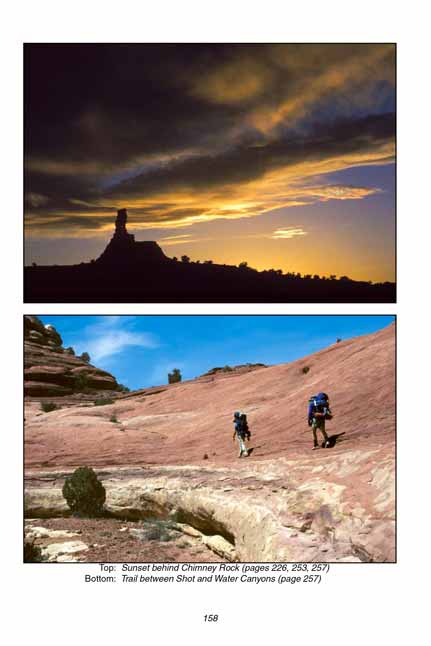
But whatever the reasons, the Needles District of Canyonlands National Park is an incredible place for hikers.
A wide selection of trails meander through the canyons and spires, sometimes entering surprisingly flat meadows where the sandstone has been completely removed.
The parks and meadows of the Needles District were a great attraction for local ranchers before Canyonlands became a national park, and cattle were grazed there throughout the first half of the last century.
Most of the jeep roads in the Needles were built by the early ranchers, including the famous Elephant Hill Road that will be described later.
The ranchers even maintained landing strips for small airplanes in a few of the meadows. The largest and best know of the ranches was the Dugout Ranch.
Although cattle are no longer grazed within the boundaries of the national park, the Dugout Ranch is still in operation just east of the park boundary.
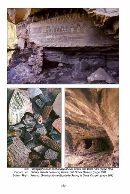
Before 1300 AD there were a large number of Indians living on the east side of the Colorado River, and many of their artifacts can still be seen in the Needles District.
The ruins are especially numerous in Lavender, Davis, Horse, and Salt Creek Canyons near the park's southern boundary.
The prehistoric Indian dwellers were primarily Anasazis, although there are a number of fine pictograph panels in the area that were made by the Fremont Indians.
The two cultures seem to have peacefully cohabited the area for several centuries, but archeologists are still not sure what their relationship was.
Before the mid-1990s it was possible to drive a jeep into all four canyons, but now Davis and Salt Creek Canyon are open to hikers only.
Note to web developers: You may copy this material onto your site, but in return please include a link to my home page
www.utahtrails.com. Thank you, David Day (utahdavidday at gmail.com)
Click here to see more trails in
Canyonlands National Park
© Rincon Publishing Company, all rights reserved
|