Pictograph Fork
excerpted from our book
Canyonlands National Park
Favorite Jeep Roads & Hiking Trails
pages 253-256
|
Buy book directly from the author!
Canyonlands National Park
Favorite Jeep Roads & Hiking Trails
- has access info for 75 trailheads
- 56 detailed trail maps
- 241 photographs
- loads of driving and hiking tips
|
regularly $14.95
now on sale for only
$11.95
click here
for book orders
|
 This hike provides an opportunity to explore four intersecting canyons of the Maze, that crazy labyrinth of canyons after which the Maze District of Canyonlands was named. As a bonus, the trail also passes by the Harvest Scene, an impressive panel of ancient Indian pictographs near the mouth of Pictograph Fork. The Harvest Scene was probably painted by the Archaic People who lived in the canyons from about 6,000 B.C. until the time of Christ. They tended to live further inland from the Colorado and Green Rivers than the Anasazi and Fremont Indians who came to the area much later. Why the preferred to live so far from the rivers is a mystery, but their distinctive red, purple, orange, and gray pictographs can be found at a number of sites in the upper reaches of the dry desert canyons of Canyonlands National Park.
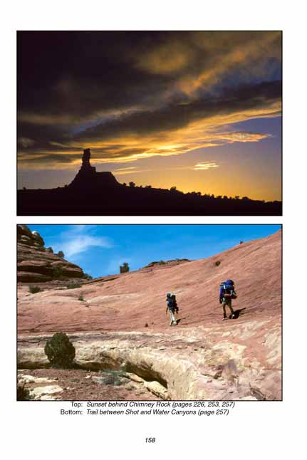
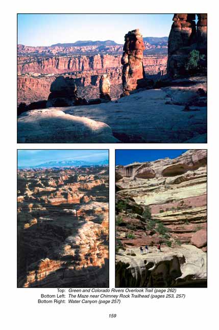
There are four cairned trails leaving from the Chimney Rock parking area. The first trail on the left, bearing around the west side of Chimney Rock, leads directly to the bottom of Pictograph Fork. When you return to the trailhead at the end of the loop you will be on this trail. The second trail from the left passes by the east side of Chimney Rock and heads north across the plateau above Pictograph Fork. The hike starts on this trail. (The third and forth trails from the left lead to Shot Canyon and Water Canyon, respectively.
As you walk northward across the slickrock from Chimney Rock you will see Petes Mesa directly in front of you. The large butte behind Petes Mesa is Ekker Butte. If you loose track of the cairns just stay high on the ridge as you continue towards Petes Mesa. When you get to within a half mile of the mesa, however, be sure to watch more carefully for the cairns so you will not miss the turn when the trail begins its descent down into the Maze. Also, be on the lookout for mountain sheep in this area. They are often sighted on the plateau near Petes Mesa.
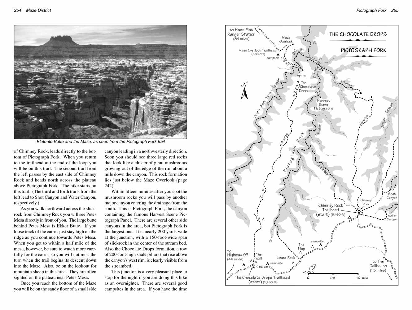 Once you reach the bottom of the Maze you will be on the sandy floor of a small side canyon leading in a northwesterly direction. Soon you should see three large red rocks that look like a cluster of giant mushrooms growing out of the edge of the rim about a mile down the canyon. This rock formation lies just below the Maze Overlook (page 242).
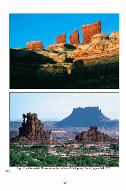
Within fifteen minutes after you spot the mushroom rocks you will pass by another major canyon entering the drainage from the south. This is Pictograph Fork, the canyon containing the famous Harvest Scene Pictograph Panel. There are several other side canyons in the area, but Pictograph Fork is the largest one. It is nearly 200 yards wide at the junction, with a 150-foot-wide span of slickrock in the center of the stream bed. Also the Chocolate Drops formation, a row of 200-foot-high shale pillars that rise above the canyon's west rim, is clearly visible from the streambed.
 This junction is a very pleasant place to stop for the night if you are doing this hike as an overnighter. There are several good campsites in the area. If you have the time you might also want to consider a side trip to the top of the Maze Overlook. The walk from Pictograph Fork to the Maze Overlook and back will take you about 2 hours. (See page 242 for a description of this hike.)
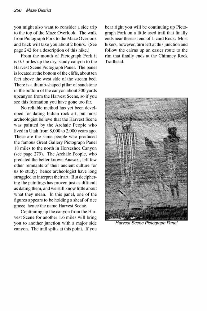
From the mouth of Pictograph Fork it is 0.7 miles up the dry, sandy canyon to the Harvest Scene Pictograph Panel. The panel is located at the bottom of the cliffs, about ten feet above the west side of the stream bed. There is a thumb-shaped pillar of sandstone in the bottom of the canyon about 300 yards upcanyon from the Harvest Scene, so if you see this formation you have gone too far.
No reliable method has yet been developed for dating Indian rock art, but most archeologist believe that the Harvest Scene was painted by the Archaic People who lived in Utah from 8,000 to 2,000 years ago. These are the same people who produced the famous Great Gallery Pictograph Panel 18 miles to the north in Horseshoe Canyon (see page 279). The Archaic People, who predated the better known Anasazi, left few other remnants of their ancient culture for us to study; hence archeologist have long struggled to interpret their art. But deciphering the paintings has proven just as difficult as dating them, and we still know little about what they mean. In this panel, one of the figures appears to be holding a sheaf of rice grass; hence the name Harvest Scene.
Continuing up the canyon from the Harvest Scene for another 1.6 miles will bring you to another junction with a major side canyon. The trail splits at this point. If you bear right you will be continuing up Pictograph Fork on a little used trail that finally ends near the east end of Lizard Rock. Most hikers, however, turn left at this junction and follow the cairns up an easier route to the rim that finally ends at the Chimney Rock Trailhead.
Note to web developers: You may copy this material onto your site, but in return please include a link to my home page
www.utahtrails.com. Thank you, David Day (utahdavidday at gmail.com)
Click here to see more trails in
Canyonlands National Park
© Rincon Publishing Company, all rights reserved
|