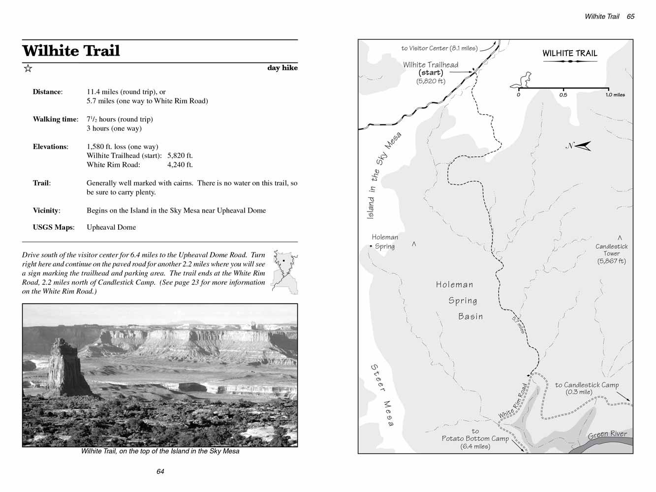
Wilhite Trail
excerpted from our book
Canyonlands National Park
Favorite Jeep Roads & Hiking Trails
pages 64-67
|
Buy book directly from the author!
Canyonlands National Park
Favorite Jeep Roads & Hiking Trails
- has access info for 75 trailheads
- 56 detailed trail maps
- 241 photographs
- loads of driving and hiking tips
|
regularly $14.95
now on sale for only
$11.95
click here
for book orders
|
 The Wilhite Trail was probably built by sheep ranchers sometime before World War II, but no one now seems to know much about its
history or even who the trail was named after. The name comes from an old inscription on a boulder beside the trail containing the words ōWilhite
Trailö. Wilhite was probably one of the sheep ranchers or herders who worked in the area.
The Wilhite Trail was probably built by sheep ranchers sometime before World War II, but no one now seems to know much about its
history or even who the trail was named after. The name comes from an old inscription on a boulder beside the trail containing the words ōWilhite
Trailö. Wilhite was probably one of the sheep ranchers or herders who worked in the area.
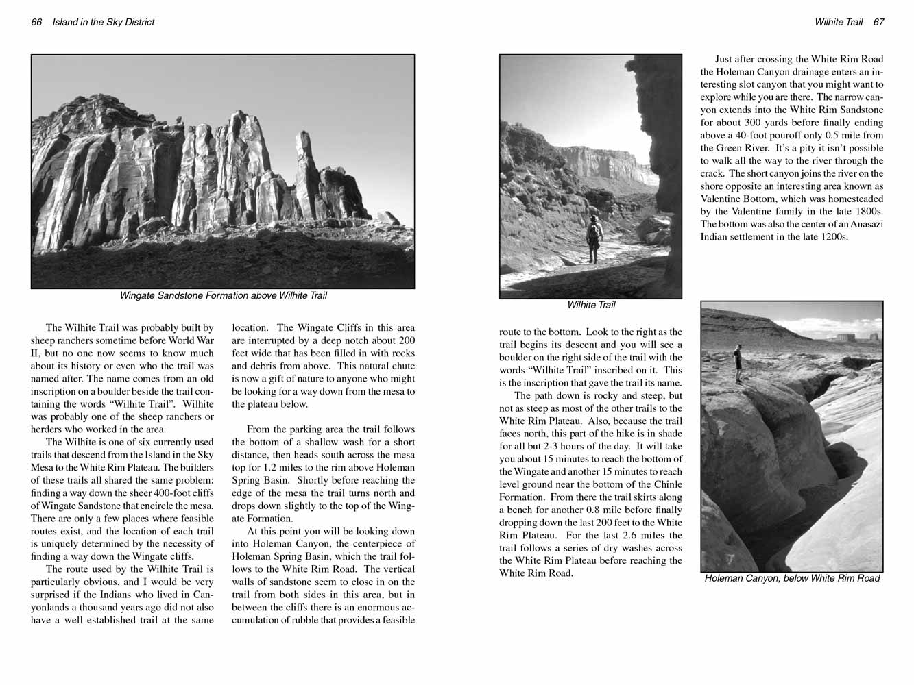
The Wilhite Trail is one of six currently used trails that descend from the Island in the Sky Mesa to the White Rim Plateau. The builders of these trails all
shared the same problem: finding a way down the sheer 400-foot cliffs of Wingate Sandstone that encircle the mesa. There are only a few places where
feasible routes exist, and the location of each trail is uniquely determined by the necessity of finding a way down the Wingate cliffs.
The route used by the Wilhite Trail is particularly obvious, and I would be very surprised if the Indians who lived in Canyonlands a thousand years ago
did not also have a well established trail at the same location. The Wingate Cliffs in this area are interrupted by a deep notch about 200 feet wide
that has been filled in with rocks and debris from above. This natural chute is now a gift of nature to anyone who might be looking for a way down
from the mesa to the plateau below.
From the parking area the Wilhite Trail follows the bottom of a shallow wash for a short distance, then heads south across the mesa top for 1.2 miles to
the rim above Holeman Spring Basin. Shortly before reaching the edge of the mesa the trail turns north and drops down slightly to the top of the
Wingate Formation.
 At this point you will be looking down into Holeman Canyon, the centerpiece of Holeman Spring Basin, which the trail follows to the
White Rim Road. The vertical walls of sandstone seem to close in on the
Wilhite Trail from both sides in this area, but in between the cliffs there is an
enormous accumulation of rubble that provides a feasible route to the bottom. Look to the right as the
Wilhite Trail begins its descent and you will see
a boulder on the right side of the trail with the words ōWilhite Trailö inscribed on it. This is the inscription that gave the trail its name.
At this point you will be looking down into Holeman Canyon, the centerpiece of Holeman Spring Basin, which the trail follows to the
White Rim Road. The vertical walls of sandstone seem to close in on the
Wilhite Trail from both sides in this area, but in between the cliffs there is an
enormous accumulation of rubble that provides a feasible route to the bottom. Look to the right as the
Wilhite Trail begins its descent and you will see
a boulder on the right side of the trail with the words ōWilhite Trailö inscribed on it. This is the inscription that gave the trail its name.
The path down is rocky and steep, but not as steep as most of the other trails to the White Rim Plateau. Also, because the
Wilhite Trail faces north, this part
of the hike is in shade for all but 2-3 hours of the day. It will take you about 15 minutes to reach the bottom of the Wingate and another 15 minutes
to reach level ground near the bottom of the Chinle Formation. From there the
Wilhite Trail skirts along a bench for another 0.8 mile before finally dropping
down the last 200 feet to the White Rim Plateau. For the last 2.6 miles the trail follows a series of dry washes across the White Rim Plateau before
reaching the White Rim Road.
Just after crossing the White Rim Road the Holeman Canyon drainage enters an interesting slot canyon that you might want to explore while you are
there. The narrow canyon extends into the White Rim Sandstone for about 300 yards before finally ending above a 40-foot pouroff only 0.5 mile from
the Green River. ItÆs a pity it isnÆt possible to walk all the way to the river through the crack. The short canyon joins the river on the shore
opposite an interesting area known as Valentine Bottom, which was homesteaded by the Valentine family in the late 1800s. The bottom was also the
center of an Anasazi Indian settlement in the late 1200s.
Note to web developers: You may copy this material onto your site, but in return please include a link to my home page
www.utahtrails.com. Thank you, David Day (utahdavidday at gmail.com)
Click here to see more trails in
Canyonlands National Park
® Rincon Publishing Company, all rights reserved
|