The Black Canyon of the Gunnison River is surely one
of the most awesome spectacles in Colorado. The canyon’s average depth
is 2,000 feet, and in many places it is much deeper. But the
characteristic that makes the canyon so unusual is the sheerness of its
walls. At the Painted Wall, for example, the gorge is 2,300 feet deep,
yet the horizontal distance from the river to the edge of the north rim
is scarcely 500 feet.
Adding to the visual effect of the seemingly
bottomless chasm is the dark color of the metamorphic gneiss and schist
that make up most of the inner canyon walls. This ancient stone was
formed during Precambrian time and is well over a billion years old. It
is also extremely hard, and to a large extent that is why the walls are
so sheer. The hard, crystalline rock has great compressive strength, and
it does not erode away as fast as a softer material might.
There are scenic drives on both the north and south rims
of the Black Canyon, and the Park Service has established overlook points on
both rims from where you can gaze into the canyon. There are also several
relatively safe, non-technical routes into the canyon if you are inclined to
climb down to the water. These routes generally involve less than 2 miles,
round trip, of scrambling, but the climb out is very strenuous. The rangers
can tell you more about these routes.
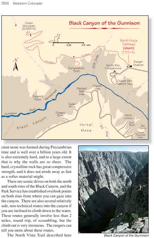
The North Vista Trail described here does not actually go
inside the canyon, but it goes to the Exclamation Point Overlook which will
give you a fine overview of the canyon. It also goes to the top of Green
Mountain, which will give you as close to an aerial view of the canyon as
you can get from the ground. Furthermore this trail is on the less-traveled
north rim side of the park, where you might be able to enjoy a measure of
solitude on your walk.
From the ranger station the trail proceeds west
through the sagebrush and pinion/juniper forest for 0.3 mile to the edge
of the Black Canyon Gorge. It then parallels the rim of the canyon above
SOB draw for the next 0.9 mile, passing several unnamed overlook points
along the way. Finally, 1.2 mile from the ranger station you will come
to a signed spur trail that goes the last 0.2 mile to Exclamation Point.
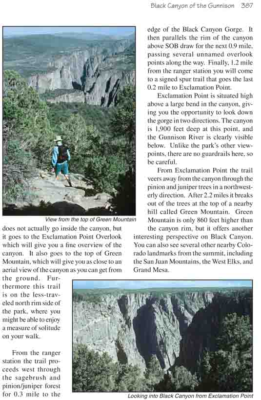
Exclamation Point is situated high above a large bend
in the canyon, giving you the opportunity to look down the gorge in two
directions. The canyon is 1,900 feet deep at this point, and the
Gunnison River is clearly visible below. Unlike the park’s other
viewpoints, there are no guardrails here, so be careful.
From Exclamation Point the trail veers away from the canyon through the
pinion and juniper trees in a northwesterly direction. After 2.2 miles it
breaks out of the trees at the top of a nearby hill called Green Mountain.
Green Mountain is only 860 feet higher than the canyon rim, but it offers
another interesting perspective on Black Canyon. You can also see several
other nearby Colorado landmarks from the summit, including the San Juan
Mountains, the West Elks, and Grand Mesa.