This is one of those hikes that offers a big reward for
relatively little work. Blue Lake is only 2.4 miles from the Mitchell Lake
Trailhead with an elevation gain of just 830 feet, yet it is one of the
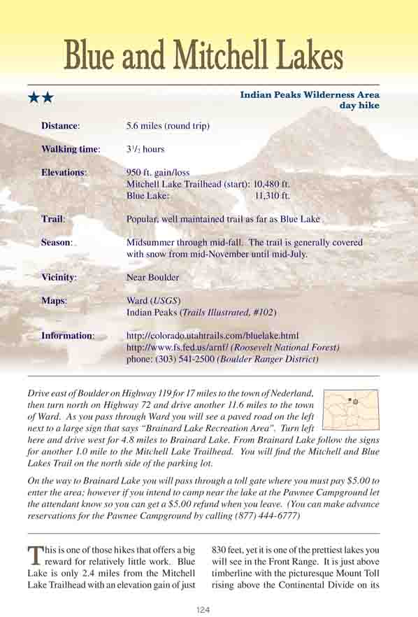
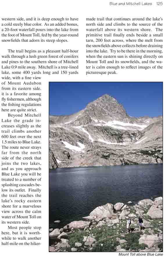
prettiest lakes you will see in the Front Range. It is just above timberline
with the picturesque Mount Toll rising above the Continental Divide on its
western side, and it is deep enough to have a cold steely blue color. As an
added bonus, a 20-foot waterfall pours into the lake from the foot of Mount
Toll, fed by the year-round snowfields that adorn its steep slopes.
The trail begins as a pleasant half-hour walk through
a lush green forest of conifers and pines to the southern shore of
Mitchell Lake 0.9 mile away. Mitchell is a tree-lined lake, some 400
yards long and 150 yards wide, with a fine view of Mount Audubon from
its eastern side. it is a favorite among fly fishermen, although the
fishing regulations here are quite strict.
Beyond Mitchell Lake the grade increases slightly as
the trail climbs another 600 feet over the next 1.5 miles to Blue Lake.
The route never strays far from the north side of the creek that joins
the two lakes, and as you approach Blue Lake you will be treated to a
number of splashing cascades below its outlet. Finally the trail reaches
the lake’s rocky eastern shore for a marvelous view across the calm
water of Mount Toll on its western side.
Most people stop here, but it is worthwhile to walk
another half-mile on the hiker-made trail that continues around the lake’s
north side and climbs to the source of the waterfall above its western
shore. The primitive trail finally ends beside a small tarn, 200 feet
across, where the melt from the snowfields above collects before draining
into the lake. Try to be there in the morning, when the eastern sun is
shining directly on Mount Toll and its snowfields, and the water is calm
enough to reflect images of the picturesque peak.