It is common for hikers to begin this trek at the North
Brush Creek Trailhead near the end of Forest Road 337; however in my opinion
it makes better sense to start at the Peerless Mine Trailhead described
here. The round trip distance to the lakes from Peerless Mine is nearly five
miles shorter; hence it is relatively easy to walk from there to the lakes
as a day hike.
The Brush Creek Lakes are two of the largest lakes in the
Sangre de Cristo Range, and the fishing can be good. Also, they are not as
frequently visited as many other lakes in the vicinity, so you can usually
expect more solitude there. The lakes are situated right on the edge of
timberline in a picturesque alpine cirque just east of Thirsty Peak (13,213
ft.) and Lakes Peak (13,375 ft.). Unfortunately the talus slopes below the
surrounding peaks extend all the way to the water’s edge, and the jagged
boulders make it impossible to enjoy a pleasant stroll around the lakes.
Furthermore, good campsites near the lakes are limited.
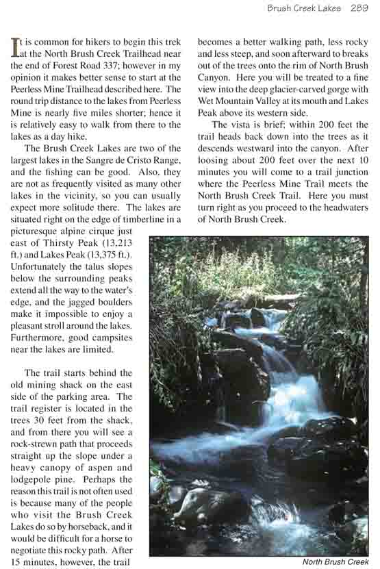
The trail starts behind the old mining shack on the
east side of the parking area. The trail register is located in the
trees 30 feet from the shack, and from there you will see a rock-strewn
path that proceeds straight up the slope under a heavy canopy of aspen
and lodgepole pine. Perhaps the reason this trail is not often used is
because many of the people who visit the Brush Creek Lakes do so by
horseback, and it would be difficult for a horse to negotiate this rocky
path. After 15 minutes, however, the trail becomes a better walking
path, less rocky and less steep, and soon afterward to breaks out of the
trees onto the rim of North Brush Canyon. Here you will be treated to a
fine view into the deep glacier-carved gorge with Wet Mountain Valley at
its mouth and Lakes Peak above its western side.
The vista is brief; within 200 feet the trail heads
back down into the trees as it descends westward into the canyon. After
loosing about 200 feet over the next 10 minutes you will come to a trail
junction where the Peerless Mine Trail meets the North Brush Creek
Trail. Here you must turn right as you proceed to the headwaters of
North Brush Creek.
For the next hour the trail remains immersed in a dense
forest of lodgepole pine, gradually changing to Engelmann spruce, as it
follows the north side of the canyon. The grade is generally level and the
walking is easy. Then, 2.2 miles from the trail junction ,the path crosses
to the south side of the creek and begins climbing up the slope toward the
lower lake. From there you must climb another 440 feet over the next
half-mile to reach the lower lake.
My first impression upon gazing across Lower Brush Lake
was one of disappointment. The shore of the lake is so rocky it is not
easily accessed from the trail, and although Thirsty Peak makes a fine
backdrop above the western shore I didn’t find the lake to be particularly
inspirational. There are a few reasonable campsites in a grove of trees on
the lake’s southern shore, but elsewhere there is too little soil for trees.
Although most maps show the trail continuing on from the
lower lake to the upper lake, the trail essentially disappears once it
enters the trees on the south side of the lower lake. The easiest way to get
to the upper lake is to head upward in a southwesterly direction from a
point near the outlet of the lower lake. After gaining 120 feet of elevation
you will find a good trail that follows the grassy area at the base of the
talus slopes south of the lakes. Following this trail for another 400 yards
will bring you to the most accessible southern shore of the upper lake.
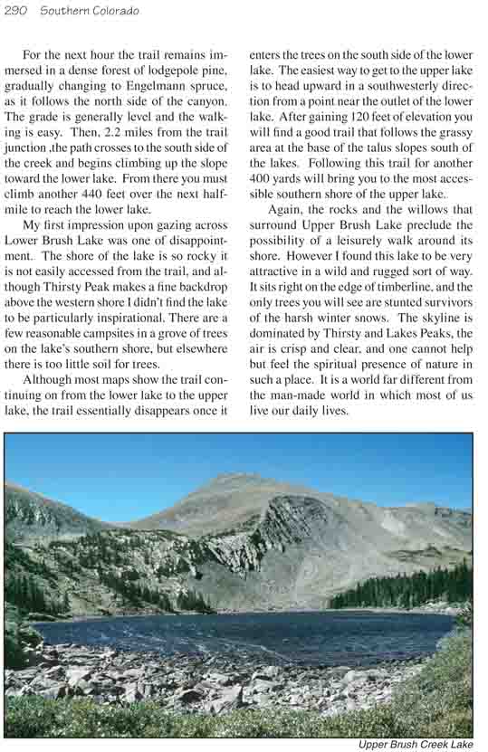
Again, the rocks and the willows that surround Upper
Brush Lake preclude the possibility of a leisurely walk around its shore.
However I found this lake to be very attractive in a wild and rugged sort of
way. It sits right on the edge of timberline, and the only trees you will
see are stunted survivors of the harsh winter snows. The skyline is
dominated by Thirsty and Lakes Peaks, the air is crisp and clear, and one
cannot help but feel the spiritual presence of nature in such a place. It is
a world far different from the man-made world in which most of us live our
daily lives.