The Rocky Mountains are a consequence of a little
understood subterranean force that began pushing up the earth’s crust in
western North America some 65 million years ago-about the same time the age
of the dinosaurs was coming to an end. The land continued to rise for the
next 60 million years before reaching its present height, but the initial
uplift marked only the first phase in the formation of the Colorado Rockies.
Nature’s real artistry began about 3 million years ago with the onset of the
Ice Age. Since that time the Rocky Mountains have been encased in ice at
least a half dozen times, and a succession of glaciations have gouged out
valleys, cleaved off peaks, and excavated alpine lakes throughout the range.
This sculpting process came to an end when the glaciers subsided some 10,000
years ago, and today a fine example of nature’s handiwork is preserved in
the 409 square miles of Rocky Mountain National Park.
Glacier Gorge is an example of a U-shaped canyon that was
carved by the Pleistocene glaciers. Again and again over the past 3 million
years the gorge has been filled with rivers of ice that slowly flowed from
Black Lake, to Glacier Gorge Junction and Moraine Park. At its deepest point
the ice was probably in excess of 1,500 feet thick, entirely sufficient to
carve the valley into its present form. Like giant, slow motion bulldozers
the glaciers excavated rock from the canyon bottom and deposited it into
tills and moraines further down the valley.
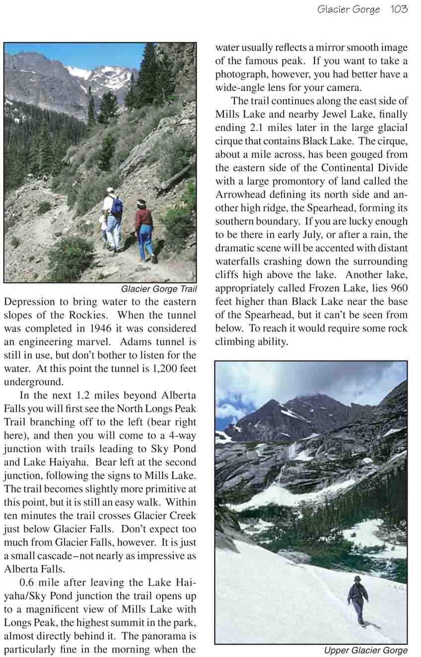
From Glacier Gorge Junction Trailhead the trail proceeds
into the woods in a general southerly direction. Within a few feet of the
trailhead you will see a junction where the trail to Bear Lake branches to
the right. Keep to the left at this point, following the signs to Mills Lake
and Black Lake. There is another junction 0.4 miles from the trailhead where
the trail to Glacier Basin branches off to the left. Here you should bear
right.
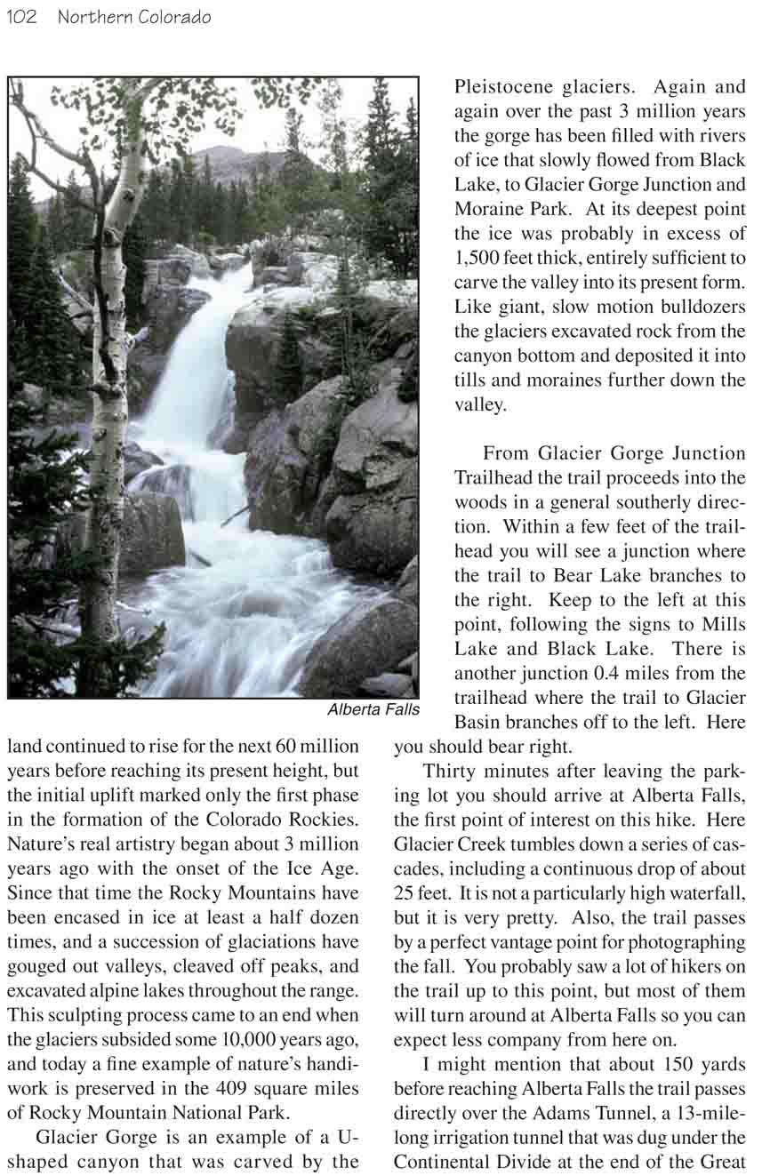
Thirty minutes after leaving the parking lot you should
arrive at Alberta Falls, the first point of interest on this hike. Here
Glacier Creek tumbles down a series of cascades, including a continuous drop
of about 25 feet. It is not a particularly high waterfall, but it is very
pretty. Also, the trail passes by a perfect vantage point for photographing
the fall. You probably saw a lot of hikers on the trail up to this point,
but most of them will turn around at Alberta Falls so you can expect less
company from here on.
I might mention that about 150 yards before reaching
Alberta Falls the trail passes directly over the Adams Tunnel, a
13-mile-long irrigation tunnel that was dug under the Continental Divide at
the end of the Great Depression to bring water to the eastern slopes of the
Rockies. When the tunnel was completed in 1946 it was considered an
engineering marvel. Adams tunnel is still in use, but don’t bother to listen
for the water. At this point the tunnel is 1,200 feet underground.
In the next 1.2 miles beyond Alberta Falls you will first
see the North Longs Peak Trail branching off to the left (bear right here),
and then you will come to a 4-way junction with trails leading to Sky Pond
and Lake Haiyaha. Bear left at the second junction, following the signs to
Mills Lake. The trail becomes slightly more primitive at this point, but it
is still an easy walk. Within ten minutes the trail crosses Glacier Creek
just below Glacier Falls. Don’t expect too much from Glacier Falls, however.
It is just a small cascade-not nearly as impressive as Alberta Falls.
0.6 mile after leaving the Lake Haiyaha/Sky Pond junction
the trail opens up to a magnificent view of Mills Lake with Longs Peak, the
highest summit in the park, almost directly behind it. The panorama is
particularly fine in the morning when the water usually reflects a mirror
smooth image of the famous peak. If you want to take a photograph, however,
you had better have a wide-angle lens for your camera.
The trail continues along the east side of Mills Lake and
nearby Jewel Lake, finally ending 2.1 miles later in the large glacial
cirque that contains Black Lake. The cirque, about a mile across, has been
gouged from the eastern side of the Continental Divide with a large
promontory of land called the Arrowhead defining its north side and another
high ridge, the Spearhead, forming its southern boundary. If you are lucky
enough to be there in early July, or after a rain, the dramatic scene will
be accented with distant waterfalls crashing down the surrounding cliffs
high above the lake. Another lake, appropriately called Frozen Lake, lies
960 feet higher than Black Lake near the base of the Spearhead, but it can’t
be seen from below. To reach it would require some rock climbing ability.