Driving to the Goose Creek Trailhead is a depressing
experience. On June 8, 2002 it was reported that a fire was burning in
Tappan Gulch, 9 miles south of Goose Creek. Fire crews were sent in to stop
the blaze, but it would be six weeks before the conflagration was
controlled. By the time it was extinguished the inferno had destroyed 133
homes and 137,760 acres of timber, including much of the Lost Creek
Wilderness Area. The Hayman Fire, as it has since been named, was the
largest fire in Colorado’s history.
For fifteen miles, before reaching the trailhead, you
will be driving through the Hayman burn area and probably wondering how
there could possibly be a scenic hiking trail in the midst of such
devastation. The burn extends all the way to the trailhead and beyond. But
don’t give up. You will be relieved to learn that nearly all of the forest
surrounding this part of Goose Creek escaped destruction. Now, as before,
the Goose Creek Trail remains one of Colorado’s premier hiking trails. It is
a miracle that this incredible valley was spared from the holocaust.
From the parking area the trail begins by dropping
down 120 feet to the bottom of Hankins Gulch. This is an eerie section
of trail, through a dense, blackened forest of dead lodgepole pines.
Most of the trees are still standing straight and tall, but they have no
needles and they are uniformly jet black in color. It is strangely
beautiful in a grotesque way-perhaps because of the lush ground cover.
The forest floor is filled with lupine, larkspur, and other sun-loving
plants that would not grow in such profusion if the forest canopy were
still intact.
Once you reach the bottom of the gulch you will see a
sign marking the junction of the Goose Creek and Hankins Trails. The
Goose Creek Trail turns north for 200 yards to the confluence of Hankins
Creek and Goose Creek, and then turns west again to follow Goose Creek
for the remainder of the hike.
The burn area persists for a short distance further, but
soon you will find yourself in a lovely green valley, surrounded by a
montane forest with a sparkling stream flowing through it. The walls of the
valley are decorated with odd shaped outcroppings of Pikes Peak Granite that
often look like hordes of goblins peering down. The grassy meadows along the
creek are about as perfect a setting as you will find for overnight camping,
and if you are there on a weekend you will surely see a few tents pitched
off the trail.
Upon leaving Hankins Gulch the trail initially stays near
the shore of Goose Creek, but after following the creek for 0.9 mile it
veers away and begins to climb up into the trees on the eastern side of the
canyon. You will gain 540 feet of elevation over the next 1.6 miles before
dropping back down to the upper reaches of Goose Creek.
2.3 miles after leaving the shore of Goose Creek the
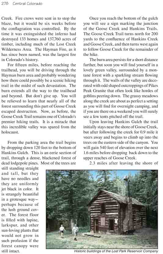
trail comes to another junction marked by a sign directing you to the
"Historic Buildings" on the left. The historic buildings consist of two
intact cabins and one that has already collapsed; they are located in a
clearing about 100 yards down the slope from the main trail. These cabins
were built between 1891 and 1913 to accommodate employees of the Antero and
Lost Park Reservoir Company, a company that was trying create a reservoir by
damming up Lost Creek.
Lost Creek originates 15 miles north of Goose Creek in
the Kenosha Mountains. As it flows south, however, it disappears underground
and emerges again further south. In fact it does this no fewer than 11
times, finally emerging for the last time as Goose Creek. The ground in this
area consists of a jumble of granite boulders with many voids between; hence
the river’s strange behavior. If you will walk down the slope for 200 yards
below the historic buildings, then walk upstream for another 200 feet, you
can see where Lost Creek bubbles up out of the ground to become Goose Creek.
The Lost Park Reservoir Company thought that by drilling
a shaft into the granite bedrock above Goose Creek and pumping concrete into
the voids they could effectively dam up Lost Creek and form the Lost Park
Reservoir. It was a bold idea, and with our modern technology it would
probably work. But turn of the century drilling technology was not adequate
for the job, and the project ultimately failed.
The last thing you must see before walking back to your
car is the shafthouse site where the Lost Park Reservoir Company engineers
attempted to drill into the jumble of granite boulders. The trail to the
shafthouse begins just 100 feet north of the first historic cabin. Follow
this trail for 0.4 mile and you will come upon the old steam engine that was
used to drill the shaft. The actual shafthouse is not there anymore, but the
steam engine is a fascinating artifact in itself. It must have taken a great
deal of effort to get it to this site.
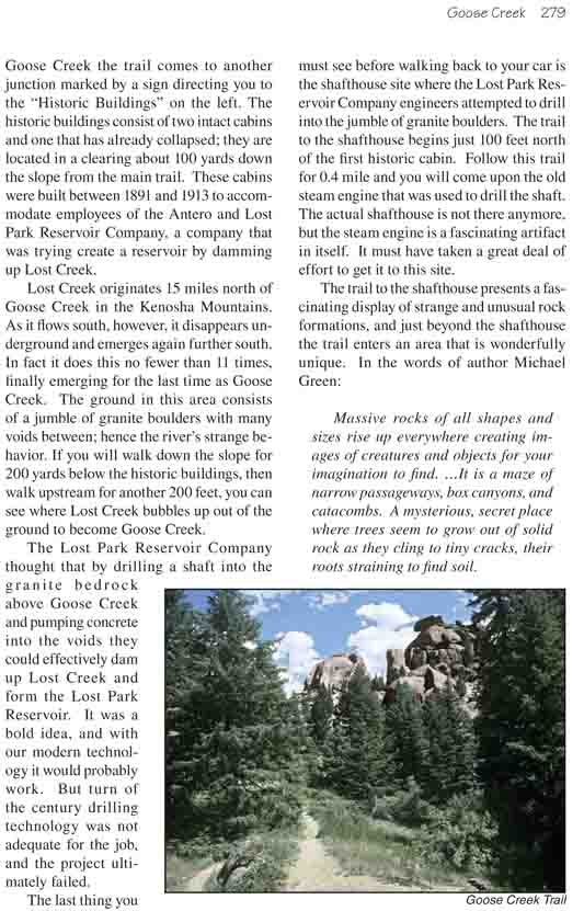
The trail to the shafthouse presents a fascinating
display of strange and unusual rock formations, and just beyond the
shafthouse the trail enters an area that is wonderfully unique. In the words
of author Michael Green:
Massive rocks of all shapes and sizes rise up
everywhere creating images of creatures and objects for your imagination
to find. …It is a maze of narrow passageways, box canyons, and
catacombs. A mysterious, secret place where trees seem to grow out of
solid rock as they cling to tiny cracks, their roots straining to find
soil.