Gr
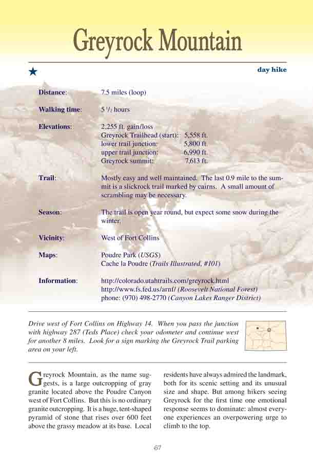
eyrock Mountain, as the name suggests, is a
large outcropping of gray granite located above the Poudre Canyon west
of Fort Collins. But this is no ordinary granite outcropping. It is a
huge, tent-shaped pyramid of stone that rises over 600 feet above the
grassy meadow at its base. Local residents have always admired the
landmark, both for its scenic setting and its unusual size and shape.
But among hikers seeing Greyrock for the first time one emotional
response seems to dominate: almost everyone experiences an overpowering
urge to climb to the top.
Fortunately there is a relatively easy route to the
top. The Greyrock Summit Trail was built in the 1930s by the Civilian
Conservation Crops, and in 1978 a second connecting trail called the
Greyrock Meadows Trail was completed. Together, these two routes make it
possible to do the loop hike described here.
From the parking area the trail first crosses the
highway and then drops down to enter a small footbridge across the Cache
la Poudre River. Once on the north side of the river the path makes an
abrupt left turn and begins working its way westward up a shallow
drainage. Then, about fifteen minutes after leaving the river, the trail
comes to a junction where the newer Greyrock Meadows Trail begins. I
suggest you bear left at this point onto the Meadows Trail and use the
steeper Summit Trail as your return route.
The Meadows Trail continues following the drainage in
a westerly direction for another 1.0 mile, and then begins a long,
gradual climb up the north side of Poudre Canyon. The south-facing slope
has very few trees, and the views back down into the canyon are
magnificent. As you climb higher you will also be able to look down into
Hewlett Gulch to the west.
After an elevation gain of 1200 feet the Meadows
Trail levels out briefly and then looses 200 feet as it drops back down
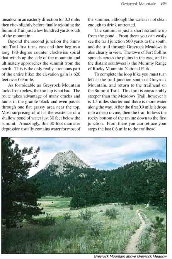
into the Greyrock Meadows. Now, for the first time, you will be able to
see Greyrock Mountain. There are other outcroppings of granite here and
there on the edge of the meadow, but Greyrock is the one that stands
out. The trail proceeds along the flat bottom of the meadow in an
easterly direction for 0.3 mile, then rises slightly before finally
rejoining the Summit Trail just a few hundred yards south of the
mountain.
Beyond the second junction the Summit Trail first
turns east and then begins a long 180-degree counter clockwise spiral
that winds up the side of the mountain and ultimately approaches the
summit from the north. This is the only really strenuous part of the
entire hike; the elevation gain is 620 feet over 0.9 mile.
As formidable as Greyrock Mountain looks from below,
the trail up is not bad. The route takes advantage of many cracks and
faults in the granite block and even passes through one flat grassy area
near the top. Most surprising of all is the existence of a shallow pond
of water just 30 feet below the summit. Amazingly, this 30-foot diameter
depression usually contains water for most of the summer, although the
water is not clean enough to drink untreated.
The summit is just a short scramble up from the pond.
From there you can easily see the trail junction 500 yards to the south,
and the trail through Greyrock Meadows is also clearly in view. The town
of Fort Collins spreads across the plains in the east, and in the
distant southwest is the Mummy Range of Rocky Mountain National Park.
To complete the loop hike you must turn left at the trail junction
south of Greyrock Mountain, and return to the trailhead on the Summit
Trail. This trail is considerably steeper than the Meadows Trail,
however it is 1.5 miles shorter and there is more water along the way.
After the first 0.9 mile it drops into a deep ravine, then the trail
follows the rocky bottom of the ravine down to the first junction. From
there you can retrace your steps the last 0.6 mile to the trailhead.