The Gunnison Gorge Wilderness Study Area was established
by the BLM in 1978 in order to preserve a 13-mile stretch of the Gunnison
River below the Black Canyon of the Gunnison National Park while it is being
considered as a possible wilderness area. The scenic canyon has also long
been coveted as a possible a site for a large hydroelectric dam, but
thankfully the environmental movement in the West is now sufficiently strong
that the dam will probably never be built. After this hike I think you will
agree, it would be a tragedy of major proportions if the Gunnison Gorge was
ever dammed.
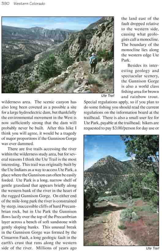
There are five trails accessing the river within the
wilderness study area, but for several reasons I think the Ute Trail is the
most interesting. This trail was originally built by the Ute Indians as a
way to access Ute Park, a place where the Gunnison can often be easily
forded. Ute Park is a long, narrow shelf of gentle grassland that appears
briefly along the western bank of the river in the heart of the rugged
Gunnison Gorge. On either end of the mile-long park the river is constrained
by steep, inaccessible cliffs of hard Precambrian rock, but in Ute Park the
Gunnison flows lazily over the top of the Precambrian layer across a bench
of soft sandstone with gently sloping banks. This unusual break in the
Gunnison Gorge was formed by the Cimarron Fault, a long geologic fault in
the earth's crust that runs along the western side of the river. Millions of
years ago the land east of the fault dropped relative to the western side,
causing what geologists call a monocline. The boundary of the monocline lies
along the western edge Ute Park.
Besides its interesting geology and spectacular scenery,
the Gunnison Gorge is also a world class fishing area for brown and rainbow
trout. Special regulations apply, so if you plan to do some fishing you
should read the current regulations on the information board at the
trailhead. There is also a small user fee for Ute Park, payable at the
trailhead; hikers are requested to pay $3.00/person for day use or
$5.00/person for overnight use.
From the rim of the canyon the trail winds down through a
large amphitheater filled with pinion pine and juniper trees to the head of
a small drainage 450 feet below the trailhead. It then follows the drainage
to a bench of smooth, reddish Entrada Sandstone that lies some 700 feet
above the river. Having reached this plateau the path turns northward for
0.7 mile before turning east again for another descent through a layer of
black schist and gneiss. Surprisingly, when you finish the second descent
you will be back at the top of the Entrada Sandstone again! This is because
the trail makes its descent at the precise boundary of a monocline, and you
must drop about 400 feet, just as the land has dropped, to stay on the top
of the Entrada Formation.
Upon reaching the lower bench the trail turns south again
and continues downward to Ute Park. But before you continue you should take
a short spur trail a few hundred yards to the end of a long hourglass-shaped
outcropping of slickrock sandstone that overlooks the river. At the end of
the point you will be rewarded with a marvelous view of the gorge below.
About 0.8 mile further will bring you to the northern
edge of Ute Park, and from there the trail continues south, along the river
for another 1.0 mile to the southern edge of the park. As you walk notice
the black cliffs of Precambrian rock on the west side of the park at the
boundary of the monocline. Gradually the cliffs close in on the flat, sandy
bench, making it impossible to continue.
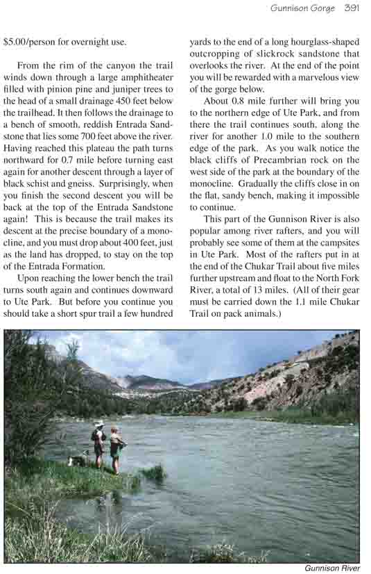
This part of the Gunnison River is also popular among river rafters, and
you will probably see some of them at the campsites in Ute Park. Most of the
rafters put in at the end of the Chukar Trail about five miles further
upstream and float to the North Fork River, a total of 13 miles. (All of
their gear must be carried down the 1.1 mile Chukar Trail on pack animals.)