The unpredictable nature of Colorado weather dictates
that you should always begin your hikes as early in the morning as possible,
but on this particular trail there are several additional reasons why you
should get an early start. First, the Stillwater Trailhead is also where the
popular hike to the Devils Causeway begins (page 144), and by 9:00 a.m. the
limited parking space at the trailhead is often completely filled. Second,
both Hooper and Keener lakes are situated directly east of a long stretch of
spectacular cliffs below Flat Top Mountain, and the early morning views from
across the lakes are outstanding. And third, as you cross over the pass
between the Route and White River National Forests you will briefly be above
timberline on a beautiful alpine tundra of rolling, flower-laden hills that
is especially stunning in the crisp morning air. Many of the flowers close
their blossoms in the heat of the afternoon.
If time permits there are several other lakes in the area
that you might want to visit, including Edge Lake and the Bailey Lakes. But
in my opinion Hooper and Keener are the centerpieces of this trail. Not only
are they the largest, but they are both located right at the bottom of the
600-foot cliffs that border Flat Top Mountain and, again, the views are
breathtaking. If you are there before all the winter snow has melted you may
also see a 200-foot waterfall that plunges down the cliffs directly east of
Keener Lake. The fall is usually active until early July.
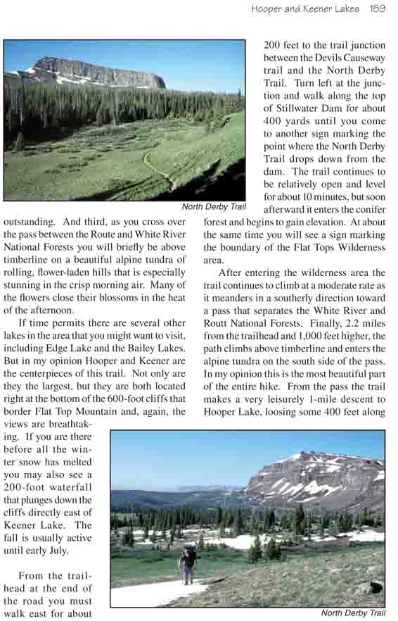
From the trailhead at the end of the road you must
walk east for about 200 feet to the trail junction between the Devils
Causeway trail and the North Derby Trail. Turn left at the junction and
walk along the top of Stillwater Dam for about 400 yards until you come
to another sign marking the point where the North Derby Trail drops down
from the dam. The trail continues to be relatively open and level for
about 10 minutes, but soon afterward it enters the conifer forest and
begins to gain elevation. At about the same time you will see a sign
marking the boundary of the Flat Tops Wilderness area.
After entering the wilderness area the trail
continues to climb at a moderate rate as it meanders in a southerly
direction toward a pass that separates the White River and Routt
National Forests. Finally, 2.2 miles from the trailhead and 1,000 feet
higher, the path climbs above timberline and enters the alpine tundra on
the south side of the pass. In my opinion this is the most beautiful
part of the entire hike. From the pass the trail makes a very leisurely
1-mile descent to Hooper Lake, loosing some 400 feet along the way and
reentering an open forest just before it reaches the lake. There are
flat top mountains on both sides of the trail here, however the mountain
on the east side where Edge Lake is located is not as impressive as the
one on the west side of the trail. The path is rather vague in a few
places in this grassy alpine meadow and you may loose it. When in doubt
keep to the west. If you loose the trail and stray too far to the east
you can easily miss the lakes.
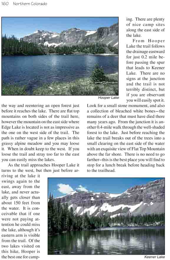
As the trail approaches Hooper Lake it turns to the west,
but then just before arriving at the lake it swings again to the east, away
from the lake, and never actually gets closer than about 150 feet from the
water. It is conceivable that if one were not paying attention he could miss
the lake, although it’s eastern arm is visible from the trail. Of the two
lakes visited on this hike, Hooper is the best one for camping. There are
plenty of nice camp sites along the east side of the lake.
From Hooper Lake the trail follows the drainage eastward
for just 0.2 mile before passing the spur that leads to Keener Lake. There
are no signs at the junction and the trail is not terribly distinct, but if
you are observant you will easily spot it. Look for a small stone monument,
and also a collection of bleached white bones-the remains of a deer that
must have died there many years ago. From the junction it is another
0.4-mile walk through the well-shaded forest to the lake. Just before
reaching the lake the trail breaks out of the trees into a small clearing on
the east side of the water with an exquisite view of Flat Top Mountain above
the far shore. There is no need to go farther-this is the best place you
will find to stop for a lunch break before heading back to the trailhead.