La Plata Peak lies in the Sawatch Range near the center
of Colorado’s Rocky Mountains. This 80-mile-long range of mountains contains
more 14,000-foot peaks than any other range in the lower 48 United States.
La Plata is the fourth highest peak in the range and the fifth highest in
Colorado. Like most Sawatch peaks, La Plata is a relatively easy class-2
climb, but the feature that really gives it a personality of its own is the
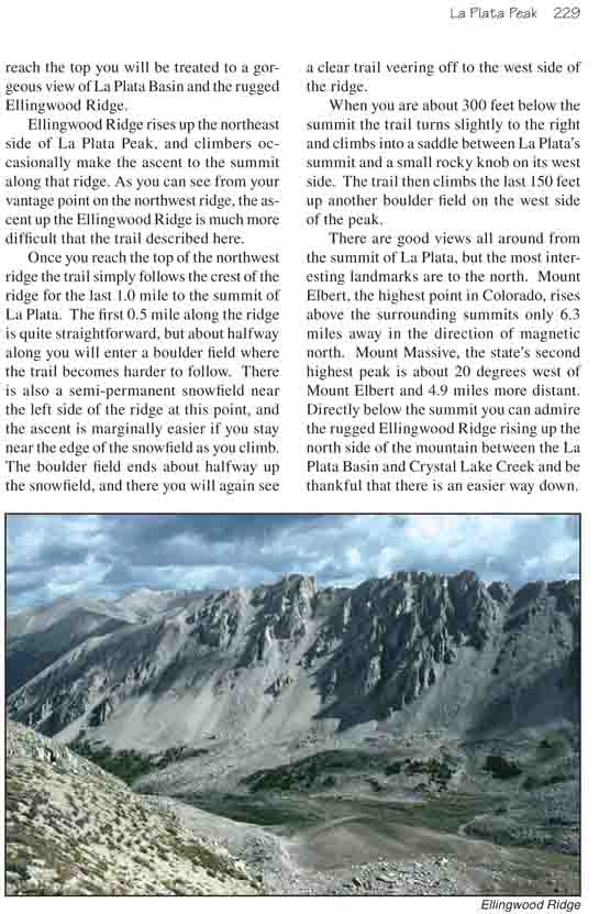
spectacular Ellingwood Ridge. This rugged 2-mile-long ridge up the northeast
side of the mountain has intrigued mountaineers since La Plata was first
climbed in 1873. The imposing ridge was named after Albert Ellingwood who
first scaled La Plata via this route in 1921.
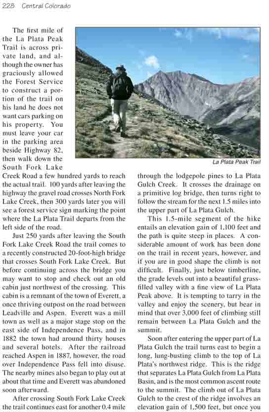
The first mile of the La Plata Peak Trail is across
private land, and although the owner has graciously allowed the Forest
Service to construct a portion of the trail on his land he does not want
cars parking on his property. You must leave your car in the parking area
beside Highway 82, then walk down the South Fork Lake Creek Road a few
hundred yards to reach the actual trail. 100 yards after leaving the highway
the gravel road crosses North Fork Lake Creek, then 300 yards later you will
see a forest service sign marking the point where the La Plata Trail departs
from the left side of the road.
Just 250 yards after leaving the South Fork Lake Creek
Road the trail comes to a recently constructed 20-foot-high bridge that
crosses South Fork Lake Creek. But before continuing across the bridge you
may want to stop and check out an old cabin just northwest of the crossing.
This cabin is a remnant of the town of Everett, a once thriving outpost on
the road between Leadville and Aspen. Everett was a mill town as well as a
major stage stop on the east side of Independence Pass, and in 1882 the town
had around thirty houses and several hotels. After the railroad reached
Aspen in 1887, however, the road over Independence Pass fell into disuse.
The nearby mines also began to play out at about that time and Everett was
abandoned soon afterward.
After crossing South Fork Lake Creek the trail continues
east for another 0.4 mile through the lodgepole pines to La Plata Gulch
Creek. It crosses the drainage on a primitive log bridge, then turns right
to follow the stream for the next 1.5 miles into the upper part of La Plata
Gulch.
This 1.5-mile segment of the hike entails an elevation
gain of 1,100 feet and the path is quite steep in places. A considerable
amount of work has been done on the trail in recent years, however, and if
you are in good shape the climb is not difficult. Finally, just below
timberline, the grade levels out into a beautiful grass-filled valley with a
fine view of La Plata Peak above. It is tempting to tarry in the valley and
enjoy the scenery, but bear in mind that over 3,000 feet of climbing still
remain between La Plata Gulch and the summit.
Soon after entering the upper part of La Plata Gulch the
trail turns east to begin a long, lung-busting climb to the top of La
Plata’s northwest ridge. This is the ridge that separates La Plata Gulch
from La Plata Basin, and is the most common ascent route to the summit. The
climb out of La Plata Gulch to the crest of the ridge involves an elevation
gain of 1,500 feet, but once you reach the top you will be treated to a
gorgeous view of La Plata Basin and the rugged Ellingwood Ridge.
Ellingwood Ridge rises up the northeast side of La Plata
Peak, and climbers occasionally make the ascent to the summit along that
ridge. As you can see from your vantage point on the northwest ridge, the
ascent up the Ellingwood Ridge is much more difficult that the trail
described here.
Once you reach the top of the northwest ridge the trail
simply follows the crest of the ridge for the last 1.0 mile to the summit of
La Plata. The first 0.5 mile along the ridge is quite straightforward, but
about halfway along you will enter a boulder field where the trail becomes
harder to follow. There is also a semi-permanent snowfield near the left
side of the ridge at this point, and the ascent is marginally easier if you
stay near the edge of the snowfield as you climb. The boulder field ends
about halfway up the snowfield, and there you will again see a clear trail
veering off to the west side of the ridge.
When you are about 300 feet below the summit the trail
turns slightly to the right and climbs into a saddle between La Plata’s
summit and a small rocky knob on its west side. The trail then climbs the
last 150 feet up another boulder field on the west side of the peak.
There are good views all around from the summit of La Plata, but the most
interesting landmarks are to the north. Mount Elbert, the highest point in
Colorado, rises above the surrounding summits only 6.3 miles away in the
direction of magnetic north. Mount Massive, the state’s second highest peak
is about 20 degrees west of Mount Elbert and 4.9 miles more distant.
Directly below the summit you can admire the rugged Ellingwood Ridge rising
up the north side of the mountain between the La Plata Basin and Crystal
Lake Creek and be thankful that there is an easier way down.