The mid-1800s was a time of great expectations in
Colorado. Gold was discovered near Denver in 1858 and soon the territory’s
population began to swell with an influx of prospectors and dreamers. One of
the hopefuls was Joe Shipler, a prospector who spent close to a decade
searching for precious metals west of the Never Summer Mountains before
moving into what is now Rocky Mountain National Park. In 1879, soon after
entering the Kawuneeche Valley on the west side of the park, Shipler made
two promising silver claims, and within months scores of other miners began
to arrive in hopes of sharing his good fortune. Hopes ran high as the
get-rich-quick enthusiasts flocked in, and by 1881 the small valley was home
to an estimated 500 people. The center of population was Lulu City, a mining
camp near the headwaters of the Colorado River.
At its peak Lulu possessed at least ten commercial
buildings, including a clothing store, an assay office, a hotel and, of
course, a brothel. The stagecoach arrived three times a week from Fort
Collins and Grand Lake, and two sawmills were kept busy churning out lumber
for new buildings. But the heyday was short lived. The mines proved
disappointing, and soon the initial euphoria began to ebb. By the fall of
1883 most of the miners had left and the town was largely deserted.
Interestingly, Joe Shipler never left with the other
miners, but continued to live on his claim near the Colorado River for
the next 30 years. What prompted him to choose this lonely lifestyle?
Was it his lingering hope of striking it rich in his silver mine? More
likely it was a deep attachment for his beautiful mountain home that
kept him from leaving. The remains of his cabins can still be seen
today, not far from his abandoned mine.
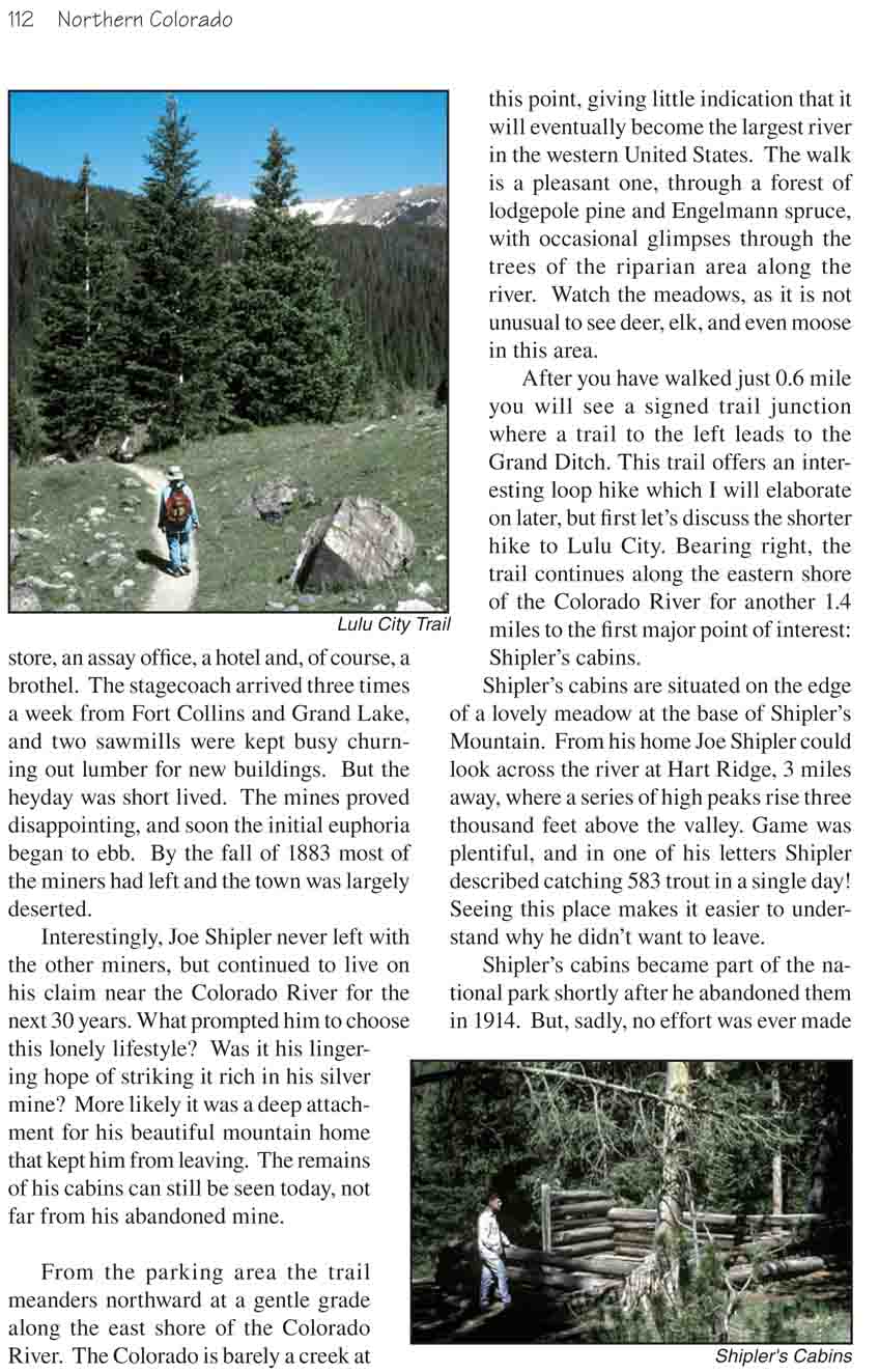
From the parking area the trail meanders northward at
a gentle grade along the east shore of the Colorado River. The Colorado
is barely a creek at this point, giving little indication that it will
eventually become the largest river in the western United States. The
walk is a pleasant one, through a forest of lodgepole pine and Engelmann
spruce, with occasional glimpses through the trees of the riparian area
along the river. Watch the meadows, as it is not unusual to see deer,
elk, and even moose in this area.
After you have walked just 0.6 mile you will see a
signed trail junction where a trail to the left leads to the Grand
Ditch. This trail offers an interesting loop hike which I will elaborate
on later, but first let’s discuss the shorter hike to Lulu City. Bearing
right, the trail continues along the eastern shore of the Colorado River
for another 1.4 miles to the first major point of interest: Shipler’s
cabins.
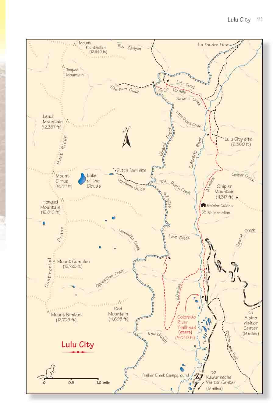
Shipler’s cabins are situated on the edge of a lovely
meadow at the base of Shipler’s Mountain. From his home Joe Shipler
could look across the river at Hart Ridge, 3 miles away, where a series
of high peaks rise three thousand feet above the valley. Game was
plentiful, and in one of his letters Shipler described catching 583
trout in a single day! Seeing this place makes it easier to understand
why he didn’t want to leave.
Shipler’s cabins became part of the national park
shortly after he abandoned them in 1914. But, sadly, no effort was ever
made to preserve this bit of history and today they are in an advanced
state of decay. Shipler’s silver mine is also nearby. The trail passes
below it just before arriving at the cabins. (Look for the mound of
yellowish tailings above the right side of the path.) Also, with a
little searching you can find the remains of an old mining trolley in
the trees, just below the tailings on the left side of the trail.
Lulu City is located north of the Shipler cabins 1.7
miles further up the trail. Most hikers are disappointed by what they
see when they get there; there are one or two obvious remains of cabins,
but nothing to accurately portray the thriving community that once
existed at Lulu. Many of the original logs and other remnants were
scavenged by later settlers elsewhere in the valley. And most of what
wasn’t carried away has since been covered over by nature. However, if
one is willing to spend some time exploring off the trail there is more
to see than first meets the eye.
Grand Ditch
Although the round-trip hike to Lulu City is the most
interesting and picturesque short hike along the Colorado River trail, there
are several other worthwhile trails in the area. For someone interested in a
longer hike I suggest combining the trail to Lulu City with the Grand Ditch
trail to form a 13.6 mile loop.
Begin by walking along the Colorado River trail toward
Lulu City for 0.6 mile, then turn left at the junction with the Grand Ditch
Trail. As the sign at the junction indicates, it is 2.8 miles from there to
the ditch. The trail gains 1,200 feet in elevation before reaching the Grand
Ditch, but the gain is gradual and the climb is not a tiring one. Moreover,
once you reach the ditch you will be at the highest point of the hike.
The Grand Ditch was originally conceived in the late
1800s as a way to bring water across the Continental Divide for the purpose
of irrigating dry farm land near Fort Collins. It was a huge undertaking at
that time. Most of the excavation work had to be done by hand, and it took
30 years just to complete the first 8 miles. The final 6 miles were dug as a
public works project in the 1930s when better equipment became available.
Today the canal winds northward high on the western side
of the Kawuneeche Valley for about 14 miles before crossing the divide at La
Poudre Pass. There it empties its water into the Cache la Poudre watershed
on the Atlantic side of the divide. Each year the Grand Ditch diverts some
40,000 acre-feet of water that would otherwise flow into the Colorado River,
and channels it to the eastern side of the Rocky Mountains.
When the trail reaches the Grand Ditch turn right and
walk along the jeep road that parallels the eastern side of the canal for
the next 4.7 miles. On the way you will pass five streams that flow down
from Hart Ridge to add their water to the Ditch. Big Dutch Creek, the second
of these streams, flows out of Hitchens Gulch, a shallow canyon that
contains the remains of another old mining camp. This camp was named Dutch
Town, and like Lulu City it dates back to the 1880s. If you are interested,
there is a trail to Dutch Town that begins just north of where Big Dutch
Creek empties into the Ditch. The trail to Dutch Town is only 0.7 mile each
way, but don’t expect too see too much of the town when you get there. Like
Lulu city, there isn’t a great deal left of the old abandoned camp.
2.7 miles beyond Hitchens Gulch you will come to another
foot bridge where the Skeleton Gulch trail crosses the Grand Ditch. Turn
right here; this is the path you must take to return back to the Colorado
River Trail and Lulu City. You should see a Park Service sign marking the
trail as you leave the Grand Ditch. From there it is 1.8 miles to Lulu City.
Just five minutes after leaving the Grand Ditch you will
come to Ditch Camp, where workers on the Grand Ditch once maintained a camp,
and soon afterward you will see another trail junction where you must turn
right. Again, the Park Service has placed a sign at this junction pointing
the way to Lulu City. Just after leaving Ditch Camp the trail immediately
starts loosing elevation at a fairly steep grade. This trail is the old
stagecoach road that once connected Lulu City to Fort Collins. As you go
down you will probably wonder how in the world the horses could pull a
stagecoach up this trail-especially with a full load of passengers!
Soon you will come to the first of three trails that
branch off to La Poudre Pass; in all cases you should bear right. Then, 1.1
miles after leaving the Ditch Camp, the trail reaches the Colorado River.
The river here is only two miles from its point of origin, and it is hardly
a shadow of the mighty river it will eventually become. Cross the creek on
the log bridge and soon you will see another trail branching off on the left
for La Poudre Pass. Bear right again, and in 0.4 miles you will arrive at
Lulu City. From there it is 3.7 miles along the trail described earlier to
the trailhead.
Note: There are several nice campsites along the
Grand Ditch. If you wish to make this an overnight hike I suggest you
camp at Dutch Town, Skeleton Gulch, or on the Old Stage Road, but be
sure to get a backcountry permit first at the Kawuneeche Visitor Center.