This hike, with its 4,660 feet of elevation gain, is a
relatively strenuous choice, but the rewards are ample. After climbing for
the first two miles the trail finally levels out in a high alpine valley
with picturesque fourteen-thousand-foot peaks on both sides and, if you are
lucky enough to be there in early August, a splendid carpet of wildflowers.
There are no lakes in the upper Missouri Gulch, but water is abundant and
many backpackers opt to spend day or two in the scenic valley. The hanging
alpine meadow is particularly popular with peak baggers who come during the
summer months to climb Mounts Belford, Oxford, and Missouri.
From the trailhead the path drops down briefly to a
footbridge across Clear Creek, then begins ascending immediately on the
south side of the stream. For the next mile you will be climbing almost
without pause up a steep, tiring but well maintained trail through a
dense forest of spruce and subalpine fir. Near the bottom of the climb
the trail passes through an old abandoned cemetery, a relic of the late
1800s when there were many mining camps in this area. Most of the graves
are now unmarked, but the local historical society has restored one of
them near the trail-the grave of a child that died soon after birth.
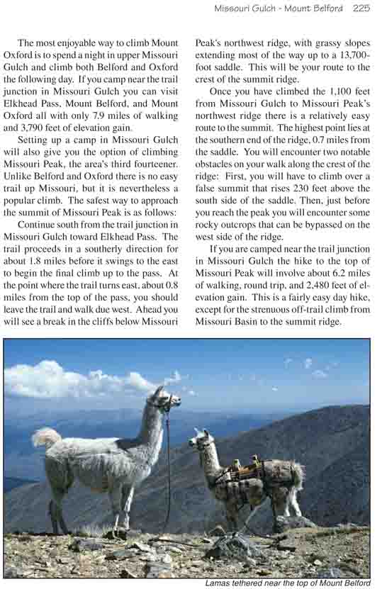
1.3 miles from the parking area the trail crosses to
the east side of Missouri Gulch Creek, then 0.3 mile further you will
see the remains of an old abandoned cabin on your left. A plaque has
been nailed to the roofless cabin proclaiming that it once belonged to a
hardy miner named Joe Anderson. Beyond Joe Anderson’s cabin the forest
begins to open up as you approach timberline. As the trail continues the
dense stand of spruce quickly deteriorates into a patchwork of knurled,
bushy plants that bear little resemblance to trees. Then after a few
hundred additional feet of elevation gain all that is left of the
confining forest is a carpet of alpine grasses and flowers. Forests have
their own special appeal, but for me the openness of the alpine tundra
never fails to make my spirits soar.
As you emerge from the forest you can see the summit
Belford Peak clearly on your left. It is a gentle peak, as fourteeners go,
more like a high rolling hill that a mountain. The ridge on the west side of
Missouri Gulch, by contrast, is a very rugged formation, bordered by cliffs
and talus slopes. The highest point on this ridge, near the southern end, is
Missouri Peak (14,067 ft.).
After you have walked 0.5 mile from Joe Anderson’s
cabin you should see a trail junction with a sign marking the trail to
Mount Belford, on the left, and Elkhead Pass, on the right. Either route will take
you to the top of Mount Belford, but the more direct trail on the left is
2.3 miles shorter. Nevertheless, the elevation gain is the same and the
trail on the right is much less steep. I suggest you continue to Elkhead
Pass before climbing Belford, enjoying the beauty of upper Missouri Gulch,
and use the steeper trail on the left for your return journey.
The Elkhead Pass trail continues climbing gradually
for another 2.6 miles, gaining another 1,580 feet before it reaches the
pass. Sandwiched in between two fourteeners at an elevation of 13,220
feet, Elkhead is almost the highest mountain pass in Colorado. The only
one higher is the 13,300-foot Electric Pass, near Aspen. To the north
you can look down into the Missouri Gulch, through which you have come,
and to the south, in front of the Continental Divide, is the remote
Missouri Basin. Seeing Missouri Peak above the west side of the pass is
a great incentive to push on to Belford, the higher of the two peaks.
The trail to Belford begins by heading due east from
Elkhead Pass, then it makes a long sweeping turn to the left as it follows
the southern ridge to the summit. The grade continues to be gradual, and
were it not for the altitude it would be an easy walk to the top. The trail
gains only 980 feet in 1.3 miles. After a mile you will see a spur trail
branching off to the right toward Mount Oxford, then less than 10 minutes
later you will encounter the small outcropping of rock that marks the summit
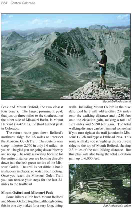
of Mount Belford. From there you can look down on both Missouri Peak and
Mount Oxford, the two closest fourteeners. The large, prominent peak that
juts up three miles to the southeast, on the other side of Missouri Basin,
is Mount Harvard (14,420 ft.), the third highest peak in Colorado.
The return route goes down Belford’s northwest ridge for
1.6 miles to intersect the Missouri Gulch Trail. The route is very steep-it
looses 2,560 in only 1.6 miles-so you will be glad you are going down this
way and not up. The route is exciting because for the entire distance you
are looking directly down into the lush green tundra of the Missouri Gulch.
The trail is not difficult but it is slippery in places, so watch your
footing. Once you reach the Missouri Gulch Trail you can retrace your steps
for the last 2.1 miles to the trailhead.
Mount Oxford and Missouri Peak
Some hikers climb both Mount Belford and Mount Oxford
together, although doing this in one day makes for a very long, tiring walk.
Including Mount Oxford in the hike described here will add another 2.4 miles
onto the walking distance and 1,230 feet onto the elevation gain, making a
total of 12.1 miles and 5,890 feet gain. The total walking distance can be
trimmed somewhat if you turn right at the trail junction in Missouri Gulch
and bypass Elkhead Pass. This route will take you straight up the northwest
ridge to the top of Mouth Belford, shaving 2.3 miles of the total hiking
distance. But this plan will also bring the total elevation gain up to 6,000
feet.
The most enjoyable way to climb Mount Oxford is to spend
a night in upper Missouri Gulch and climb both Belford and Oxford the
following day. If you camp near the trail junction in Missouri Gulch you can
visit Elkhead Pass, Mount Belford, and Mount Oxford all with only 7.9 miles
of walking and 3,790 feet of elevation gain.
Setting up a camp in Missouri Gulch will also give you
the option of climbing Missouri Peak, the area’s third fourteener. Unlike
Belford and Oxford there is no easy trail up Missouri, but it is
nevertheless a popular climb. The safest way to approach the summit of
Missouri Peak is as follows:
Continue south from the trail junction in Missouri Gulch
toward Elkhead Pass. The trail proceeds in a southerly direction for about
1.8 miles before it swings to the east to begin the final climb up to the
pass. At the point where the trail turns east, about 0.8 miles from the top
of the pass, you should leave the trail and walk due west. Ahead you will
see a break in the cliffs below Missouri Peak's northwest ridge, with grassy
slopes extending most of the way up to a 13,700-foot saddle. This will be
your route to the crest of the summit ridge.
Once you have climbed the 1,100 feet from Missouri Gulch
to Missouri Peak’s northwest ridge there is a relatively easy route to the
summit. The highest point lies at the southern end of the ridge, 0.7 miles
from the saddle. You will encounter two notable obstacles on your walk along
the crest of the ridge: First, you will have to climb over a false summit
that rises 230 feet above the south side of the saddle. Then, just before
you reach the peak you will encounter some rocky outcrops that can be
bypassed on the west side of the ridge.
If you are camped near the trail junction in Missouri Gulch the hike to
the top of Missouri Peak will involve about 6.2 miles of walking, round
trip, and 2,480 feet of elevation gain. This is a fairly easy day hike,
except for the strenuous off-trail climb from Missouri Basin to the summit
ridge.