Mount Bierstadt was named after Albert Bierstadt, a
nineteenth-century landscape artist who first visited the American West
as a member of a Rocky Mountains Survey Team in 1859. Bierstadt’s
resulting works soon catapulted him to fame, and he spent most of the
rest of his life painting a series of dramatic landscapes of the West.
Today he is recognized as one of the greatest American artists of all
time. It is fitting that one of Colorado’s fourteeners should be named
after him.
Serious mountaineers often climb Bierstadt in
combination with Mount Evans. The double ascent requires a traverse from
Bierstadt to Evans across a formidable looking ridge that includes a
step called the Sawtooth. There is a great view of Bierstadt and the
Sawtooth from the Guanella Pass Trailhead, but unfortunately Mount Evans
is hidden behind the ridge and can’t be seen from that perspective. The
traverse between the two peaks doesn’t look any easier when viewed from
the top of Bierstadt, but it is actually not as technically difficult as
it appears. It is usually rated as a class-3 climb.
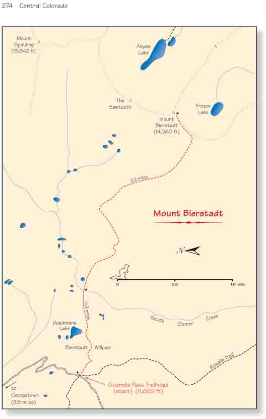
The trail looses 160 feet of elevation in the first
0.8 mile as it descends toward Scott Gomer Creek. This area is a
marshland filled with dense thickets of Scouler willows that once
presented a serious obstacle to hikers. Many older maps and guidebooks
warn that the trail is impassable in spring, and suggest that Mount
Bierstadt is best climbed in the winter when the bog is frozen.
Fortunately, considerable work has been done on this trail in the last
eight years, and there are now boardwalks across the worst parts of the
marsh. The Bierstadt Willows are no longer as intimidating as they once
were.
After crossing Scott Gomer Creek the trail continues east
for another 1.1 miles, heading for the top of a ridge on the northwest side
of the summit. When you reach the crest of this ridge you will be treated to
a fine view of the Sawtooth and the rugged basin below it.
Once the trail reaches the crest of the northwest ridge
it turns south and continues to gain altitude as it makes a long sweeping
turn to the east. Finally the trail levels out and seems to end at the base
of a rocky outcropping 250 feet below the summit. A large stone monument has
been erected at this point to make it easier for hikers to pick up the trail
again on the return trip.
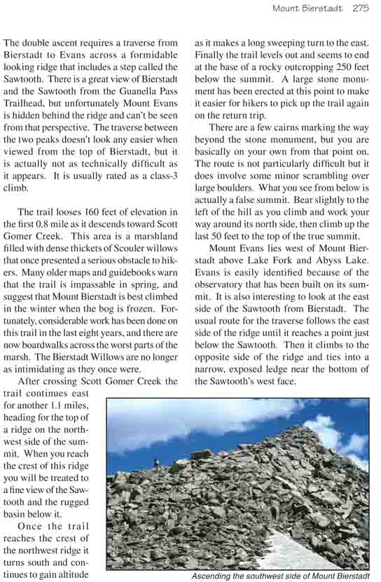
There are a few cairns marking the way beyond the stone
monument, but you are basically on your own from that point on. The route is
not particularly difficult but it does involve some minor scrambling over
large boulders. What you see from below is actually a false summit. Bear
slightly to the left of the hill as you climb and work your way around its
north side, then climb up the last 50 feet to the top of the true summit.
Mount Evans lies west of Mount Bierstadt above Lake Fork
and Abyss Lake. Evans is easily identified because of the observatory that
has been built on its summit. It is also interesting to look at the east
side of the Sawtooth from Bierstadt. The usual route for the traverse
follows the east side of the ridge until it reaches a point just below the
Sawtooth. Then it climbs to the opposite side of the ridge and ties into a
narrow, exposed ledge near the bottom of the Sawtooth’s west face.