In Colorado you can’t really call yourself a serious
outdoorsman until you have climbed at least a few of the state’s 55
fourteen-thousand-foot peaks. This trail is a peak-baggers delight, because
it will allow you to ascend to the tops of no fewer than three fourteeners
within the space of a single day. The trailhead is located in the bottom of
a high alpine basin that lies just south of Mount Democrat, Mount Cameron,
Mount Lincoln, and Mount Bross. The elevation of the basin is only 2,270
feet below the highest peak, and the summits are all connected by a high
rocky ridge that circles the north side of the basin.
One thing that stands out along this trail is the
abundance of mining activity. These mountains are full of precious mineral
deposits, and prospectors have been combing them in search of wealth for the
past 150 years. Miners have never been known for their tidiness, and on this
hike you will seldom be out of site of their refuse. There are old mine
shafts and fallen-down shacks everywhere-even near the peaks themselves. The
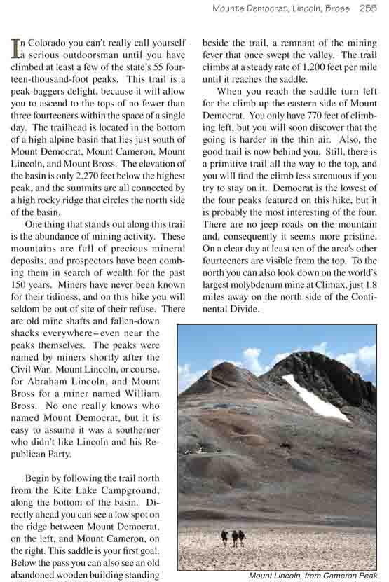
peaks were named by miners shortly after the Civil War. Mount Lincoln, or
course, for Abraham Lincoln, and Mount Bross for a miner named William Bross.
No one really knows who named Mount Democrat, but it is easy to assume it
was a southerner who didn’t like Lincoln and his Republican Party.
Begin by following the trail north from the Kite Lake
Campground, along the bottom of the basin. Directly ahead you can see a
low spot on the ridge between Mount Democrat, on the left, and Mount
Cameron, on the right. This saddle is your first goal. Below the pass
you can also see an old abandoned wooden building standing beside the
trail, a remnant of the mining fever that once swept the valley. The
trail climbs at a steady rate of 1,200 feet per mile until it reaches
the saddle.
When you reach the saddle turn left for the climb up
the eastern side of Mount Democrat. You only have 770 feet of climbing
left, but you will soon discover that the going is harder in the thin
air. Also, the good trail is now behind you. Still, there is a primitive
trail all the way to the top, and you will find the climb less strenuous
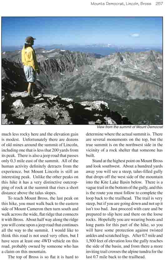
if you try to stay on it. Democrat is the lowest of the four peaks
featured on this hike, but it is probably the most interesting of the
four. There are no jeep roads on the mountain and, consequently it seems
more pristine. On a clear day at least ten of the area's other fourteeners are visible from the top. To the north
you can also look down on the world’s largest molybdenum mine at Climax,
just 1.8 miles away on the north side of the Continental Divide.
From the top of Mount Democrat you will have to retrace
your steps back to the saddle in order to begin the 860-foot climb up Mount
Cameron. This time the climb is somewhat easier because the trail is better
and not as steep. The peak does not have a steep, well defined summit like
Mount Democrat, but is more of a rounded knob on the top of the ridge. It’s
summit is only 140 feet higher than the saddle between Cameron and Lincoln.
For this reason Mount Cameron is not officially included in the list of
Colorado’s 14,000-foot peaks, but few people climb Democrat and Lincoln
without including Mount Cameron in their itinerary.
As you can see from this prospective, once you reach the
top of Mount Cameron it is an easy 20-minute walk to get to the summit of
Mount Lincoln. The terrain is much less rocky here and the elevation gain is
modest. Unfortunately there are dozens of old mines around the summit of
Lincoln, including one that is less that 200 yards from its peak. There is
also a jeep road that passes only 0.3 mile east of the summit. All of the
human activity definitely detracts from the experience, but Mount Lincoln is
still an interesting peak. Unlike the other peaks on this hike it has a very
distinctive outcropping of rock at the summit that rises a short distance
above the talus slopes.
To reach Mount Bross, the last peak on this hike, you
must walk back to the eastern side of Mount Cameron then turn south and walk
across the wide, flat ridge that connects it with Bross. About half way
along the ridge you will come upon a jeep road that continues all the way to
the summit. I would like to think this road is not used very often, but I
have seen at least one 4WD vehicle on this road, probably owned by someone
who has a claim on this mountain.
The top of Bross is so flat it is hard to determine where
the actual summit is. There are several monuments on the top, but the true
summit is on the northwest side in the vicinity of a rock shelter that
someone has built.
Stand at the highest point on Mount Bross and look southwest. About a
hundred yards away you will see a steep, talus-filled gully that drops
off the west side of the mountain into the Kite Lake Basin below. There
is a vague trail in the bottom of the gully, and this is the route you
must follow to complete the loop back to the trailhead. The trail is
very steep, but if you are going down and not up it isn’t too bad. Just
proceed with care and be prepared to slip here and there on the loose
rocks. Hopefully you are wearing boots and long pants for this part of
the hike, so you will have some protection against twisted ankles and
scratched legs. After 0.7 mile and 1,500 feet of elevation loss the
gully reaches the side of the basin, and from there a more inviting
trail crosses the alpine tundra for the last 0.7 mile back to the
trailhead.