Mount Elbert is not the most scenic fourteener in
Colorado, but it can certainly hold its own-and it does happen to be the
highest mountain in the state! The peak was named in 1871 after Samuel
Elbert, the territorial governor of Colorado, and it was first climbed 3
years later by members of the Hayden Survey Expedition. At that time no one
realized that Mount Elbert was the highest peak in Colorado. That honor was
mistakenly bestowed upon Pikes Peak and later upon Mount Massive. We now
know, however, that the stately Mount Elbert is not only the highest peak in
Colorado, but it is the second loftiest summit outside Alaska in the entire
United States. Only Mount Whitney in California is higher.
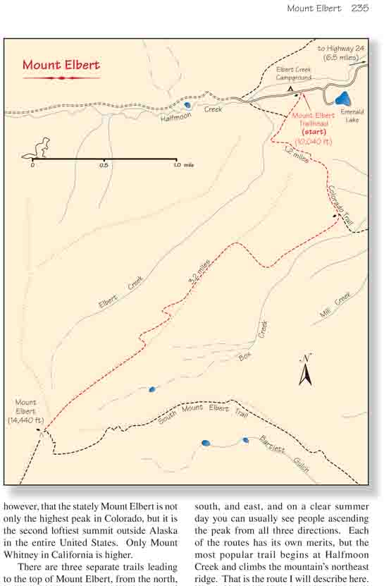
There are three separate trails leading to the top of
Mount Elbert, from the north, south, and east, and on a clear summer day you
can usually see people ascending the peak from all three directions. Each of
the routes has its own merits, but the most popular trail begins at Halfmoon
Creek and climbs the mountain’s northeast ridge. That is the route I will
describe here. Halfmoon Creek is an easy 11-mile drive from Leadville, and
there is a nice Forest Service campground just 100 yards from the trailhead.
As an added bonus, the trail up Mount Elbert is located only 0.5 mile from
the Mount Massive Trailhead, so it is possible to stay at the campground and
hike up Colorado’s two highest peaks on successive days. Occasionally
someone will climb both peaks on the same day, but unless you are in superb
physical condition I wouldn’t recommend that.
The trail starts out by ambling along a very gentle
grade through the lodgepole pines in a southwesterly direction. Less
than five minutes from the parking area you will come to a junction
where the route joins the Colorado Trail, a 471-mile-long footpath that
runs from Denver to Durango. You will be following the Colorado Trail
for the next 1.0 mile to another well-marked trail junction where the
Mount Elbert Trail departs on the right. Here is where the climb really
begins. The elevation gain to this point is only 460 feet, leaving
nearly 4,000 feet of climbing for the last 3.2 miles of trail.
After leaving the Colorado Trail the path turns west
and climbs to the crest of the northeast ridge, a long, sloping ramp of
granite with Elbert Creek running below its north side and Box Creek to
the south. The top of the ridge is almost obstacle-free and provides a
perfect platform for a trail. There are no serious outcroppings of rock
along the way, and the trail requires only a minimum of switchbacks to
negotiate the grade. Nevertheless the climb is unrelenting. Every step
is up.
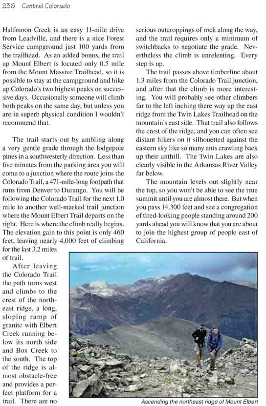
The trail passes above timberline about 1.3 miles from
the Colorado Trail junction, and after that the climb is more interesting.
You will probably see other climbers far to the left inching there way up
the east ridge from the Twin Lakes Trailhead on the mountain’s east side.
That trail also follows the crest of the ridge, and you can often see
distant hikers on it silhouetted against the eastern sky like so many ants
crawling back up their anthill. The Twin Lakes are also clearly visible in
the Arkansas River Valley far below.
The mountain levels out slightly near the top, so you
won’t be able to see the true summit until you are almost there. But when
you pass 14,300 feet and see a congregation of tired-looking people standing
around 200 yards ahead you will know that you are about to join the highest
group of people east of California.