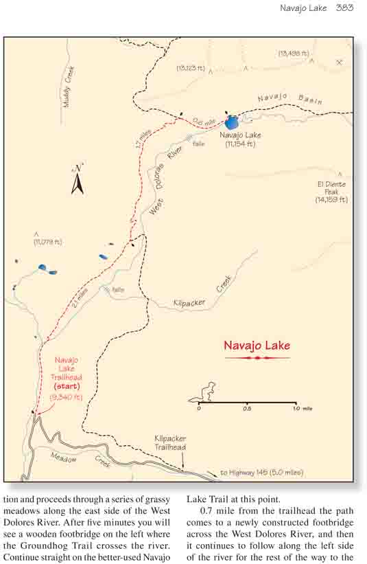
Navajo Lake is probably the most popular destination in
the Lizard Head Wilderness Area. Not only is the lake itself an alpine gem,
but it is located in a ruggedly beautiful basin that is surrounded on three
sides by 13,000-foot ridges and three 14,000-foot peaks (Wilson Peak, Mount
Wilson, and El Diente Peak). Peak baggers often use Navajo Basin as a base
for climbing these three peaks.
The trail starts out in a northerly direction and
proceeds through a series of grassy meadows along the east side of the
West Dolores River. After five minutes you will see a wooden footbridge
on the left where the Groundhog Trail crosses the river. Continue
straight on the better-used Navajo Lake Trail at this point.
0.7 mile from the trailhead the path comes to a newly
constructed footbridge across the West Dolores River, and then it
continues to follow along the left side of the river for the rest of the
way to the lake. For the next mile the western skyline is dominated by
views of Dolores Peak, a dome-shaped volcanic cone 2.5 miles west of the
trail that tops out at 13,290 feet. The treeless almost perfectly
symmetrical peak seems to stand all alone above the flower-laden meadows
that surround the trail.
For the first 3.3 miles this trail ascends gradually
through a series of intermittent meadows that are often filled with dense
beds of skunk cabbage. As you gain altitude the other types of wildflowers
gain more prominence, and when you reach about 10,500 feet the fields become
alive with the purples, blues, yellows and reds of larkspurs, bluebells,
sunflowers, and paintbrushes.
After walking 2.1 miles you will pass the junction with
the Kilpacker Trail, and about fifteen minutes later you will notice the
trail getting much steeper. As you approach Navajo Lake Basin the terrain
near the river becomes too rough for the trail, so the route veers up the
north side of the basin before dropping back down to the lake. Look for a
nice waterfall on the south side of the basin in this area.
After the trail has climbed 400 feet above the West
Dolores River you will come to another trail junction where the Woods Lake
Tail branches off to the north. Then, immediately after leaving the
junction, the path drops 250 feet back down to the river. It arrives at the
west end of Navajo Lake 300 yards later.
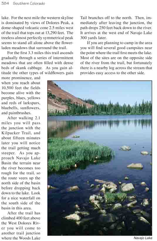
If you are planning to camp in the area you will find several good
campsites near the point where the trail first meets the lake. Most of the
sites are on the opposite side of the river from the trail, but fortunately
there is a nearby log across the stream that provides easy access to the
other side.