Because of water rights issues in the Piedra River
watershed this area missed being declared a Wilderness Area in the 1993
Colorado Wilderness Act. Fortunately, however, because of its vast
expanse of old-growth forest it was decided to make it a "Special
Management Area". Consequently, the virgin forest is now protected
against future logging and road building activities, and its 62,550-acre
size makes it the largest such forest preserve in the state.
Fishermen have a special appreciation for the Piedra
River area. The river and its tributaries are teaming with fish, with
rainbow trout and brown trout being particularly abundant. The Piedra River
is also the site of an experimental project to reintroduce the endangered
river otter back into its native habitat. But even if you aren’t carrying a
fishing pole or looking for river otters there is enough great scenery along
the river to make this trail a worthwhile walk.
From the trailhead the well-used trail meanders southward
for the first mile, passing through a particularly interesting area where
the river is overhung by cliffs on the east side. After a mile the river
makes an abrupt 90-degree turn and begins flowing westward through a long,
narrow flat-bottomed valley. 0.6 mile after the turn it crosses a small
bridge that spans Williams Creek, then it continues in a southwest direction
along the north shore of the Piedra.
The trail crosses Trail Creek about a half hour beyond
Williams Creek, and 10 minutes later you will notice another trail branching
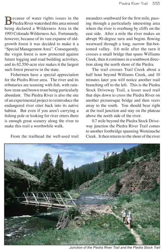
off to the left. This is the Piedra Stock Driveway Trail, a lesser used
trail that dips down to cross the Piedra River on another picturesque bridge
and then veers away to the south. You should bear right at the trail
junction and stay on the plateau above the north side of the river.
0.7 mile beyond the Piedra Stock Driveway junction the
Piedra River Trail comes to another footbridge spanning Weminuche Creek. It
then returns to the shore of the river and closely follows its twists and
turns for the next 3.0 miles. If you are a fisherman with an intent to spend
the night along the river this section of the trail would be your best
choice.
An hour and twenty minutes after leaving Weminuche Creek
the trail crosses the third major side drainage on this hike, and this time
there is no footbridge to assist your crossing. This tributary is called
Sand Creek, and it is the only place along the trail where you must get your
feet wet to get across. The water is only a foot deep and 15 feet wide, but
there seems to be no easy way to cross it.
Sand Creek represents the beginning of a narrow part of
the Piedra River Canyon called the Second Box, and 0.6 mile beyond the
confluence the trail begins climbing up the north side of the canyon to get
around the steep cliffs below. This part of the trail is, for me, a
disappointment. River runners attest that the scenery inside the Second Box
is dramatic, with the river rushing through the confines of the inner
canyon, roaring through class IV rapids and pounding against the cliffs that
line the shore. But, alas, from 500 feet above the canyon floor where the
trail is located the river is seldom visible, and there is scarcely a hint
of the spectacle that exists within the gorge. I suppose it would be
impractical to construct a trail closer to the water at this point, but what
a hike it would be if the route could follow the river through the Second
Box!
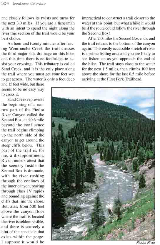
After 2.0 miles the Second Box ends, and the trail returns to the bottom
of the canyon again. This easily accessible stretch of river is a prime
fishing area and you are likely to see fishermen as you approach the end of
the hike. The trail stays close to the water for the next 1.5 miles, then
climbs 100 feet above the shore for the last 0.5 mile before arriving at the
First Fork Trailhead.