Many mysteries still surround the formation of the Rocky
Mountains, but one of the most intriguing puzzles concerns the formation of
Pikes Peak on the southern tip of the Front Range. Pikes Peak was created
some 60 million years ago when a large deposit Pikes Peak Granite was pushed
up from deep within the earth. The puzzling thing is that after the rock
reached the earth’s surface it seemed to expand and flow outward, eventually
covering many square miles of much younger sedimentary rock. This wouldn’t
seem unreasonable if the rock had been in liquid or plastic form, but in
this case the material was far from liquid. It was solid Precambrian granite
that had cooled and crystallized a billion years before it was pushed to the
surface. It is difficult to imagine solid granite being squeezed out of the
earth like toothpaste from a tube and then flowing horizontally like cold
molasses across the earth’s surface. But that appears to be exactly what
happened.
Granite is an igneous rock that can only form under
extreme temperatures and pressures, so it was definitely not in a liquid or
plastic state when the extrusion took place. The Pikes Peak Granite,
however, is so badly fractured and jointed that it must have been subjected
to enormous forces while it was being pushed to the surface. The beautiful,
pinkish boulders that surround the peak often look like they have been
pushed through a meat chopper.
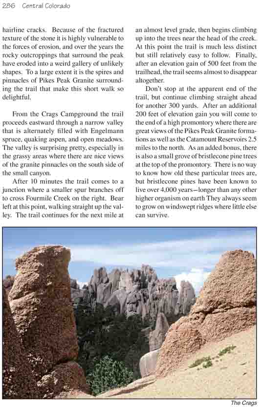
Granite is normally a hard, smooth material that stands
up well to the forces of erosion, but on Pikes Peak the stubby interlocking
crystals of quartz, feldspar, hornblende and mica are filled with hairline
cracks. Because of the fractured texture of the stone it is highly
vulnerable to the forces of erosion, and over the years the rocky
outcroppings that surround the peak have eroded into a weird gallery of
unlikely shapes. To a large extent it is the spires and pinnacles of Pikes
Peak Granite surrounding the trail that make this short walk so delightful.
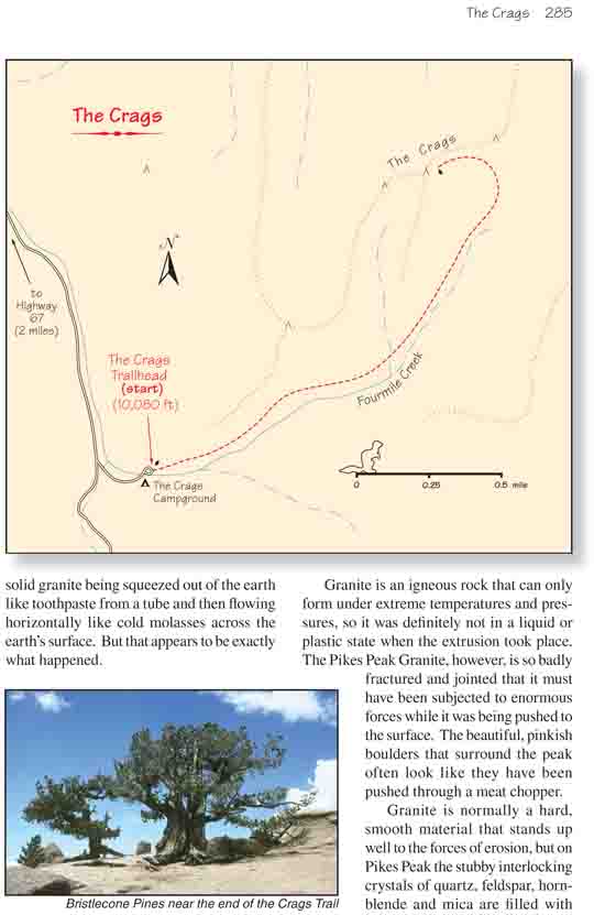
From the Crags Campground the trail proceeds eastward
through a narrow valley that is alternately filled with Engelmann spruce,
quaking aspen, and open meadows. The valley is surprising pretty, especially
in the grassy areas where there are nice views of the granite pinnacles on
the south side of the small canyon.
After 10 minutes the trail comes to a junction where a
smaller spur branches off to cross Fourmile Creek on the right. Bear left at
this point, walking straight up the valley. The trail continues for the next
mile at an almost level grade, then begins climbing up into the trees near
the head of the creek. At this point the trail is much less distinct but
still relatively easy to follow. Finally, after an elevation gain of 500
feet from the trailhead, the trail seems almost to disappear altogether.
Don’t stop at the apparent end of the trail, but continue climbing
straight ahead for another 300 yards. After an additional 200 feet of
elevation gain you will come to the end of a high promontory where there are
great views of the Pikes Peak Granite formations as well as the Catamount
Reservoirs 2.5 miles to the north. As an added bonus, there is also a small
grove of bristlecone pine trees at the top of the promontory. There is no
way to know how old these particular trees are, but bristlecone pines have
been known to live over 4,000 years-longer than any other higher organism on
earth They always seem to grow on windswept ridges where little else can
survive.