Donut Falls
excerpted from our book
Salt Lake City's Incredible Hiking and Biking Trails
pages 82-85
|
Buy book directly from the author!
Salt Lake City's Incredible Hiking and Biking Trails
- has access info for 73 trailheads
- 73 colorful trail maps
- 325 full color photographs
- loads of hiking tips
|
regularly $19.95
now on sale for only
$9.95
click here
for book orders
|
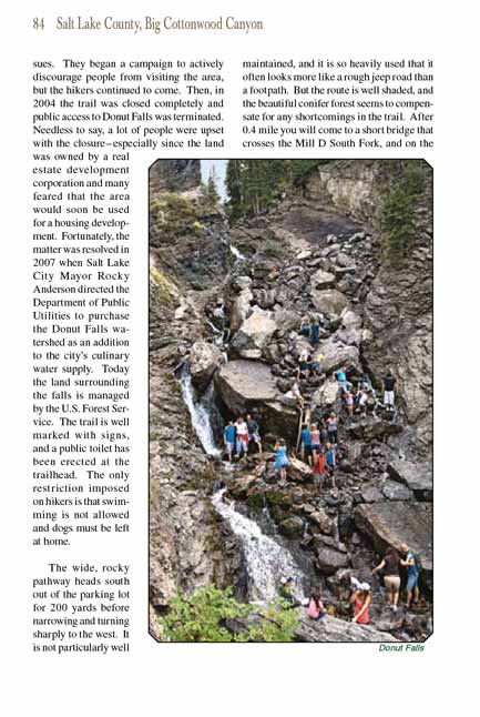
 Donut Falls is one of those hikes that typically draws Salt Lake residents back over and over again. It is a nice afternoon get-away that
is short enough and close enough to the city that the whole trip can be completed in less than two hours. It is also a great hike for families with children; the
elevation gain is minimal, there is plenty of shade, and the kids always enjoy wading through the water at the bottom of
Donut Falls. For those willing to take a
risk, the hike also offers a bit of adventure. The unusual “donut hole” in the rock through which Donut Falls flows is actually located at the top of a
hundred-foot scramble over a rockfall at the end of the trail. The climb is not technically difficult, but the boulders below the donut hole are always slick
with spay from the waterfall and accidents are common. Every year people are injured, sometimes seriously, on this climb, and at least one person was killed
when he slipped and fell through the donut hole.
Donut Falls is one of those hikes that typically draws Salt Lake residents back over and over again. It is a nice afternoon get-away that
is short enough and close enough to the city that the whole trip can be completed in less than two hours. It is also a great hike for families with children; the
elevation gain is minimal, there is plenty of shade, and the kids always enjoy wading through the water at the bottom of
Donut Falls. For those willing to take a
risk, the hike also offers a bit of adventure. The unusual “donut hole” in the rock through which Donut Falls flows is actually located at the top of a
hundred-foot scramble over a rockfall at the end of the trail. The climb is not technically difficult, but the boulders below the donut hole are always slick
with spay from the waterfall and accidents are common. Every year people are injured, sometimes seriously, on this climb, and at least one person was killed
when he slipped and fell through the donut hole.
During the 1990s Donut Falls was nearly as popular among outdoor recreationists as it is today. The land was privately owned, however, and because of frequent
accidents the owners were troubled by liability issues. They began a campaign to actively discourage people from visiting the area, but the hikers continued to
come. Then, in 2004 the trail was closed completely and public access to Donut Falls was terminated. Needless to say, a lot of people were upset with the
closure-especially since the land was owned by a real estate development corporation and many feared that the area would soon be used for a housing development.
Fortunately, the matter was resolved in 2007 when Salt Lake City Mayor Rocky Anderson directed the Department of Public Utilities to purchase the Donut Falls
watershed as an addition to the city’s culinary water supply. Today the land surrounding the falls is managed by the U.S. Forest Service. The trail is well
marked with signs, and a public toilet has been erected at the trailhead. The only restriction imposed on hikers is that swimming is not allowed and dogs
must be left at home.
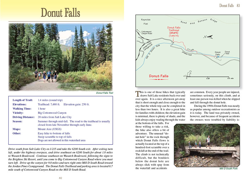
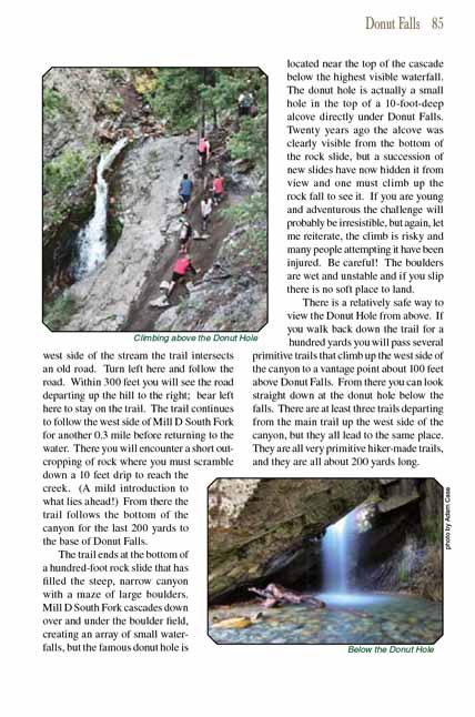
The wide, rocky pathway heads south out of the parking lot for 200 yards before narrowing and turning sharply to the west. It is not particularly well maintained,
and it is so heavily used that it often looks more like a rough jeep road than a footpath. But
the route to Donut Falls is well shaded, and the beautiful conifer forest seems
to compensate for any shortcomings in the trail. After 0.4 mile you will come to a short bridge that crosses the Mill D South Fork, and on the west side of the
stream the Donut Falls trail intersects an old road. Turn left here and follow the road. Within 300 feet you will see the road departing up the hill to the right; bear
left here to stay on the trail. The trail continues to follow the west side of Mill D South Fork for another 0.3 mile before returning to the water. There
you will encounter a short outcropping of rock where you must scramble down a 10 feet drip to reach the creek. (A mild introduction to what lies ahead!)
From there the trail follows the bottom of the canyon for the last 200 yards to the base of Donut Falls.
The Donut Falls trail ends at the bottom of a hundred-foot rock slide that has filled the steep, narrow canyon with a maze of large boulders. Mill D South Fork cascades
down over and under the boulder field, creating an array of small waterfalls, but the famous donut hole is located near the top of the cascade below the highest
visible waterfall. The donut hole is actually a small hole in the top of a 10-foot-deep alcove directly under Donut Falls. Twenty years ago the alcove was
clearly visible from the bottom of the rock slide, but a succession of new slides have now hidden it from view and one must climb up the rock fall to see it.
If you are young and adventurous the challenge will probably be irresistible, but again, let me reiterate, the climb is risky and many people attempting it
have been injured. Be careful! The boulders are wet and unstable and if you slip there is no soft place to land.
There is a relatively safe way to view the Donut Hole from above. If you walk back down the trail for a hundred yards you will pass several primitive trails
that climb up the west side of the canyon to a vantage point about 100 feet above Donut Falls. From there you can look straight down at the donut hole below
the falls. There are at least three trails departing from the main trail up the west side of the canyon, but they all lead to the same place. They are all
very primitive hiker-made trails, and they are all about 200 yards long.
Note to web developers: You may copy this material onto your site, but in return please include a link to my home page
www.utahtrails.com. Thank you, David Day (utahdavidday
at gmail.com)
Click here to see more
trails near Salt Lake City
© Rincon Publishing Company, all rights reserved
|