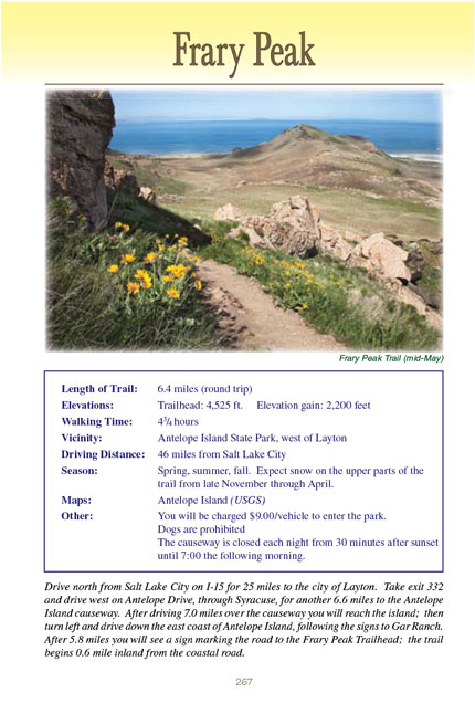
Frary Peak Trail
excerpted from our book
Salt Lake City's Incredible Hiking and Biking Trails
pages 267-270
|
Buy book directly from the author!
Salt Lake City's Incredible Hiking and Biking Trails
- has access info for 73 trailheads
- 73 colorful trail maps
- 325 full color photographs
- loads of hiking tips
|
regularly $19.95
now on sale for only
$9.95
click here
for book orders
|
 Frary Peak is the highest point on Antelope Island, a 42-square-mile island on the southeastern side of Utah’s Great Salt Lake.
The island’s unique ecological and historical value has long been recognized, but for more than a hundred years it was privately owned and access was strictly
limited. Then in 1981, after twelve years of negotiation, the state of Utah was finally able to purchase the last remaining privately owned portion of the
island, and now Antelope Island is a state park.
Frary Peak is the highest point on Antelope Island, a 42-square-mile island on the southeastern side of Utah’s Great Salt Lake.
The island’s unique ecological and historical value has long been recognized, but for more than a hundred years it was privately owned and access was strictly
limited. Then in 1981, after twelve years of negotiation, the state of Utah was finally able to purchase the last remaining privately owned portion of the
island, and now Antelope Island is a state park.
Antelope Island State Park, like the Great Salt Lake that surrounds it, is unique in a number of ways, but the feature that attracts most hikers to
the Frary Peak Trail
is the wildlife. The higher elevations are home to an estimated 200 bighorn sheep and about the same number of pronghorn antelope live below the peaks. There
is also a large population of mule deer on the island, but Antelope Island’s most celebrated mammal is the bison. These iconic animals were first introduced to
the island in 1893, and the prairie-like environment proved to be an ideal habitat for them. Today their offspring comprise one of the oldest and largest
publicly owned bison herds in the nation; 500-700 of them are allowed to roam free on the island.
You might be lucky, but, to be honest, many people will complete
the Frary Peak hike without having had the opportunity to see any of Antelope Island’s large mammals.
There is another kind of animal, however, that you are certain to see: birds. The Great Salt Lake is a birders’ paradise, and nearly 250 different species
have been observed on Antelope Island. Their calls during the spring nesting season are incessant, and the music changes as you gain elevation. Driving to
the trailhead you will cross the shoreline habitat of the avocets, stilts, geese, ducks, grebes, egrets, and ibis. Walking through the grasslands you will
encounter pheasants, quail, partridges, doves, larks, and blackbirds. And as you approach the higher elevations of Frary Peak your treat will be the soaring
birds-hawks, falcons, eagles, harriers, and kestrels. Be sure to take your binoculars for a closer look.
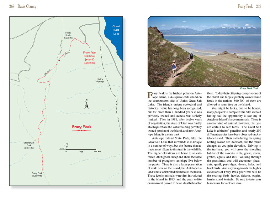
The Frary Peak Trail begins by winding up the eastern side of Dooly Knob (named after John Dooly, the previous owner of Antelope Island). The grade is moderate, gaining 500
feet in the first half mile. The trail passes through open grassland with no trees, but the monotony is broken by occasional outcroppings of badly weathered
igneous and metamorphic rock. This rock, mostly gneiss, is some of the oldest rock in the United States-even older than the deposits found in the bottom of the
Grand Canyon. Geologists have identified it as Archeozoic Precambrian, which means it is over 2.5 billion years old!
After 0.7 mile you will come to a trail junction where a spur branches off to the right for Dooly Knob, the large outcropping of rock 0.5 mile north of the
junction. Bear left here for Frary Peak. Upon leaving the junction the Frary
Peak Trail stays fairly level for the next 0.5 mile, making its way along the west side of
the summit ridge before suddenly turning to climb to the top of the ridge. Just before the turn you will pass under a group of large boulders-almost the only
shady spot on the entire hike and a nice place to take a break.
Once it reaches the top of the summit ridge the
Frary Peak Trail turns south again and continues along the west side of the ridge for the next 1.3 miles to Stringham Peak.
Stringham is just a minor bump on the summit ridge, hardly worthy of being called a peak. It is also the location of an unsightly communications antenna tower,
but I suppose it is better to have it there than on Frary Peak itself. Frary Peak, the highest point on the island, is another 0.3 mile along the ridge and is
clearly visible from Stringham.
Continuing beyond Stringham Peak the Frary
Peak Trail dips down about 120 feet and then climbs steeply up the last 300 feet to the summit of Frary. The terrain surrounding
the peak is extremely rocky, and this part of the trail is not as well constructed as before. The park rangers have installed some crude steps up the last 150
feet, but, even so, you may have to use your hands in a few places.
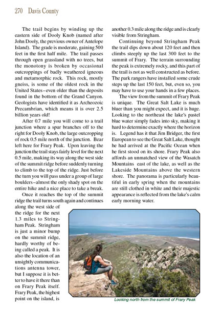
The view from the summit of Frary Peak is unique. The Great Salt Lake is much bluer than you might expect, and it is huge. Looking to the northeast the lake’s
pastel blue water simply fades into sky, making it hard to determine exactly where the horizon is. Legend has it that Jim Bridger, the first European to see
the Great Salt Lake, thought he had arrived at the Pacific Ocean when he first stood on its shore. Frary Peak also affords an unmatched view of the Wasatch
Mountains east of the lake, as well as the Lakeside Mountains above the western shore. The panorama is particularly beautiful in early spring when the mountains
are still clothed in white and their majestic appearance is reflected from the lake’s calm early morning water.
Note to web developers: You may copy this material onto your site, but in return please include a link to my home page
www.utahtrails.com. Thank you, David Day (utahdavidday at gmail.com)
Click here to see more
trails near Salt Lake City
© Rincon Publishing Company, all rights reserved
|