Grandeur Peak Trail
excerpted from our book
Salt Lake City's Incredible Hiking and Biking Trails
pages 39-41
|
Buy book directly from the author!
Salt Lake City's Incredible Hiking and Biking Trails
- has access info for 73 trailheads
- 73 colorful trail maps
- 325 full color photographs
- loads of hiking tips
|
regularly $19.95
now on sale for only
$9.95
click here
for book orders
|
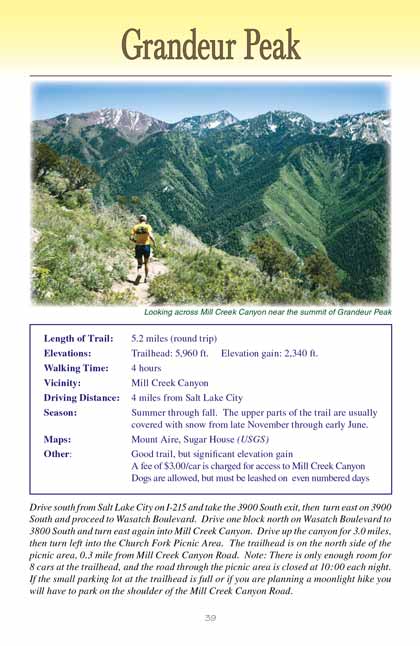
Grandeur Peak is a favorite among residents of Salt Lake City simply because of its commanding position above the city. It is the
last peak on the ridge separating Mill Creek Canyon from Parleys Canyon, and it seems to stand like a sentinel over South Salt Lake watching every move in the
city below. At 8,299 feet above sea level the peak is not particularly high, but from the ground it looks very imposing and many a resident of southeast Salt
Lake has felt compelled to climb Grandeur Peak just for the opportunity to view his neighborhood from above.
The summit of Grandeur Peak is an especially fun place to be at sunset on a night with a full moon. As the sun sheds its last light on the valley the lights of
the city slowly start to flicker on until eventually the entire valley is aglow with the beacons of human activity. The moonlit descent down the upper portion
of the trail is easy, but you will need a flashlight for the last 0.7 mile through the darker recesses of Church Fork Canyon.
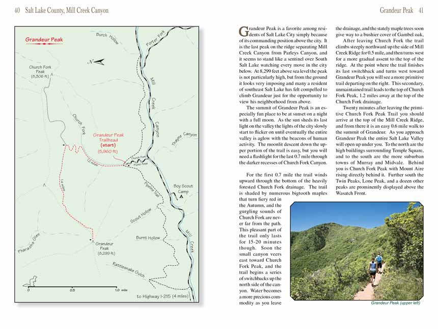
For the first 0.7 mile the Grandeur Peak trail winds upward through the bottom of the heavily forested Church Fork drainage. The trail is shaded by numerous bigtooth maples
that turn fiery red in the Autumn, and the gurgling sounds of Church Fork are never far from the path. This pleasant part of the trail only lasts for 15-20
minutes though. Soon the small canyon veers east toward Church Fork Peak, and the
Grandeur Peak trail begins a series of switchbacks up the north side of the canyon. Water
becomes a more precious commodity as you leave the drainage, and the stately maple trees soon give way to a bushier cover of Gambel
oak.
After leaving Church Fork the Grandeur
Peak trail climbs steeply northward up the side of Mill Creek Ridge for 0.5 mile, and then turns west for a more gradual assent to the
top of the ridge. At the point where the trail finishes its last switchback and turns west toward Grandeur Peak you will see a more primitive trail departing
on the right. This secondary, unmaintained trail leads to the top of Church Fork Peak, 1.2 miles away at the top of the Church Fork drainage.
Twenty minutes after leaving the primitive Church Fork Peak Trail you should arrive at the top of the Mill Creek Ridge, and from there it is an easy 0.6 mile
walk to the summit of Grandeur Peak. As you approach Grandeur Peak the entire Salt Lake Valley will open up under you. To the north are the high buildings
surrounding Temple Square, and to the south are the more suburban towns of Murray and Midvale. Behind you is Church Fork Peak with Mount Aire rising directly
behind it. Further south the Twin Peaks, Lone Peak, and a dozen other peaks are prominently displayed above the Wasatch Front.
Note to web developers: You may copy this material onto your site, but in return please include a link to my home page
www.utahtrails.com. Thank you, David Day (utahdavidday
at gmail).com
Click here to see more
trails near Salt Lake City
© Rincon Publishing Company, all rights reserved
|