Horsetail Falls
excerpted from our book
Salt Lake City's Incredible Hiking and Biking Trails
pages 161-164
|
Buy book directly from the author!
Salt Lake City's Incredible Hiking and Biking Trails
- has access info for 73 trailheads
- 73 colorful trail maps
- 325 full color photographs
- loads of hiking tips
|
regularly $19.95
now on sale for only
$9.95
click here
for book orders
|


 Horsetail falls is a popular day hike among the local residents of Alpine and other nearby communities, but it is not well known
outside the area. The Horsetail Falls trail is actually an old wagon road, but it has not been used by a wheeled vehicle since at least 1978, when it became part of the Lone Peak
Wilderness Area. The route is generally well defined, but it is not well maintained and is subject to a great deal of erosion. Furthermore, if you want
more than a distant view of
Horsetail Falls you must leave the main trail and follow a very primitive hiker-made trail for the last 200 yards to the base of the
waterfall. In short, the Horsetail Falls walk is best suited for hikers with a taste for adventure, and if you are one of those you will be amply rewarded
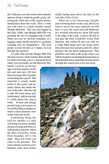
for your effort. At the end of the hike you will be standing beside a 120-foot long cascade of water that pours down
the granite face of Horsetail Falls and then continues into the canyon through a series of smaller cascades. There are also a number of small waterfalls and
wading pools directly above the main fall, but getting to them requires some scrambling.
The first few hundred yards of the
Horsetail Falls Trail were severely damaged by a flood in the summer of 2013, and as this book goes to press the trail has still not been repaired.
Consequently, there is now some confusion as to exactly where the trail
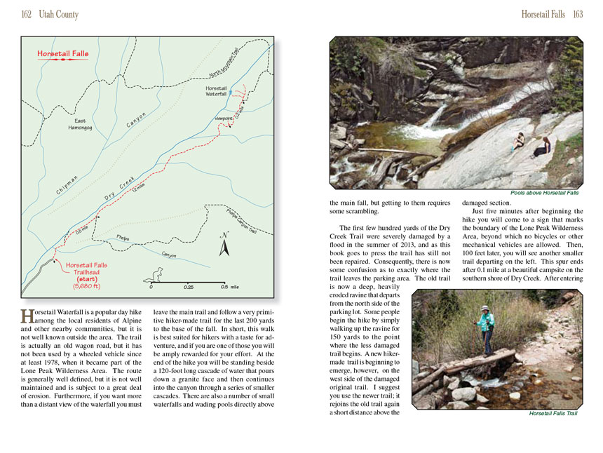
to Horsetail Falls leaves the parking area. The old trail is now a deep, heavily eroded ravine that departs from the north side of the parking lot.
Some people begin the hike by simply walking up the ravine for 150 yards to the point where the less damaged trail begins. A new hiker-made trail is
beginning to emerge, however, on the west side of the damaged original
Horsetail Falls trail. I suggest you use the newer trail; it rejoins the old trail again a short distance above the damaged section.
Just five minutes after beginning the Horsetail Falls hike you will come to a sign that marks the boundary
of the Lone Peak Wilderness Area, beyond which no bicycles or other mechanical vehicles are allowed. Then, 100 feet later, you will see another smaller trail
departing on the left. This spur ends after 0.1 mile at a beautiful campsite on the southern shore of Dry Creek. After entering the wilderness area the main
trail continues upward along a relatively gentle grade, following the south side of the canyon about a hundred feet above the creek. After 1.1 mile you will
come to a small meadow named Shingle Mill Flat. This area was logged in the early 1900s, and Shingle Mill Flat was probably the site of a logging camp or mill.
There are now no obvious remnants of a logging camp, but the meadow is a popular camping area for backpackers. The trail passes several fire pits as it makes
its way through the meadow.
0.2 mile after leaving Shingle Mill Flat the trail crosses a small stream; then another 0.2 mile will bring you to a viewpoint from where you can finally see
the Horsetail
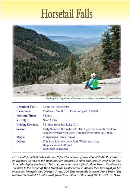
Falls. Look for an obvious spur trail that departs on the left and ends just 100 feet later on a large slab of granite overlooking the canyon.
Horsetail Falls is clearly visible north of this point, and for many visitors this marks the end of the hike. But the
waterfall is still 350 yards away, and, furthermore, only its top half is visible above the canyon walls. If time and energy permit I urge you to press on
for another fifteen minutes to where a more dramatic view of the
Horsetail Falls awaits.
Continuing along the Horsetail Falls trail for another 0.2 mile will bring you first to another stream crossing
and then to a well-marked junction where the Deer Creek-Dry Creek Trail branches off to the right. Bear left when you come to the junction. The trail continues
north for a few hundred yards more before finally fading away above the falls on the east side of Dry Creek.
There are a few interesting cascades and swimming holes in this area, but if you want to access the main waterfall you will have to leave the main trail and bushwack in a westerly direction for about 200 yards to the edge of the creek. Look to the left as you pass the Deer Creek-Dry Creek Trail Junction, and within
50 feet you will see a crude hiker-made trail that drops down from the main trail and proceeds for a short distance into the dense undergrowth. This primitive
trail ends at the gorge where you will be treated to an unimpeded panorama of the powerful, noisy
Horsetail Falls as it roars down through the canyon just a few feet away.
Note to web developers: You may copy this material onto your site, but in return please include a link to my home page
www.utahtrails.com. Thank you, David Day (utahdavidday at gmail.com)
Click here to see more
trails near Salt Lake City
© Rincon Publishing Company, all rights reserved
|


 Horsetail falls is a popular day hike among the local residents of Alpine and other nearby communities, but it is not well known
outside the area. The Horsetail Falls trail is actually an old wagon road, but it has not been used by a wheeled vehicle since at least 1978, when it became part of the Lone Peak
Wilderness Area. The route is generally well defined, but it is not well maintained and is subject to a great deal of erosion. Furthermore, if you want
more than a distant view of
Horsetail Falls you must leave the main trail and follow a very primitive hiker-made trail for the last 200 yards to the base of the
waterfall. In short, the Horsetail Falls walk is best suited for hikers with a taste for adventure, and if you are one of those you will be amply rewarded
for your effort. At the end of the hike you will be standing beside a 120-foot long cascade of water that pours down
the granite face of Horsetail Falls and then continues into the canyon through a series of smaller cascades. There are also a number of small waterfalls and
wading pools directly above the main fall, but getting to them requires some scrambling.