Jordan River Parkway Trail
South Jordan to Bluffdale
excerpted from our book
Salt Lake City's Incredible Hiking and Biking Trails
pages 156-160
|
Buy book directly from the author!
Salt Lake City's Incredible Hiking and Biking Trails
- has access info for 73 trailheads
- 73 colorful trail maps
- 325 full color photographs
- loads of hiking tips
|
regularly $19.95
now on sale for only
$9.95
click here
for book orders
|
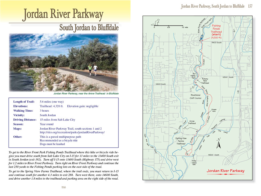
 This chapter describes the last segment of the uninterrupted 25-mile-long paved
Jordan River Parkway Trail that follows the Jordan River south
from Salt Lake City to Bluffdale, The first three segments of the trail are described in the preceding three chapters. If you have walked or ridden the
northern parts of the Jordan River Parkway Trail you will soon notice its changing character as you travel south. As one might expect, there is much more development along
the river in Salt Lake City and South Salt Lake, and as you leave the industrialized cities behind the trail assumes a more rural feel.
This chapter describes the last segment of the uninterrupted 25-mile-long paved
Jordan River Parkway Trail that follows the Jordan River south
from Salt Lake City to Bluffdale, The first three segments of the trail are described in the preceding three chapters. If you have walked or ridden the
northern parts of the Jordan River Parkway Trail you will soon notice its changing character as you travel south. As one might expect, there is much more development along
the river in Salt Lake City and South Salt Lake, and as you leave the industrialized cities behind the trail assumes a more rural feel.
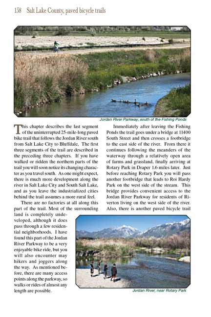
There are no factories at all along this part of the trail. Most of the surrounding land is completely undeveloped, although it does pass through a few
residential neighborhoods. I have found this part of the Jordan River Parkway
Trail to be a very enjoyable bike ride, but you will also encounter may hikers and
joggers along the way. As mentioned before, there are many access points along the
Jordan River Parkway Trail, so walks or rides of almost any length are possible.
Immediately after leaving the Fishing Ponds the
Jordan River Parkway Trail goes under a bridge at 11400 South Street and then crosses a footbridge to the east side of the river.
From there it continues following the meanders of the waterway through a relatively open area of farms and grassland, finally arriving at Rotary Park in
Draper 1.6 miles later. Just before reaching Rotary Park you will pass another footbridge that leads to Roi Hardy Park on the west side of the stream. This bridge provides convenient access to the Jordan River Parkway for residents of Riverton living on the west side of the river. Also, there is another
paved bicycle trail that begins in Roi Hardy Park and winds northward through a wetland on the west side of the river. Unfortunately, that path does not
reconnect with the Jordan River Parkway Trail; it ends after one mile on the east side of a residential area.
Continuing south from Rotary Park the Jordan
River Parkway Trail crosses under 12600 South Street and then continues through a largely undeveloped swath of land on the east side of
the river. Surrounding the Jordan River Parkway Trail is a large open wetland called the Riverbend Nature Area, and on the opposite side of the river is the Riverbend Golf Course.
Shortly after entering the wetland you will pass a spur trail that goes over a bridge and climbs through several switchbacks to the top of a bench where the
golf course is located. The spur ends 0,5 mile later at the Riverbend Trailhead on the north side of the golf course.
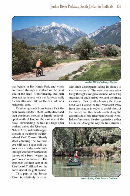
 This part of the Jordan River is relatively pristine, with little development along its shores to mar the serenity. The waterway
meanders lazily through its original channel while long stretches of undisturbed wetland dominate its shores. Shortly after leaving the Riverbend Golf Course
the Jordan River Parkway Trail veers east away from the stream in order to avoid most of the marsh, and then heads south along the eastern side of the Riverbend Nature Area. It
doesn’t return to the river again for another 1.4 miles. Along the way the
Jordan River Parkway Trail climbs a low hill that affords a nice panoramic view of the countryside,
and just before returning to the river you will pass a small geothermal steam vent on the right side of the trail.
This part of the Jordan River is relatively pristine, with little development along its shores to mar the serenity. The waterway
meanders lazily through its original channel while long stretches of undisturbed wetland dominate its shores. Shortly after leaving the Riverbend Golf Course
the Jordan River Parkway Trail veers east away from the stream in order to avoid most of the marsh, and then heads south along the eastern side of the Riverbend Nature Area. It
doesn’t return to the river again for another 1.4 miles. Along the way the
Jordan River Parkway Trail climbs a low hill that affords a nice panoramic view of the countryside,
and just before returning to the river you will pass a small geothermal steam vent on the right side of the trail.
The trail finally returns to the Jordan River just north of the Bangerter Highway, and shortly afterward it crosses to the west side of the stream on a
footbridge and enters the town of Bluffdale. Soon you will come to a junction where another short trail departs on the right and winds for 0.6 mile through
a horse pasture before ending at Bluffdale's Arrow Trailhead. Then, 250 yards beyond the junction, the
Jordan River Parkway Trail passes under the Bangerter Highway.
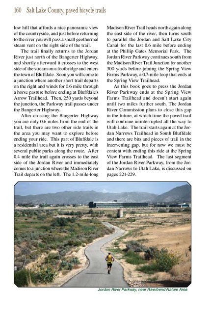
After crossing the Bangerter Highway you are only 0.6 miles from the end of the
Jordan River Parkway Trail, but there are two other side trails in
the area you may want to explore
before ending your ride. This part of Bluffdale is a residential area but it is very pretty, with several public parks along the route. After 0.4 mile the
trail again crosses to the east side of the Jordan River and immediately comes to a junction where the Madison River Trail departs on the left. The
1.2-mile-long Madison River Trail heads north again along the east side of the river, then turns south to parallel the Jordan and Salt Lake City Canal
for the last 0.6 mile before ending at the Phillip Gates Memorial Park. The Jordan River Parkway
Trail continues south from the Madison River Trail Junction
for another 300 yards before joining the Spring View Farms Parkway, a 0.7-mile loop that ends at the Spring View Trailhead.
As this book goes to press the Jordan River Parkway
Trail ends at the Spring View Farms Trailhead and doesn’t start again until two miles further south. The Jordan
River Commission plans to close this gap in the future, at which time the paved trail will continue uninterrupted all the way to Utah Lake. The trail starts
again at the Jordan Narrows Trailhead in South Bluffdale and there are bits and pieces of trail in the intervening gap, but for now we must be content with
ending this ride at the Spring View Farms Trailhead. The last segment of the Jordan River Parkway
Trail, from the Jordan Narrows to Utah Lake, is discussed on
pages 221-229.
Note to web developers: You may copy this material onto your site, but in return please include a link to my home page
www.utahtrails.com. Thank you, David Day (utahdavidday
at gmail.com)
Click here to see more
trails near Salt Lake City
© Rincon Publishing Company, all rights reserved
|