Mount Timpanogos
via Aspen Grove Trail
excerpted from our book
Salt Lake City's Incredible Hiking and Biking Trails
pages 190-195
|
Buy book directly from the author!
Salt Lake City's Incredible Hiking and Biking Trails
- has access info for 73 trailheads
- 73 colorful trail maps
- 325 full color photographs
- loads of hiking tips
|
regularly $19.95
now on sale for only
$9.95
click here
for book orders
|
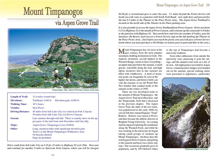
 Mount Timpanogos has, for most of the past century, been the most popular mountain climbing destination in Utah. The majestic
mountain, second highest in the Wasatch Range, seems to have everything-an alpine lake just below the summit, a small glacier, waterfalls along the trail, and
high alpine meadows that in late summer are filled with wildflowers. A herd of mountain goats can frequently be seen at the higher elevations, and history buffs
can visit the remains of an old World War Two bomber that crashed north of the summit in the winter of 1955.
Mount Timpanogos has, for most of the past century, been the most popular mountain climbing destination in Utah. The majestic
mountain, second highest in the Wasatch Range, seems to have everything-an alpine lake just below the summit, a small glacier, waterfalls along the trail, and
high alpine meadows that in late summer are filled with wildflowers. A herd of mountain goats can frequently be seen at the higher elevations, and history buffs
can visit the remains of an old World War Two bomber that crashed north of the summit in the winter of 1955.
There are two developed trails to the summit of Mount Timpanogos: the Aspen Grove Trail described here, and the Timpooneke Trail that I discussed in the previous
chapter. The Aspen Grove Trail, the older of the two trails, was popularized in the early 1900s by a local folk hero named Eugene "Timp" Roberts. Roberts was
raised in Provo, and later became the athletic director at Brigham Young University. As a young man he enjoyed exploring the mountains along the Wasatch Front,
and while he was working at the university he began taking small groups of students up Mount Timpanogos. (In those days the trail began in Provo Canyon, and
getting to the summit and back was a three-day trip.) The excursions gradually grew in popularity, and by 1913 Roberts' hikes to the top of Timpanogos had
become a university tradition.
Soon other enthusiasts from outside the university were clamoring to join the outings, and the annual event took on a life of its own. All-night parties were
held in Aspen Grove, commemorative badges were handed out on the summit, special walking sticks were presented to dignitaries, sandwiches were sold at Emerald
Lake, buses were chartered to carry hikers to the trailhead, and people showed up by the thousands. The event continued for the next 59 years.
In 1961 over 2,000 people reached the summit in a single day, and the Forest Service began to worry openly about the impact that so many hikers were having on the
environment. In 1970 over 7,000 people participated in the "Timp Hike" with 3,500 of them reaching the summit. The pressure of so many hikers on the mountain
in one day proved to be an unmitigated environmental disaster, and reluctantly the Forest Service ended the popular event.
Although the Timp Hike is no longer an organized annual event the mountain is still very popular, and thousands of people continue to climb to its summit every
summer. Now, however, the trails are much better maintained and the number of visitors is more evenly distributed throughout the summer. Also the trails are
now patrolled during summer weekends and holidays by a volunteer organization known as the Timpanogos Emergency Response Team (TERT). The primary purpose of
the TERT volunteers is to provide emergency medical assistance, but they also help protect the mountain by reporting illegal fires and other environmentally
destructive activities to the Forest Service.
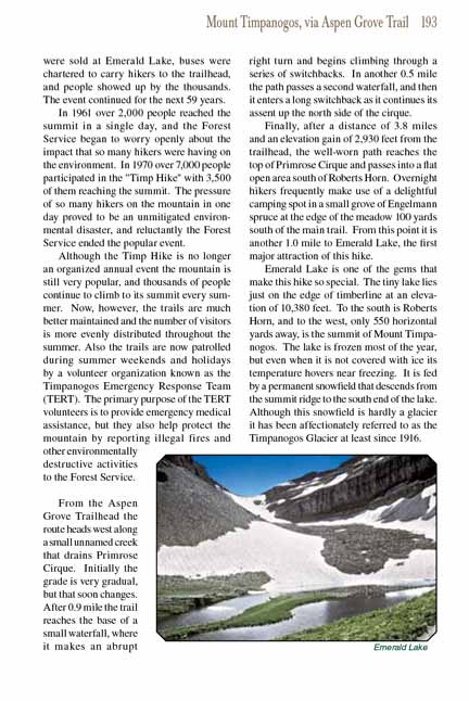
 From the Aspen Grove Trailhead the Mount
Timpanogos Trail heads west along a small unnamed creek that drains Primrose Cirque. Initially the grade
is very gradual, but that soon changes. After 0.9 mile the trail reaches the base of a small waterfall, where it makes an abrupt right turn and begins climbing
through a series of switchbacks. In another 0.5 mile the path passes a second waterfall, and then it enters a long switchback as it continues its assent up the
north side of the cirque.
From the Aspen Grove Trailhead the Mount
Timpanogos Trail heads west along a small unnamed creek that drains Primrose Cirque. Initially the grade
is very gradual, but that soon changes. After 0.9 mile the trail reaches the base of a small waterfall, where it makes an abrupt right turn and begins climbing
through a series of switchbacks. In another 0.5 mile the path passes a second waterfall, and then it enters a long switchback as it continues its assent up the
north side of the cirque.
Finally, after a distance of 3.8 miles and an elevation gain of 2,930 feet from the trailhead, the well-worn
Mount Timpanogos Trail reaches the top of Primrose Cirque and passes
into a flat open area south of Roberts Horn. Overnight hikers frequently make use of a delightful camping spot in a small grove of Engelmann spruce at the edge
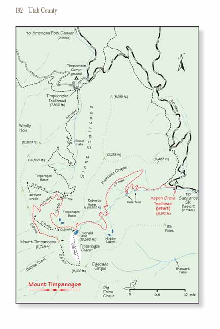
of the meadow 100 yards south of the main trail. From this point it is another 1.0 mile to Emerald Lake, the first major attraction of this hike.
Emerald Lake is one of the gems that make this hike so special. The tiny lake lies just on the edge of timberline at an elevation of 10,380 feet. To the south is
Roberts Horn, and to the west, only 550 horizontal yards away, is the summit of Mount Timpanogos. The lake is frozen most of the year, but even when it is not
covered with ice its temperature hovers near freezing. It is fed by a permanent snowfield that descends from the summit ridge to the south end of the lake.
Although this snowfield is hardly a glacier it has been affectionately referred to as the Timpanogos Glacier at least since 1916.
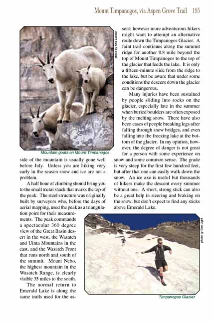
The small valley around Emerald Lake also seems to be a favorite late-summer hangout for the mountain goats that live in the wilderness area, so be sure to look
for them while you are there. The shaggy, majestic creatures have thrived since their introduction in 1981. Occasionally they venture to within a hundred feet
of campers by the lake, but more often you will need a pair of binoculars to study them in detail.
From Emerald Lake the official Forest Service trail continues west for 0.5 mile and then loses 200 feet as it contours around the southwest side of Timpanogos Basin.
1.5 miles after leaving the lake the trail comes to a junction where the summit trail departs on the left and immediately starts winding upward toward a saddle on
the ridge north of the peak.
There is also an unmaintained shortcut trail near Emerald Lake that allows hikers to climb to the saddle on the summit ridge without walking all the way into
Timpanogos Basin. Almost everyone climbing Mount Timpanogos from Emerald Lake takes this shortcut, and I advise you to do the same. The "official" trail from
the lake to the summit is almost two miles longer than the unmaintained shortcut.
The short cut route leaves the main trail 0.5 mile west of the lake near the bottom of a talus slope. You may have trouble finding the trail, since the talus
is very unstable and subject to occasional landslides. If the shortcut trail has been obliterated just angle up the side of the slope in a northwesterly direction
for a few hundred yards until you run into the well-marked summit trail just below the top of the ridge.
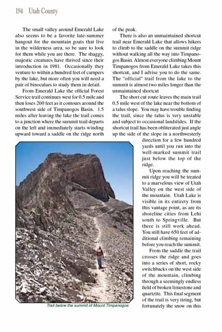
 Upon reaching the summit ridge you will be treated to a marvelous view of Utah Valley on the west side of the mountain. Utah Lake
is visible in its entirety from this vantage point, as are its shoreline cities from Lehi south to Springville. But there is still work ahead. You still have 650
feet of additional climbing remaining before you reach the summit.
Upon reaching the summit ridge you will be treated to a marvelous view of Utah Valley on the west side of the mountain. Utah Lake
is visible in its entirety from this vantage point, as are its shoreline cities from Lehi south to Springville. But there is still work ahead. You still have 650
feet of additional climbing remaining before you reach the summit.
From the saddle the trail crosses the ridge and goes into a series of short, rocky switchbacks on the west side of the mountain, climbing through a seemingly
endless field of broken limestone and quartzite. This final segment of the trail is very tiring, but fortunately the snow on this side of the mountain is usually
gone well before July. Unless you are hiking very early in the season snow and ice are not a problem.
A half hour of climbing should bring you to the small metal shack that marks the top of the peak
and the end of the Mount Timpanogos Trail. The steel structure was originally built by surveyors who,
before the days of aerial mapping, used the peak as a triangulation point for their measurements. The peak commands a spectacular 360 degree view of the Great
Basin desert in the west, the Wasatch and Uinta Mountains in the east, and the Wasatch Front that runs north and south of the summit. Mount Nebo, the highest
mountain in the Wasatch Range, is clearly visible 35 miles to the south.
The normal return to Emerald Lake is along the same trails used for the assent
of Mount Timpanogos; however more adventurous hikers might want to attempt an alternative route down
the Timpanogos Glacier. A faint trail continues along the summit ridge for another 0.8 mile beyond the top of Mount Timpanogos to the top of the glacier that
feeds the lake. It is only a fifteen-minute slide from the ridge to the lake, but be aware that under some conditions the descent down the glacier can be
dangerous.
Many injuries have been sustained by people sliding into rocks on the glacier, especially late in the summer when buried boulders are often exposed by the melting
snow. There have also been cases of people breaking legs after falling through snow bridges, and even falling into the freezing lake at the bottom of the glacier.
In my opinion, however, the degree of danger is not great for a person with some experience on snow and some common sense. The grade is very steep for the first
few hundred feet, but after that one can easily walk down the snow. An ice axe is useful but thousands of hikers make the descent every summer without one.
A short, strong stick can also be a great help in steering and braking on the snow, but don’t expect to find any sticks above Emerald Lake.
Note to web developers: You may copy this material onto your site, but in return please include a link to my home page
www.utahtrails.com. Thank you, David Day (utahdavidday
at gmail.com)
Click here to see more
trails near Salt Lake City
© Rincon Publishing Company, all rights reserved
|