Weber River Parkway Trail
excerpted from our book
Salt Lake City's Incredible Hiking and Biking Trails
pages 302-307
|
Buy book directly from the author!
Salt Lake City's Incredible Hiking and Biking Trails
- has access info for 73 trailheads
- 73 colorful trail maps
- 325 full color photographs
- loads of hiking tips
|
regularly $19.95
now on sale for only
$9.95
click here
for book orders
|
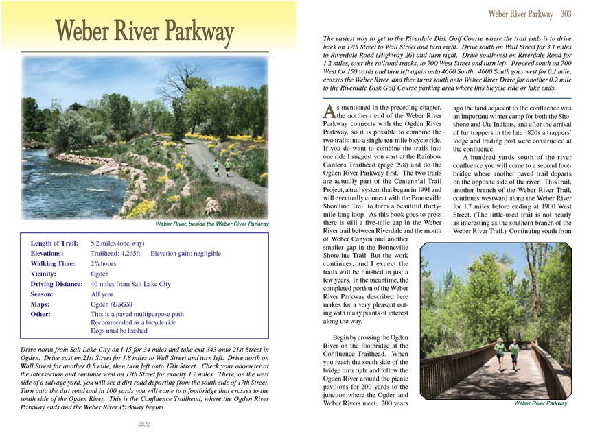
 As mentioned in the preceding chapter, the northern end of the Weber River Parkway connects with the Ogden River Parkway, so it is
possible to combine the two trails into a single ten-mile bicycle ride. If you do want to combine the trails into one ride I suggest you start at the Rainbow
Gardens Trailhead (page 298) and do the Ogden River Parkway first. The two trails are actually part of the Centennial Trail Project, a trail system that began
in 1991 and will eventually connect with the Bonneville Shoreline Trail to form a beautiful thirty-mile-long loop. As this book goes to press there is still a
five-mile gap in the Weber River Parkway Trail between Riverdale and the mouth of Weber Canyon and another smaller gap in the Bonneville Shoreline Trail. But the work
continues, and I expect the trails will be finished in just a few years. In the meantime, the completed portion of the Weber River Parkway
Trail described here makes
for a very pleasant outing with many points of interest along the way.
As mentioned in the preceding chapter, the northern end of the Weber River Parkway connects with the Ogden River Parkway, so it is
possible to combine the two trails into a single ten-mile bicycle ride. If you do want to combine the trails into one ride I suggest you start at the Rainbow
Gardens Trailhead (page 298) and do the Ogden River Parkway first. The two trails are actually part of the Centennial Trail Project, a trail system that began
in 1991 and will eventually connect with the Bonneville Shoreline Trail to form a beautiful thirty-mile-long loop. As this book goes to press there is still a
five-mile gap in the Weber River Parkway Trail between Riverdale and the mouth of Weber Canyon and another smaller gap in the Bonneville Shoreline Trail. But the work
continues, and I expect the trails will be finished in just a few years. In the meantime, the completed portion of the Weber River Parkway
Trail described here makes
for a very pleasant outing with many points of interest along the way.
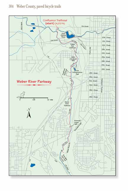
Begin by crossing the Ogden River on the footbridge at the Confluence Trailhead. When you reach the south side of the bridge turn right and follow the Ogden River
around the picnic pavilions for 200 yards to the junction where the Ogden and Weber Rivers meet. 200 years ago the land adjacent to the confluence was an important
winter camp for both the Shoshone and Ute Indians, and after the arrival of fur trappers in the late 1820s a trappers’ lodge and trading post were constructed at the
confluence.
A hundred yards south of the river confluence you will come to a second footbridge where another paved trail departs on the opposite side of the river. This trail,
another branch of the Weber River Parkway Trail, continues westward along the Weber River for 1.7 miles before ending at 1900 West Street. (The little-used trail is not
nearly as interesting as the southern branch of the Weber River Parkway Trail.) Continuing south from the bridge, the trail winds along the eastern shore of the Weber
River for another 0.4 mile before crossing under 21st Street and Middleton Road. Just 160 feet beyond Middleton Road it crosses under a railroad bridge and then
continues following the left side of the river as it swings around to the east.
 Ogden has always been an important railroad town, and as you proceed along the Weber River you will notice that almost all of the land
on the east side of the stream is railroad land. In fact, a major portion of the Weber River Parkway
Trail was built on land donated by the Southern Pacific Railroad.
The city is located just 25 miles from Promontory Summit, where the two ends of the Transcontinental Railroad met in 1869, and subsequently Ogden became a major
junction where passengers were required to change trains between the Union Pacific and the Central Pacific Railroads as they traveled across the nation. For many
years Ogden was better known by its nickname “Junction City”.
Ogden has always been an important railroad town, and as you proceed along the Weber River you will notice that almost all of the land
on the east side of the stream is railroad land. In fact, a major portion of the Weber River Parkway
Trail was built on land donated by the Southern Pacific Railroad.
The city is located just 25 miles from Promontory Summit, where the two ends of the Transcontinental Railroad met in 1869, and subsequently Ogden became a major
junction where passengers were required to change trains between the Union Pacific and the Central Pacific Railroads as they traveled across the nation. For many
years Ogden was better known by its nickname “Junction City”.
The Weber River Parkway Trail maintains an easterly course for 0.7 mile before crossing a footbridge and turning south along the river’s western shore. As you approach 24th street you
will pass Kayak Park on your right, where people sometimes launch boats into the river. Notice the interesting old building across the river at this point; it looks
like it might have once been a meat packing plant. More recently it was used as a warehouse by the Smith and Edwards Company before it was destroyed by fire in 2008.
Just before arriving at 24th Street the trail comes to a semi-deserted street called Exchange Road. This is a somewhat confusing area. The trail seems to end at
Exchange Road, but if you will pause and look to your right you will see the Kayak Park Trailhead parking area 200 feet to the west. From there the
Weber River Parkway Trail dips down
under 24th Street and another railroad bridge before continuing south along the west side of the river.
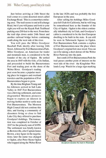
You will pass the Miles Goodyear Baseball Park shortly after leaving 24th Street, followed by Fort Buenaventura Park. Miles Goodyear, an American fur trader and
mountain man, is considered to be the founder of the city of Ogden. He settled the area in 1845 with his wife, a Ute Indian, and proceeded to build the Buenaventura
Fort and trading post on the shore of the Weber River. Goodyear’s trading post soon became a popular meeting place for trappers and overland travelers and the
population of Fort Buenaventura began to grow.
By the time Brigham Young and his followers arrived in Salt Lake Valley in 1847 Fort Buenaventura was a thriving settlement, and some disgruntled Mormon pioneers
began to express an interest in moving further north to settle near Fort Buenaventura. The Mormon High Council did not condone this idea, and fearing a community
of dissenters living so close to Salt Lake City they offered to purchase Goodyear’s holdings. The transaction was completed in October of 1847 for the princely
sum of $1,950. The settlement was briefly known as Brownsville, after Captain James Brown, a key figure in the negotiations; later the name was changed to Ogden,
after Peter Skene Ogden who trapped along the Weber River in the late 1820s and was probably the first European in the area.
After selling his holdings Miles Goodyear left Utah for California, but he will long be remembered here as the founder of the City of Ogden. Ogden is the oldest
continually inhabited city in Utah, and Goodyear’s cabin is considered to be the first European dwelling to be built in the state. It can still be seen in Tabernacle
Square in Ogden. Fort Buenaventura Park contains a replica of Fort Buenaventura near the place where Goodyear’s original fort once stood. You can see it be taking a
short detour off the Weber River Parkway into the park.
 Just south of Fort Buenaventura Park the Weber
River Parkway Trail passes another point of interest on the west side of the river: the Kingfisher Wetlands
Loop. Watch for a large sign marking the beginning of the loop on the right side of the trail after passing the second bridge into Fort Buenaventura Park. The
Kingfisher loop trail is not paved, but it is an easy 0.6-mile bike ride or walk. There is also a large pond in the wetland with two hides or observation points
on its shore strategically placed for watching the water fowl.
Just south of Fort Buenaventura Park the Weber
River Parkway Trail passes another point of interest on the west side of the river: the Kingfisher Wetlands
Loop. Watch for a large sign marking the beginning of the loop on the right side of the trail after passing the second bridge into Fort Buenaventura Park. The
Kingfisher loop trail is not paved, but it is an easy 0.6-mile bike ride or walk. There is also a large pond in the wetland with two hides or observation points
on its shore strategically placed for watching the water fowl.
Just after passing the end of the Kingfisher Wetlands Loop the Weber River Parkway
Trail passes under another railroad bridge and continues south for 0.4 mile to another
underpass at 31st Street. Then 0.4 mile south of 31st Street you will pass through another underpass at Parker Drive before arriving at the Parker Drive Trailhead
and parking area.
Parker Drive marks the approximate point where the Weber River Trail passes from Ogden into the City of Riverdale. The next mile of the path passes through a forested
area where it is at times easy to forget that you are actually in the middle of a city. The railroad yards on the east side of the river are an occasional
distraction; nevertheless this is a very pretty area.
1.2 miles after leaving the Parker Drive Trailhead the trail passes Riverdale Kayak Park, and 200 yards later it seems briefly to end. The route continues for a
short distance along the sidewalk of South Weber Drive and then departs on the left side of the street to cross under Riverdale Road. From there the trail follows
the west side of the river for another 0.2 mile to 4600 South Street.
Again, the Weber River Parkway Trail seems to end at 4600 South, but if you walk east across the river on the 4600 South Street Bridge you will see where the trail continues along the
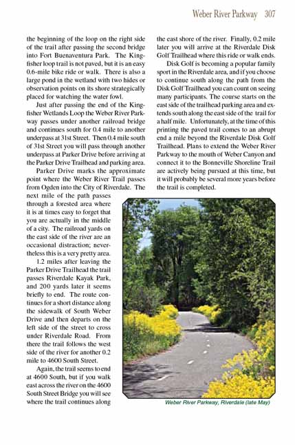
east shore of the river. Finally, 0.2 mile later you will arrive at the Riverdale Disk Golf Trailhead where this ride or walk ends.
Disk Golf is becoming a popular family sport in the Riverdale area, and if you choose to continue south along the path from the Disk Golf Trailhead you can count on
seeing many participants. The course starts on the east side of the trailhead parking area and extends south along the east side of the trail for a half mile.
Unfortunately, at the time of this printing the paved trail comes to an abrupt end a mile beyond the Riverdale Disk Golf Trailhead. Plans to extend the Weber
River Parkway Trail to the mouth of Weber Canyon and connect it to the Bonneville Shoreline Trail are actively being pursued at this time, but it will probably be
several more years before the trail is completed.
Note to web developers: You may copy this material onto your site, but in return please include a link to my home page
www.utahtrails.com. Thank you, David Day (utahdavidday at gmail.com)
Click here to see more
trails near Salt Lake City
© Rincon Publishing Company, all rights reserved
|